
Miles From Nowhere.
First, forget your modern life ….
In 1989, there was no Bluetooth, Wi-Fi, Google Maps, or Ride With GPS. Mobile phones, digital photography, and the consumer internet were years away. You had to carry a camera to shoot a photo, and when you were out of film, you were out of luck. Pay phones were still a thing. The expectation of instant connection to everyone you knew was science fiction.
Navigation was tricky. When you reached a new town and wanted to know where a particular store or swimming hole was, the easiest course of action was to ask another human, face to face!
People were accustomed to giving directions back then.
State maps were commonplace, but charting a route through an unfamiliar town using back roads was a byzantine task.
We lived in a murky, wonderful, analog world.
None of this was on my radar in the fall of 1989. It was just the way it was.
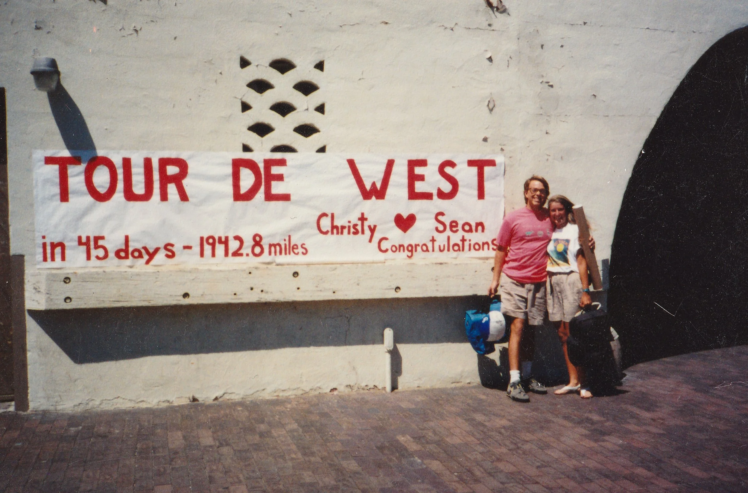
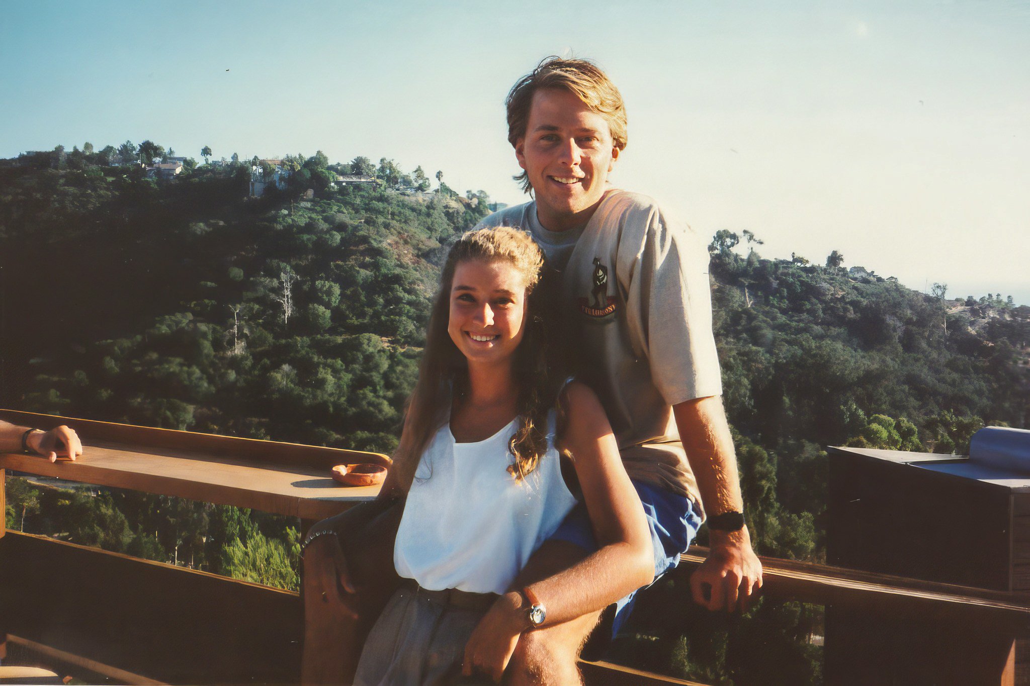
But now it suddenly mattered. A few weeks earlier, in a stroke of ambition/daring/naivety that still leaves me gobsmacked, Chris Hilbert, Christy Peterson, and I decided to ride bicycles from someplace in Southern California to Yellowstone, Wyoming, the following summer.
Now we just had to figure out how to do it. (We also needed to buy bikes and camping gear, but details, schmetails…)
I blame Barbara Savage. Her 1983 book, “Miles from Nowhere: A Round the World Bicycle Adventure,” was a gateway drug that burrowed so deeply into my gulliver that traces are still easy to spot today. Along with her husband, Savage rode 23,000 miles through 25 countries in two years, seemingly devising their daily routes on the fly.
That strategy wouldn’t work for us. First, we had a finite amount of time: six weeks, at most eight. Next, some planning seemed mandatory. I mean, how far was it to Yellowstone? How long would it take? What mountains/deserts/killer highways stood in our way? Where would we stay? Was food and water available?
These weren’t insignificant questions, and finding answers would take weeks.
Fortunately, I found a secret weapon in a small, brightly lit room on the second floor of the SDSU library. The Map Room housed thousands of local, county, and USGS topographical quadrangle maps, state maps, and navigation ephemera in dozens of wide, wooden cases with very shallow drawers. The king of this domain was a stooped man with a patient face who smelled faintly of dust. He answered my questions, and day by day, the route slowly took shape.
To start the trip, we’d use the best cheat code available: Tom Kirkendall and Vicky Spring’s seminal book Bicycling the Pacific Coast. This would take us to Oregon and give me insight into route planning so that each day would remain a “vacation” and not a “death march.” I mostly succeeded.
We’d skip L.A. and its traffic, starting in Lompoc at the home of Christy’s roommate. We’d follow the Kirkendall book for fifteen days as we mostly camped and rode along the California coast.
From the California/Oregon border, we’d head northeast to Christy’s cousin’s house in Grants Pass before climbing to Crater Lake.
From there, we’d ride the Cascade Lakes National Scenic Byway to Bend, cut across the high deserts of Southern Oregon, and climb up and around the Sawtooth Range of Central Idaho.
We’d follow the Salmon River downstream for 120 miles before climbing over the Continental Divide at Lemhi Pass, where Sacagawea led Lewis and Clark into the unexplored west in 1805.
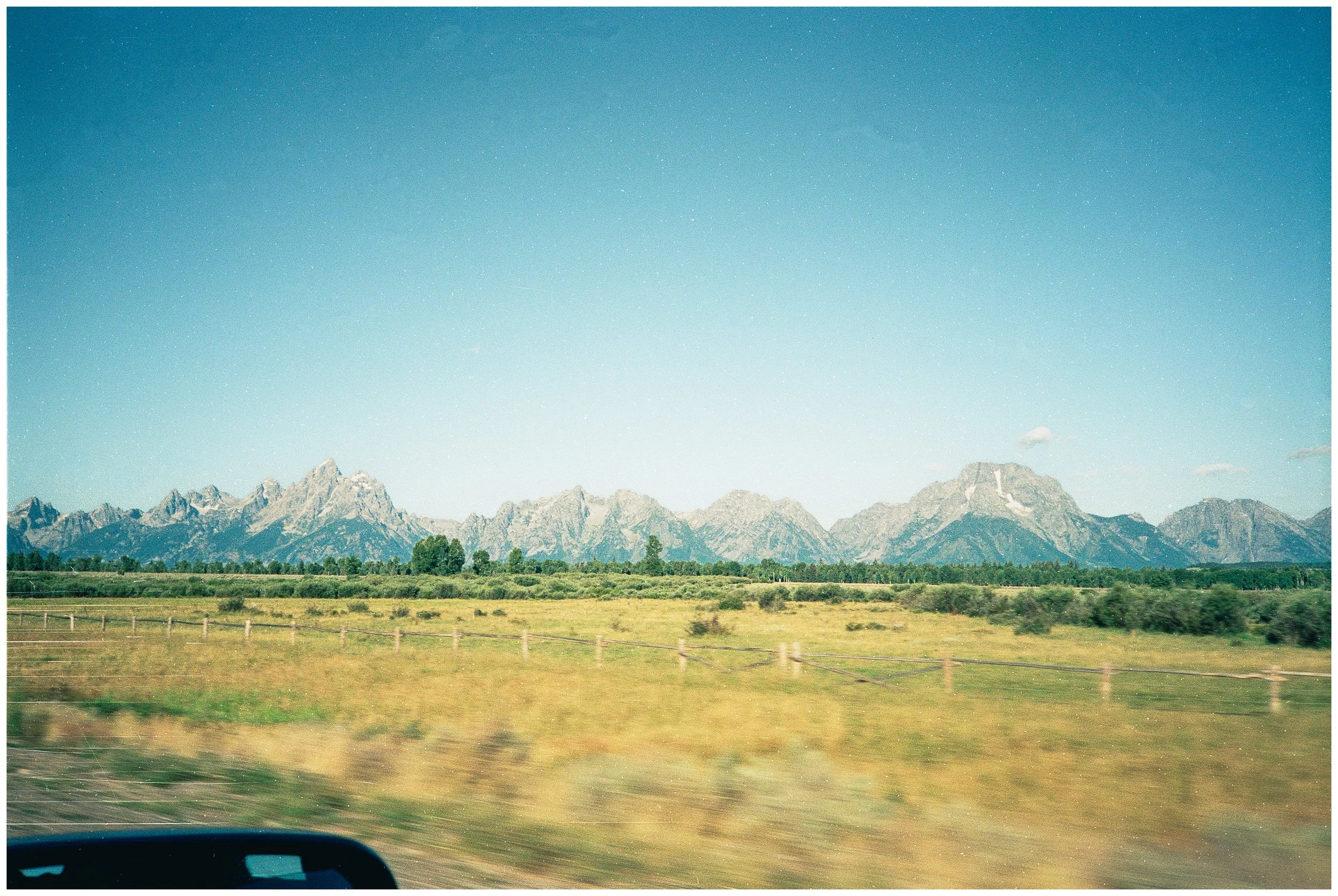
Some remote dirt road riding in SW Montana through the Centennial Valley would drop us off near our primary destination: Yellowstone National Park. We’d spend five days riding around the park before heading south past the Grand Tetons to the finish line in Jackson, Wyoming—44 days and about 2,000 miles from our start in Lompoc.
By Christmas, we were thinking, “This just might work.”
Countdown to Launch.
(Spring 1990) — We bought our bikes at Adams Avenue Cyclery in Normal Heights on October 5, 1989. Our route included several days on dirt roads, and the stability and ruggedness of mountain bikes seemed appealing. We chose Specialized Rockhoppers, the pared-back, less expensive version of the famous Stumpjumper, one of the first widely produced mountain bikes.
Chris and I lived in Tierrasanta then, close to Mission Trails, where we rode many afternoons that Fall. Weekends were for longer rides, braving the busy roads of Mission Valley to the beach, arriving back home sweaty and exhausted Saturday evening in time to watch Star Trek: The Next Generation. Yeah … nerds. Sue me.
We slowly worked our way through our gear shopping list, relying heavily on Christmas and birthdays for the larger items. Money was tight. Each addition was a triumph, a totemic representation of our coming adventure. Buying our North Face Bullfrog tent and then our Blue Kazoo sleeping bags were both causes for celebration.
Then, a setback: Chris backed out of the trip. Christy and I faced a brief crossroads when the trip hung in the balance, but it didn’t last long. Soon, it was all systems go again.
Of course, it wasn’t without a few bits of turbulence. Telling Christy’s folks about our plans the previous Fall had been nerve-racking, even if one of their questions (“What if you get a blister?”) later became a sarcastic rallying cry when things got tough. When I told my brother, he just shook his head and said, “What a dumbshit.”
Spring 1990 arrived, and the route continued to firm up. The paycheck from my North Shore article was perfectly timed and sorely needed. Reservations were made at the Old Faithful Inn. We called campgrounds to confirm that they offered “hiker biker” sites where reservations weren’t required, and the cost was minimal. We continued to ride, but failed to rack up much mileage.
The idea of riding for 44 days only to take a two-hour flight back home was ruled out. We’d stay on the ground for the duration. Once in Jackson, we’d drive a rental car to Salt Lake City, then jump on an Amtrak sleeper train to Fullerton ($316 for a private “roomette”).
I continued visiting the Map Room, focusing on the dirt days north of Crater Lake, over Lemhi Pass, and through Centennial Valley. Sitting in the library’s air-conditioned comfort, nothing looked too long or too steep.
Finally, school ended. Christy went up to her mom’s in Big Bear for a month, where she’d wait tables and save money. I took up residence in Leisure World, on the very short loveseat in my grandmother’s den. She was invariably awesome about having me stay with her.
A few weeks before the trip, I loaded my bike for the first time and headed south from Leisure World. It rode like a tank, the hills through Dana Point magnified in difficulty by the weight.
I reached the Camp Pendleton gates south of San Clemente and turned around, only to completely crack in Laguna Niguel. I wobbled into Oso Park, lightheaded and sweaty, and crashed out onto the grass, my world spinning. Was I dying? Would I ever stand again? I checked my bike’s odometer: 51 miles.
Of fuck, fuck, fuck. What had I gotten myself into?
The gear list.
Part One: The North Coast
Day 0: Off To Lompoc
-
Date: Saturday July 6, 1990
Miles: 212 (Car)
Total Climb/Descent: N/A
High Point / Low Point: N/A
Feet Per Mile: N/A
Route Score: 0 (Travel Day)
+ A Note About Photos
We’re jumping far down the road here, but on day 37 of the trip, Christy lost her left rear pannier. The last photo of it was near Red Rock Pass, so it was either lost on the descent to Henry Lake (an altogether reasonable assumption) or it was swiped once we got to Staley Springs Lodge (less likely, but something I’ve never been able to discount altogether).
Why talk about this now? Only because that pannier held seven rolls of exposed film, all our shots from Lompoc to Central Idaho. Losing those photos felt devastating then, and it still stings a bit now.
So, the photos we have from the beginning of the trip are either from Lisa and Barry, who drove us to Lompoc, or from our fellow bicycle tourers we met along the way. It’s fantastic that we have those shots, but they are a poor substitute for our own photos. A massive chunk of the trip has no photos at all.
+ A Helpful Lift
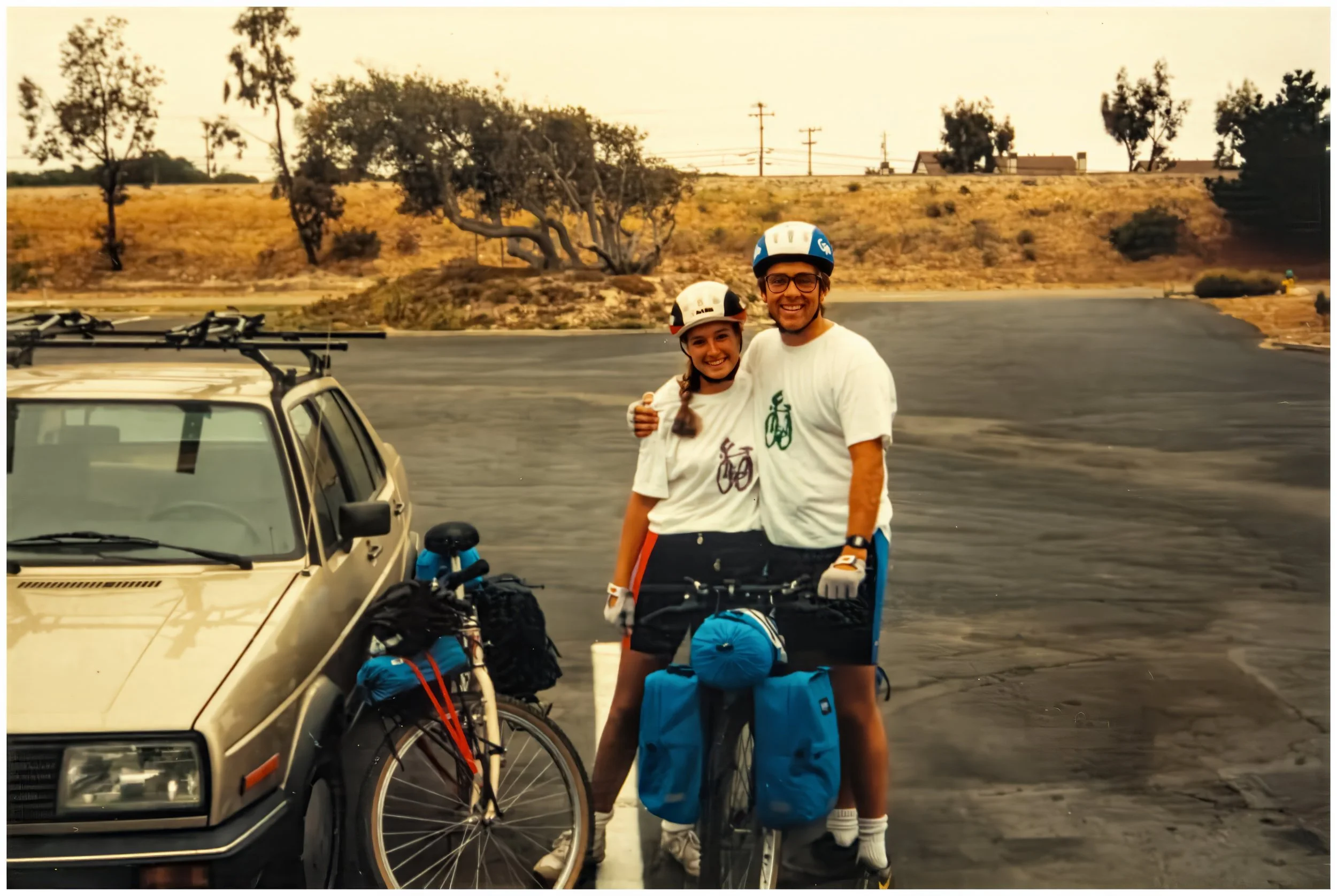
Barry and Lisa drove us to the start of the tour, a rundown hotel outside of Lompoc near Vandenberg Air Force Base.
Over the past six months, Christy and her ex-roommate, Keri, had drifted apart, so starting at Keri’s house in Lompoc was no longer an option.
That was just as well. Nerves and emotions were high the day before the start of the ride, and it was nice to spend it with close friends.
Barry and Lisa even created tour t-shirts for us with “Peterson & O’Brien Summer Tour 1990” boldly emblazoned across the back, which was awesome.
+ Final Prep
We spent that night packing and repacking our bikes. It all went quickly. We had the gear, the bikes, the route, and (most importantly) the enthusiasm needed. It would be a lie, however, to say that we had the confidence. That would come later, in a slow transformation that was only startling in retrospect. That night, however, the next 40 days were still a huge blank spot on the map.
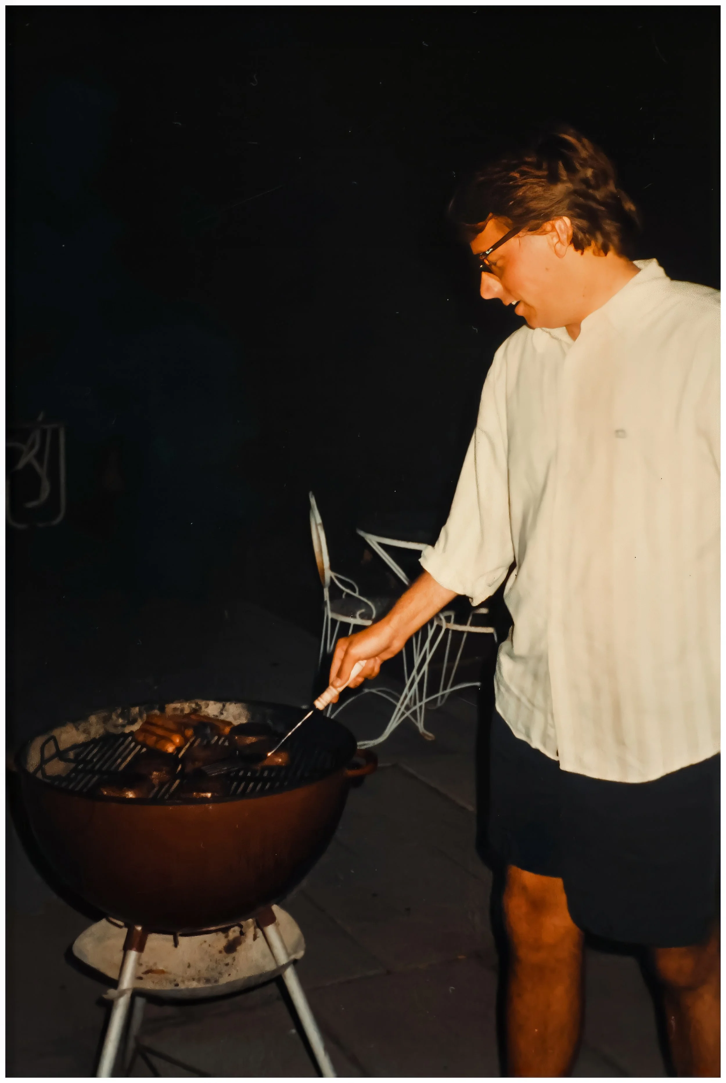
Friday, July 6, 1990: A BBQ at Robyn's house the night before we left.
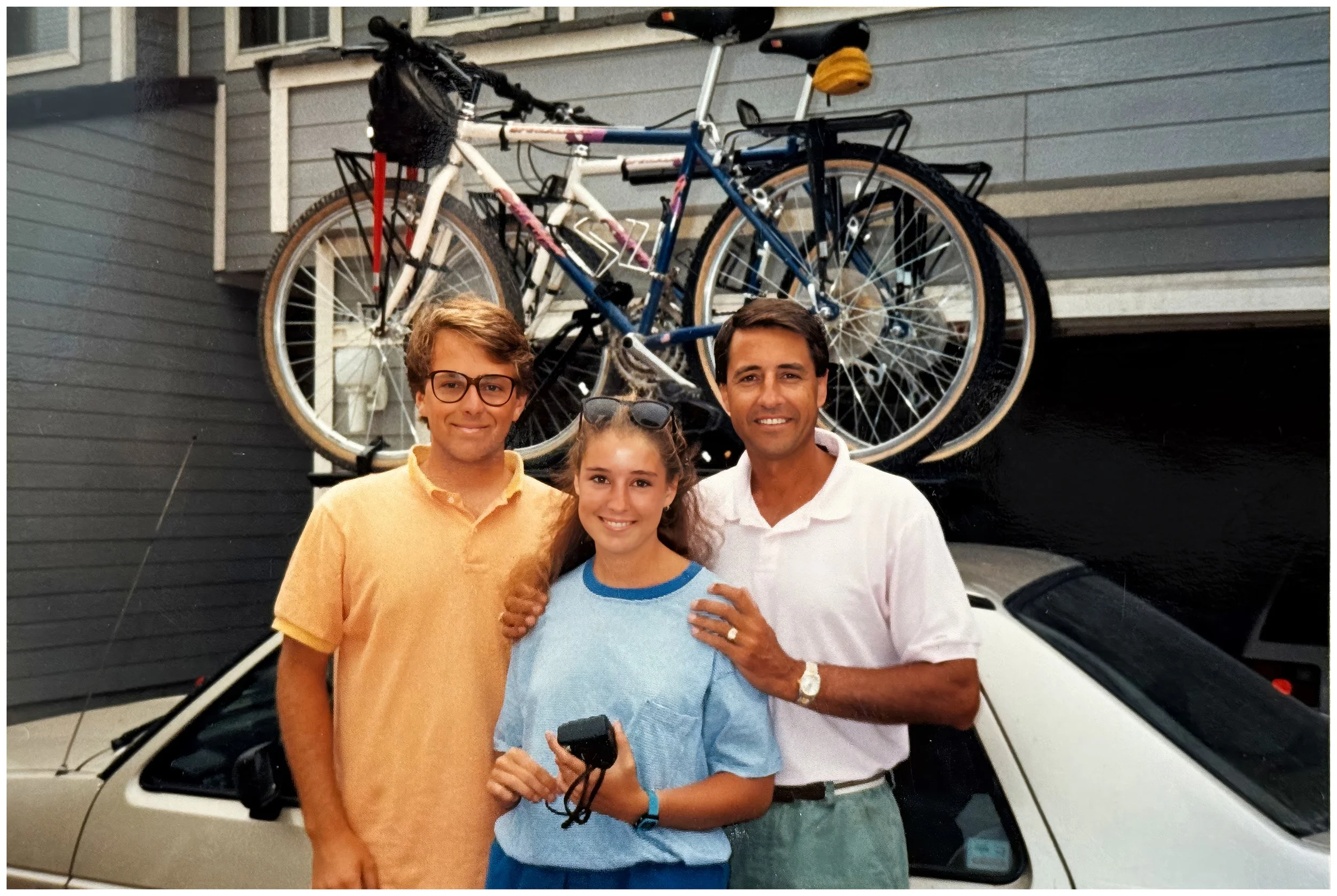
Packed up and ready to go. Saying goodbye to Christy's dad in Laguna Niguel.
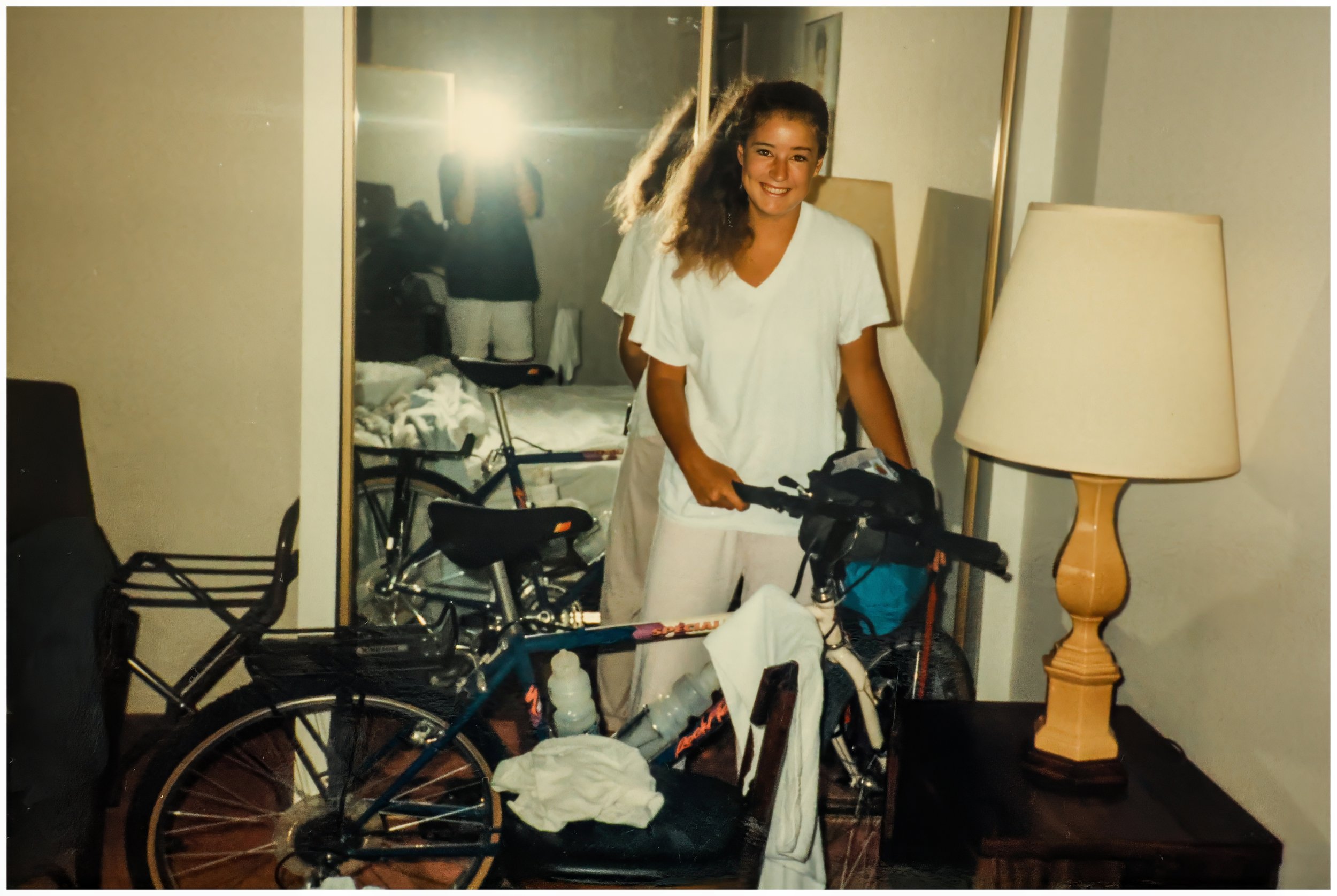
Saturday, July 7, 1990: Packing and repacking the night before the start.
Day 1: First Miles to Pismo Beach
-
Date: Sunday, July 8, 1990
Destination: Oceano Dunes C.G., Pismo Beach (C2)
Miles: 40
Total Climb/Descent: Up 1,973 / Down -2,303
High Point / Low Point: 720 feet / 3 feet
Feet Per Mile: 49
Route Score: 53 (Moderate)
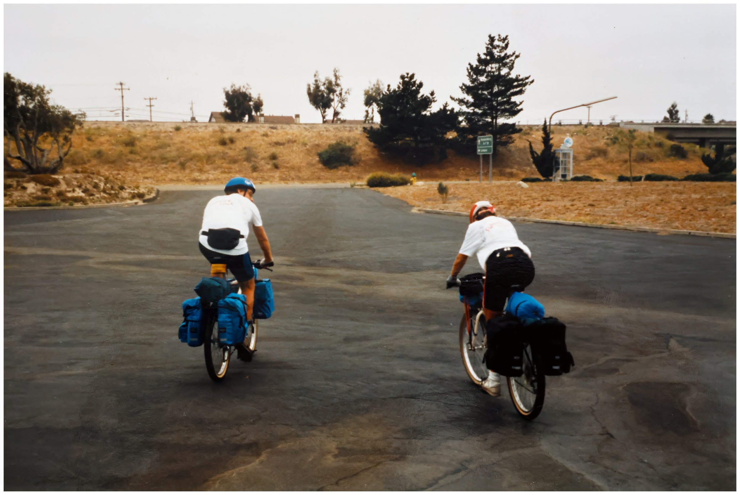
+ Here Goes Nothing
There’s no denying it: the bikes are heavy. We wobble out of the hotel parking lot and head up onto Highway 1—the Cabrillo Highway.
My heart is hammering, and it’s not because of the hills.
At mile one, we make a short, steep plunge into and then out of a canyon: our first taste of how the bikes handle with speed.
Just before mile five, we reach our first navigational waypoint: a right turn to stay on Hwy 1.
A two-mile steady climb finally settles the nerves, and we warm up and settle in.
We begin a long, easy descent through farm country near Santa Maria. The sun is out, the shoulder is broad, and we whoop with the feeling of freedom.
+ Meeting The Clan
We zoom off the mesa at mile 36 on a steep descent through eucalyptus groves, with great views of Pismo Beach to our left.
It’s early afternoon—we certainly have not set a fast pace—and we stop at Central Market and load up with spaghetti, a can of green beans, Chips Ahoy cookies, and green Gatorade.
We make it to the Hiker/Biker campsite at Oceano Dunes Campground and find it full of fellow riders, who greet us warmly.
We find a place to set up our tent, still feeling a bit tentative and green.
It’s a welcoming bunch; some are nearing the end of their ride down the coast from Canada and wear the clear patina of experience.
Many comment on how brave we are to ride north against the prevailing winds. We nod, but consider the warnings overblown, as they would turn out to be.
The most memorable person that evening is Abe, a 50-something man with a beard and pot belly, who proudly shows off his glass beer stein. It weighs a ton and seems vaguely foolish.
He’s a real character who seems to be going through a life crisis. He just recently left home and claims this isn’t a trip, but his new lifestyle. He says he’ll be riding until further notice.
+ Christy's Journal
July 8, 1990 - Day One Pismo
The day had finally arrived. Barry and Lisa sent us off to a cold, cloudy morning. The adrenaline pushed us over our first hills, which was good! About 26 miles into the ride, my spirits plummeted, but then came back : )
Once inside the camp, we set up and took a little nap. We meet some interesting bikers. One guy had tons of advice about Yellowstone and everything else.
We walked over the dunes and watched the sun set into the fog bank. Then we stuffed ourselves with spaghetti. Yum yum. We got back, had a beer and some campfire talk with Fred & Abe (interesting), and an early bedtime @ 9:30. zzzz zzzzz
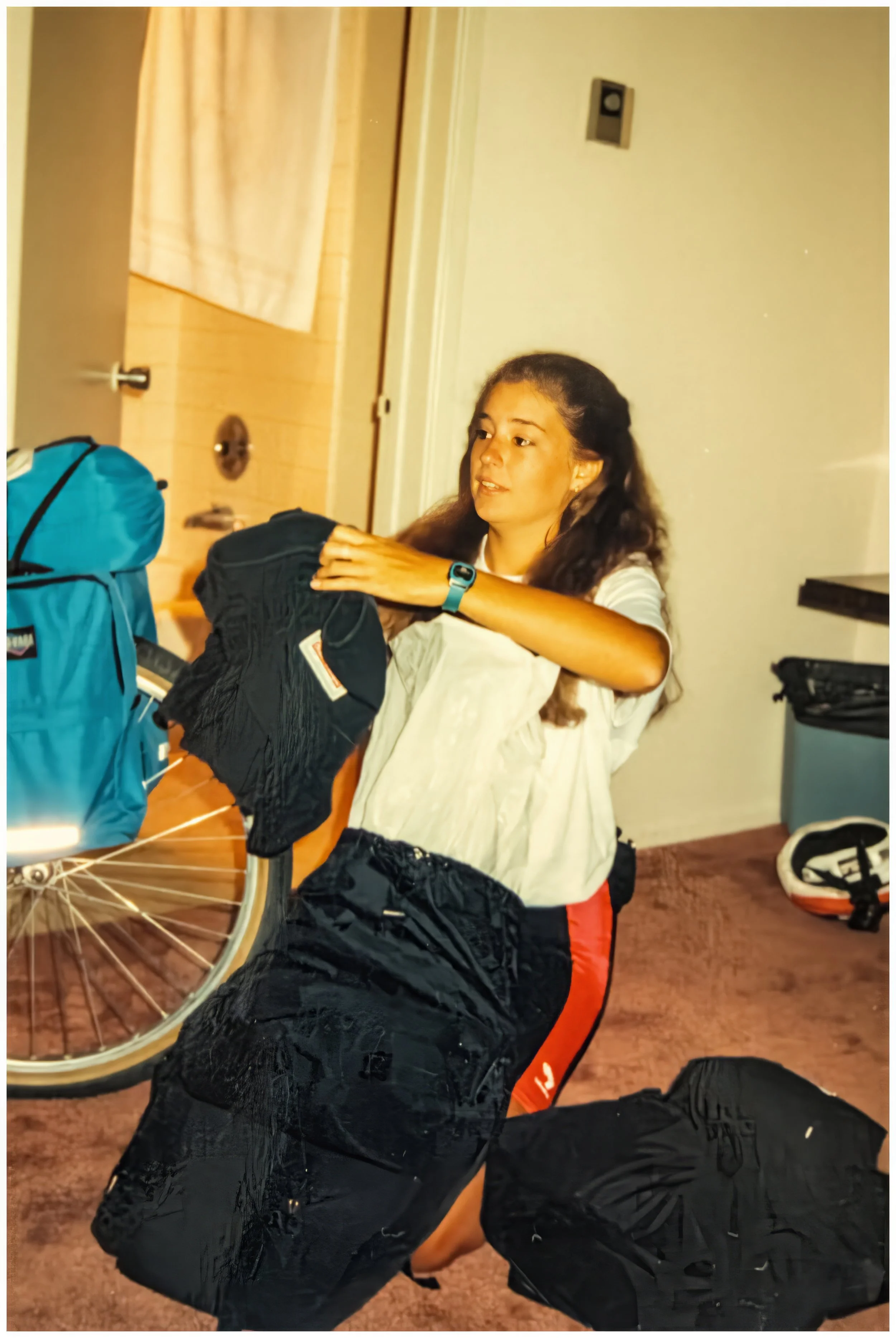
7/8/90: Up early and nervous. Christy loads a few final items into her bags before we depart. (click photo for geotag)
7/8/1990: Saying goodbye to Lisa and Barry at the real mile zero. (click photo for geotag)
7/8/1990: The first wobbly feet of our adventure. (click photo for geotag)
Day 2: A Full Day to San Simeon
-
Date: Monday, July 9, 1990
Destination: San Simeon Creek Campground (C2)
Miles: 54
Total Climb/Descent: Up 2,068 / Down -2,031
High Point / Low Point: 487 feet / 3 feet
Feet Per Mile: 38
Route Score: 75 (Moderate)
+ Navigation is Fun
The route through Pismo and into San Luis Obispo is varied and scenic, with enough turns to keep us on our toes.
The legs are a bit tired this morning, so we amble slowly through Spyglass Ridge and Shell Beach before making a long, steady climb up to San Luis Obispo.
I’m hungry again, even though we just ate breakfast a few hours ago.
Temperatures are in the high 70s, and there’s a gusty wind from the west, but neither is too bad.
The road west out of San Luis Obispo is busy, but the shoulders are good. It’s all just a bit uphill, however, which makes the pedaling noticeable.
The discomfort doesn’t last. Soon, we are freewheeling down into Morro Bay. After lunch, we head up the coast to Cayucos and then out along a beautiful stretch of coastline—a taste of what we expected to find over the next two weeks.
We head slightly inland and back uphill. None of the climbs look huge, but they are leg-sapping. The shoulder is narrower here, and the road is somewhat busy.
Cambria is bustling with tourists. We get supplies at the market before riding the last 4 miles to the campground, tired and happy to be done for the day.
+ Under The Highway to the Beach
The hiker-biker site occupies a prime position near the beach at San Simeon Creek Campground.
We shower (another bonus) and then head under the bridge that spans San Simeon Creek and end up on the beach.
It’s gray and cool—definitely not feeling like Southern California, but it’s beautiful.
The campground is crowded with cyclists from all over the world, but most of the faces are new.
We chat a bit but head to bed early, tired and a bit worried about the upcoming hills and narrow roads of Big Sur.
+ Christy's Journal
July 9, 1990 - Day Two San Simeon
Well, the first day was finally behind us, and the rest of the trip ahead. Today was 54 miles (farther than I had ever ridden).
After adjusting the front brake, then the back brake, and changing my first flat tire, we made it to San Luis Obispo.
We had lunch at Taco Bell in Morro Bay (only 20 miles left).
We made it to San Simeon around 4 pm. The site was packed, and there were a ton of foreigners at the hiker-biker site.
I made it okay, but I'm exhausted, and I could barely stand up or sit down; my knees and legs were so sore.
We watched the sunset and went to bed @ 8:30.
Day 3: Into The Hills of Big Sur
-
Date: Tuesday, July 10, 1990
Destination: Kirk Creek Campground (C1)
Miles: 40.7
Total Climb/Descent: Up 2,944 / Down -2,870
High Point / Low Point: 789 feet / 9 feet
Feet Per Mile: 72
Route Score: 80 (Hard)
+ The Power Of Breakfast
Day three greeted us with a cold fog blowing in on a stiff north wind.
Heading out of the campground was discouraging. This was a real headwind with a fog thick enough to make us feel clammy and spot up my glasses until I couldn’t see.
Two miles down the road, we spotted a place to regroup: A simple breakfast cafe in San Simeon.
This became more than a spot to wait for the weather to clear; it unlocked a secret weapon we used for the rest of the trip.
Schoolhouse Rock had spilled the beans years before, but packing in a large breakfast—French toast, side of ham, hash browns, coffee, orange juice—was precisely what our bodies needed.
A packet of instant oatmeal was convenient, but it just wasn’t enough.
So this was the first morning of many mornings when we’d ride for a few miles and then stop for a big breakfast. It did wonders for our stamina and morale.
+ The Truthfulness of Real Difficulty
With a large and excellent breakfast tucked away, we headed north.
Now, Pismo was fine, and Cayucos was top-notch, but we were heading into terrain that was world-famous for its beauty.
We knew this, but the view didn’t match the hype as we rode the 14 miles across the coastal plains to the cliffs of Big Sur. It was still foggy and chilly, and the undulating roads gave no respite.
In the Kirkendall book, this road looked dead flat until the towering climbs started north of San Carpoforo Bridge.
And, by not meeting that expectation, each small climb seemed strangely difficult.
Then something shifted.
Maybe it was the French toast and ham finally hitting the bloodstream, or perhaps the clearing weather and the moderation of the wind, but the steep climb to Ragged Point seemed not that hard, maybe even … fun.
Here, plunging by a series of near-vertical hillsides down into the Pacific below, the Big Sur coastline wears its challenges like a crown. There’s no hiding from them, and they are apparent to see.
But unlike the “pecked to death by ducks” small rises of the plains below, there was a simple honesty in their difficulty which made them—if not easy—then easier to overcome.
Safely on the inside side of the road, and with traffic not too bad at all, we tackled one mile-long climb after another, gasping not just at the difficulty but at the fantastic views every hundred yards.
It was challenging, it was gorgeous, and it was manageable
+ Christy's Journal
July 10, 1990 - Day Three Kirk Creek
Today was our first day in the mountains of Big Sur. Getting there was almost as bad as the hills themselves. It was foggy, misty, and windy. : (
We met a guy who was trying to make it to Monterey that day. Impossible, but it lifted our spirits.
The hills weren’t as bad as I imagined. We had lunch in Gorda (a town consisting of a gas station, a cafe, and a mini mart). We called Lisa and wished her a happy birthday.
Kirk Creek was lovely, but there were no showers. We walked down the cliff and strolled along the beach.
Day 4: Camping In The Redwoods
-
Date: Wednesday, July 11, 1990
Destination: Julia Pfeiffer State Park, Big Sur (C3)
Miles: 29
Total Climb/Descent: Up 2,610 / Down -2,521
High Point / Low Point: 974 feet / 102 feet
Feet Per Mile: 89
Route Score: 51 (Moderate)
+ Get Into The Groove
Packing up the tent, stuffing the sleeping bags, getting everything on the bike: these are no longer novel. They aren’t automatic yet, but we’re finding our groove. We are settling in and beginning to relax.
An easy day helps. Although this was Big Sur at its most dramatic, the climbs no longer terrified us. It was just too pretty for that.
+ The Lure of Lórien
So far, each campsite had exceeded expectations, but Julia Pfeiffer State was the first stop that felt like a true destination.
We unpacked our bikes in a towering grove of redwoods. The hiker-biker site was secluded, set away from cars but close enough to the Big Sur River to hear its murmur. A breeze swayed the branches far above. I hardly had to squint to feel transported to a place like Tolkien’s Lórien.
But there was more than mystical peacefulness here. That was expected. What pushed the campground over the top was the showers, laundry, and a stocked store full of specialty pasta and cold beer.
That night, we made a fire, the tall redwood trees around us illuminated in a soft glow that confirmed that getting here was worth the effort.
+ Christy's Journal
July 11, 1990 - Day Four, Julia Pfeiffer Big Sur
Short day but hilly. Lunch @ Big Sur Deli/Market.
Beautiful campsite — in the middle of a redwood grove! Able to do laundry and take a hike. Spaghetti dinner & campfire.
Day 5: Otters, Sheets, and Pillows.
-
Date: Thursday, July 12, 1990
Destination: Cannery Row Inn, Monterey (H3)
Miles: 34.5
Total Climb/Descent: Up 2,370 / Down -2,539
High Point / Low Point: 583 feet / 4 feet
Feet Per Mile: 69
Route Score: 55 (Moderate)
+ Back To Civilization
After three nights away from any big towns, we were headed into Monterey today.
Although the Kirkendall book guides riders to the campground at Veterans Memorial Park, we thought that was a bit out of the way from the attractions of town.
Maybe it was time to spring for a hotel room, with a bed and sheets and pillows and a shower.
First, however, we had to get there.
Leaving Julia Pfeiffer, we hit a stiff headwind from the northwest, which moderated only after we veered farther north at mile nine.
We were again taken aback by the beauty of the coastline, which seemed so much more vivid and real from the saddle of a bike.
The road was closer to sea level and undulated less. The place names felt justified: Hurricane Point, Rocky Creek, Granite Canyon, Whale Peak, and Painter’s Point.
After everything we’d seen, I can’t say the famous Bixby Bridge was the highlight, but it was still fun to pedal across.
Soon, we entered the tony neighborhood of Carmel Highlands, leaving a nature-dominated landscape behind for a neighborhood of over-the-top houses.
We entered the bustle of Monterey, even braving a bit of the four-lane Cabrillo Highway, which looked and felt like cycling down a freeway.
+ The Price of Luxury: $82.50
We decided early in the day that we’d aim for Cannery Row instead of camping.
Without much searching, we were able to find a room at The Cannery Row Inn ($82.50), in the heart of town and near the world-famous Monterey Bay Aquarium.
We napped, visited the aquarium, had a waffle cone, went out to dinner, and then thoroughly enjoyed a night in a real bed.
+ Christy’s Journal
July 12, 1990 – Day Five Monterey
Nasty headwinds while we are leaving Big Sur. We got a hotel in Monterey at the “Cannery Row Inn.” Ahhh! Pillows, TV, and a bed!!
Monterey Bay Aquarium was fascinating (Baby sea otter in the outside tidepool.
Dinner @ El Torito (Bad service).
Day 6: Bridge Out.
-
Date: Friday, July 13, 1990
Destination: New Brighton State Beach, Capitola (C2)
Miles: 54
Total Climb/Descent: Up 1,718 / Down -1,643
High Point / Low Point: 409 feet / 5 feet
Feet Per Mile: 32
Route Score: 62 (Moderate)
+ Slow is Fast
After a good night's sleep in a bed, I felt downright slothful at the prospect of today’s ride.
A quick jaunt up to Capitola, near Santa Cruz, the route promised to be a relatively easy 40 miles on mostly flat roads.
And all went well at first, as we passed through Seaside and Marina on quiet surface streets.
Farther north, we rode on the frontage roads of Highway 1, which looked like a freeway: a divided road with three lanes of traffic in each direction and large on- and off-ramps. Lots of cars and trucks, too.
So maybe it made sense when I didn’t take the onramp onto Highway 1 at Nashua Road, but instead continued straight through the quiet farm fields.
Two miles later, my mistake was apparent: Nashua Road ended at a closed bridge at Tembladero Slough.
Now, in 2025, you pull out your phone, load up Google Earth, and discover that numerous small bridges link the agricultural fields. With a bit of luck and a little stealth, you are back on track in ten minutes.
In 1990, however, all we saw was a road-closed sign, a tall fence across the mouth of the bridge, and a deep, ominous channel of water below, impossible to wade across.
So, we turned around.
I don’t recall that we discussed riding on the highway when we got back to Highway 1. It seemed so unlikely that it was the correct route.
We pedaled on, adding 12.5 miles to our route via a convoluted detour that eventually led us through the busy streets of Castroville.
We arrived at New Brighton State Beach, shattered. Not because the route was so hard, but because it was so much harder than we expected.
It took me twenty years to realize my mistake. That closed bridge was always off route. The correct course, the one the Kirkendall book described, always had us pedaling down that onramp and onto the busy freeway below.
Sometimes slowing down and paying close attention will save you time and energy—no matter how unlikely the recommended course appears.
But that lesson eluded me on this day. Unfortunately, that wasn’t the end of our bad luck.
+ Christy's Journal
Day 6: New Brighton State Beach, Santa Cruz
***Friday The 13th***
Supposed to be an easy 40-mile day. First 20 mi excellent — no wind and flat. Had a snack at a fruit stand before getting lost. There was a bridge out, so we had a 10-mile detour. Once back on track, Sean got two flats!
Got to camp. Sean called Dellefield, and I called Dad. We ordered pizza and had it delivered to the campsite.
We were tired and had to wait for showers.
Early to bed & awakened an hour later by drunk campers with car headlights, hammering tent stakes, and laughing. They kept us up until 12:30.
Day 7: A Pretty Day Out.
-
Date: Saturday, July 14, 1990
Destination: Francis Beach C.G., Half Moon Bay State Park (C2)
Miles: 58
Total Climb/Descent: Up 2,990 / Down -3,088
High Point / Low Point: 479 feet / 7 feet
Feet Per Mile: 52
Route Score: 116 (Hard)
+ About Route Ratings
So, how hard is one ride compared to another?
It’s a question I’ve tried to put a number on.
Some factors are out of your control. Rain or heavy winds can make the simplest, flattest ride feel difficult.
But generally, it boils down to distance traveled and elevation gained, with route surface and altitude layered in.
The math is:
(Mileage X (Elevation Gained / 1.5)) / 1000 = Route Rating Score
The high point of the route affects the divisor as follows;
Altitude Range
0 to 7,000 = 1,000
7,001 to 10,000 = 900
10,001 to 11,000 = 800
11,001 to 12,000 = 700
12,000 to 14,000 = 600
14,001 to 16,000 = 500
More than 16,000 = 400
Road surface is also factored in:
Dirt roads = -100 to divisor
Poor/rocky dirt roads = -200 to divisor
Technical singletrack or trail = -300 to divisor
All this gives the following range:
0 = Rest Day
1 to 21 = An Easy Ride
21 to 49 = Easier Than Most Rides
50 to 75 = Moderate
76 to 124 = Hard
125 to 175 = Difficult
176 to 225 = Very Difficult
225 to 600 = Extremely Difficult
600+ = BLACK (certain death)
It’s all pretty arbitrary, but it checks out.
For example, according to this system, my most challenging ride ever was from Grand Junction to Delta in Colorado. That route climbed 7,197 feet over Grand Mesa for 92 miles on good roads and reached a high point of 10,857 feet above sea level, giving it a score of 554 (Extremely Difficult).
Based on my memory from that day in 2010, that seems about right.
The most challenging ride on the 1990 tour had a route rating of 318, but we’ll have to wait a bit longer before talking about that.
+ Meanwhile, Back To The Tour
On paper, this is the hardest day yet of our week-old tour.
But in 1990, we only knew it was going to be long and rolling, with possible headwinds.
So we started early and stopped for breakfast in Davenport at mile 20 before there was a breath of wind.
North of Santa Cruz, Highway 1 carried us past the open fields and bluffs of Wilder Ranch, with the ocean pressed close on our left.
Davenport’s old cement plant marked the last bit of town before the road quieted, rising and falling in a steady rhythm that never felt steep but never let us settle.
The highway lifted over one low ridge after another, dipping toward empty beaches and rocky coves before tilting skyward again.
Waddell Creek opened briefly toward the redwood canyons inland, then the Pigeon Point Lighthouse came into view, bright against its low headland.
Beyond it, farms and artichoke fields lined the inland side while a string of small beach turnouts slid past on the right, guiding us over those final rollers toward the first houses of Half Moon Bay.
+ Christy's Journal
Day 7: Half Moon Bay
Fifty-eight miles on five hours of sleep was not fun. We had breakfast in Davenport. Cute Place. Quite foggy in spots.
Sean almost hit a car after it pulled in front of him @ Ano Nuevo. Took a nap once in camp. Got food at a store on the corner.
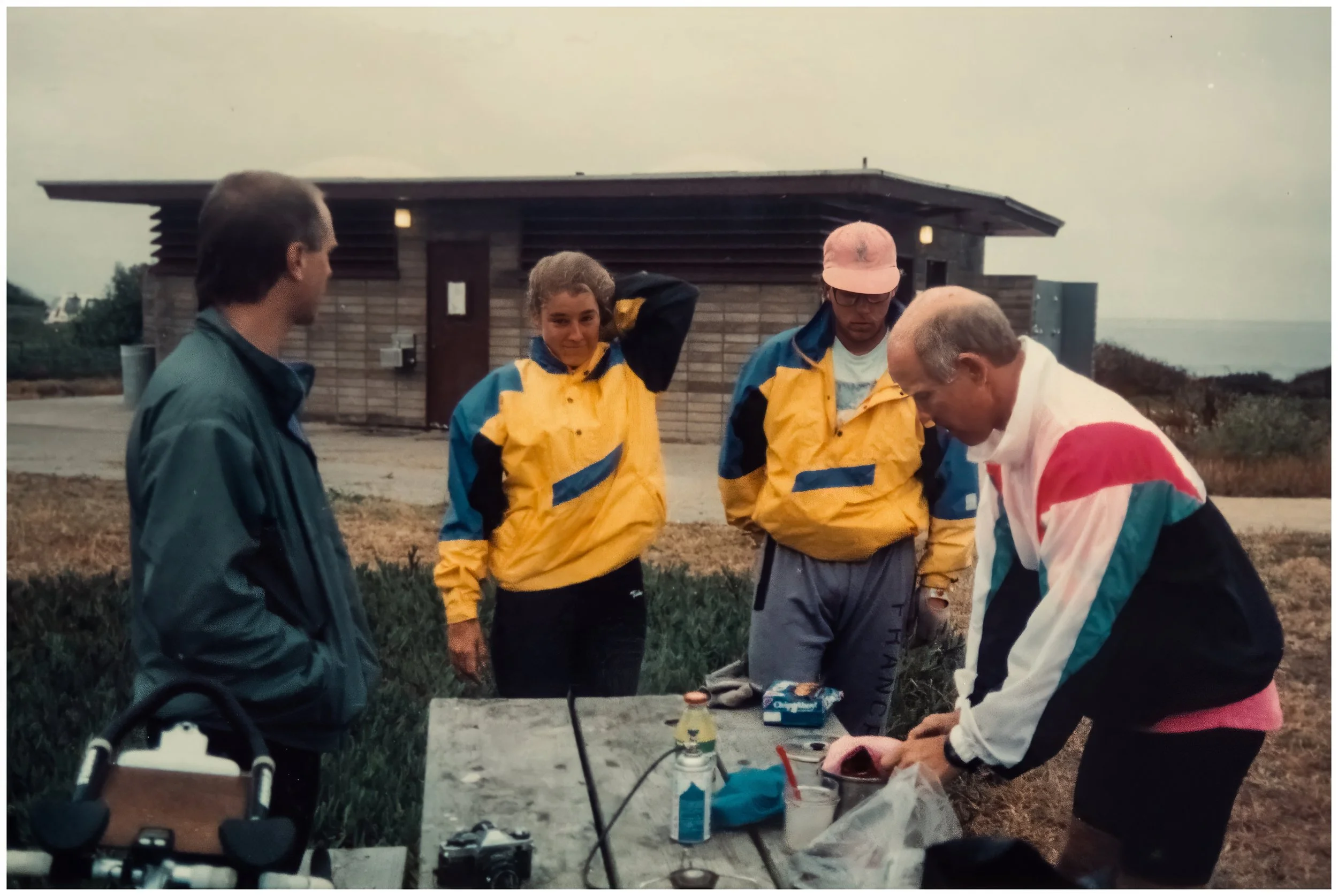
Met up with Abe and Fred again. We also met a guy from Missouri named Doug. We also met Fred’s friend Don, who came down from S.F.
Good conversation.
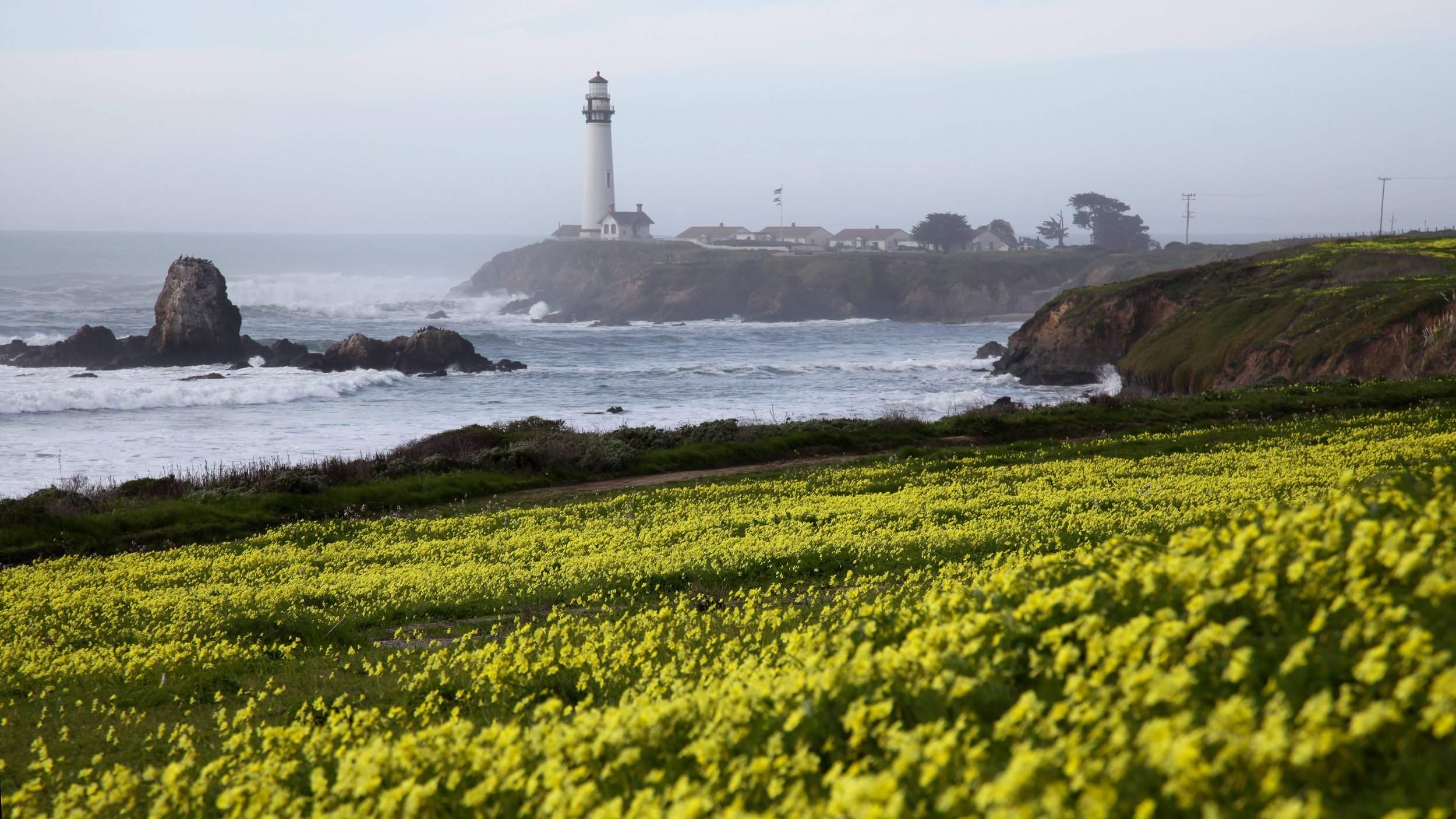
Pigeon Point Lighthouse in November, 2016.
Doug and Don (far right) with the fashion victim Bobbsey twins. Francis Beach Campground Hiker Biker Site, Half Moon Bay State Park. (click on image for geotag)
Day 8: Across The Golden Gate.
-
Date: Sunday, July 15, 1990
Destination: Creekside Loop Campground, Samuel P. Taylor State Park (C2)
Miles: 60
Total Climb/Descent: Up 3,348 / Down -3,246
High Point / Low Point: 723 feet / 7 feet
Feet Per Mile: 56
Route Score: 135 (Difficult)
+ Devil's Slide
Big Sur was days behind us, so imagine my surprise when reaching Devil’s Slide. (Map)
Since 2013, the steep, rocky, landslide-prone stretch south of Pedro Point has been bypassed by the Tom Lantos Tunnels.
In 1990, however, it was still a busy stretch of Hwy 1, perched precipitously above the ocean with clear signs of rockfall and road closures.
And did I mention the traffic?
The tricky bit didn’t last long, but it was enough to take my mind off the upcoming logistical nightmare navigating San Francisco would no doubt be.
But we had no idea what we were in for once we reached the city.
+ The Tour de San FRANCE-isco
Riding in a city, any city, can be intimidating. But San Francisco is a special case.
Not only did it have fast-moving cars and a labyrinth of streets to navigate, but it also had its famous hills, plus tram lines and tunnels.
I was so concerned that I wrote a special, extended turn-by-turn breakdown back in the SDSU map room.
This cheat sheet was a beast. From Pacifica to San Francisco, then over the Golden Gate Bridge and through Mill Valley, Marin City, and Larkspur, there were nearly a hundred turns and waypoints.
All in all, it would be a huge day.
So we carefully made our way into the city, following Palmetto Avenue and Skyline Drive while gripping our bars—and gritting our teeth—a little more tightly.
But something felt different by the time we reached the San Francisco Zoo. Instead of roads full of cars, we saw a road full of bicycles, all heading exactly where we wanted to go.
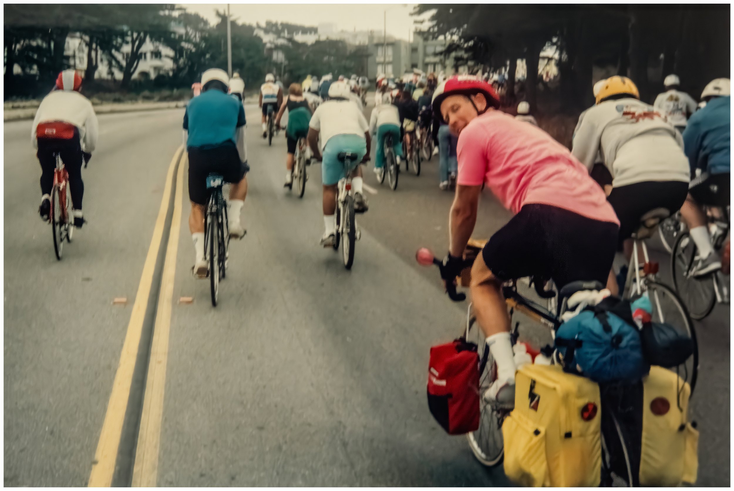
We soon realized that we had stumbled into the 11th annual “Tour de San FRANCE-isco.” This yearly group ride attracted 7,500 riders in its day and followed an out-and-back course from Fisherman’s Wharf to the Zoo and back.
We jumped in with the riders, many of whom commented on our fully loaded bikes.
That made us feel pretty good already, but when we hit the hills and started passing road-bike riders, we knew our bodies had begun to adapt to the stresses we were putting them through. That offered a new level of confidence.
We chatted and laughed and followed a traffic-free route through the Richmond District and into the Presidio that on any other day would have been impossible.
It was with some degree of sadness that we parted ways at the Golden Gate Bridge, but within a hundred yards of riding out across that iconic expanse, our mood had changed to wonder, awe, and satisfaction. We had made our way to the Golden Gate!
No matter what happened next, that was an accomplishment worth remembering.
+ Christy's Journal
Day 8: Samuel P. Taylor
Great day! Easy route through San Fran —> ran smack into the Tour de San Francisco. We talked with others on the tour. It made the trip through S.F. go by quickly.
We had problems with Sean’s chain, so we got a new one in Sausalito. We had breakfast there.
Sam P. Taylor is beautiful! We met a couple from Colorado (Mark & Mary). They were so very lovely, and we had a great conversation.
Our friend Don, riding with the Tour de San FRANCEisco crowd up Point Lobos Avenue, usually a busy road full of cars. (Click photo for Geotag)
Day 9: The North Country.
-
Date: Monday, July 16, 1990
Destination: Bodega Dunes S.B., Bodega Bay (C2)
Miles: 42
Total Climb/Descent: Up 2,685 / Down -2,722
High Point / Low Point: 436 feet / 0 feet
Feet Per Mile: 64
Route Score: 75 (Moderate)
+ The Next Stage
The redwood trees of Samuel P. Taylor were gorgeous, and the campsite first rate, and when we pedaled out the next morning, we could sense we had entered a new stage of our journey.
Since Monterey, we had been in built-up areas or less developed areas that were still linked to larger towns.
Traveling through San Francisco and Marin was exceptionally crowded.
But things on the northern coast would be different, and for the next 280 miles, the towns would be small, scenic, and built around tourism and logging (more on that later).
It was another cool and damp morning as we headed up through the tiny Point Reyes Station and along the narrow road flanking Tomales Bay.
The shoulder of the road was non-existent as it rolled over a never-ending series of short climbs and descents. The views were good, though, with the sheltered Tomales Bay giving off serious Scottish Loch vibes.
Still, it was nice to head inland a bit, where the gray coastal pall gave way to broken clouds with blue skies peeking out in places.
The road remained undulating, but now the farms spread across the rolling hills had an Irish countryside vibe. To the east, we knew the clouds gave way to blue skies and heat, and we were ready for some warmth, but that would have to wait.
As we headed back toward the ocean and Bodega Bay, the temps cooled and the skies grayed once again, giving the small town a distinct seaside-village vibe.
+ Alliances Formed
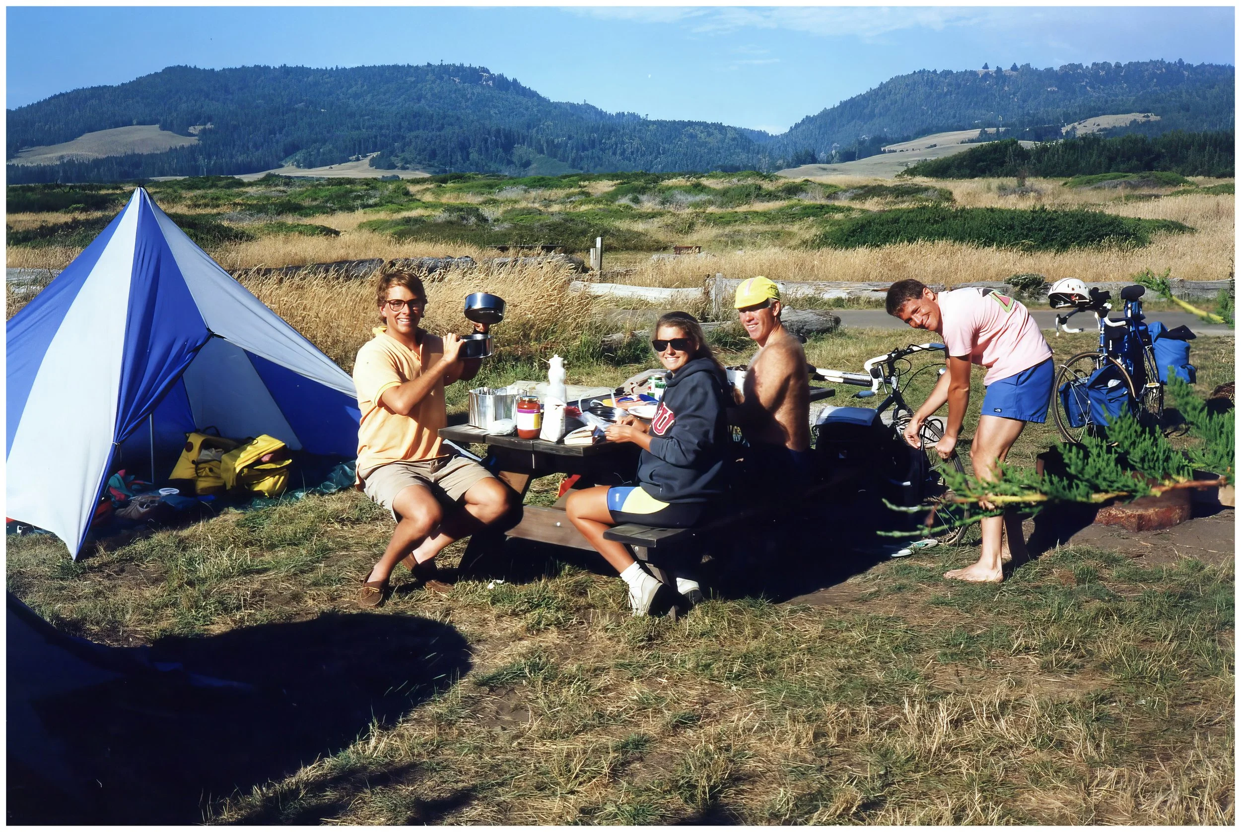
We had been bumping into Fred and Don for over a week now, sharing a campground hiker-biker site and then going a few days before linking up again.
Our pace was slow (about 10 mph before you factored in the breaks for food and sightseeing), so they usually went on ahead of us.
For the next five nights, however, we’d be sharing hiker-biker sites.
They were good guys, friendly and welcoming, and it was a pleasure to run into them.
In Bodega Bay, we also met Steve, a doctor from San Francisco who was heading to Glacier National Park, a trip of similar distance to ours. He was another nice guy we’d hang out with for the coming week. He rode a unique Bruce Gordon Rock n Road bike—arguably one of the first 700cc gravel bikes ever.
+ Christy's Journal
Day 9: Bodega Bay
A cold and dreary morning with small rollercoaster hills along the way. Snacked in Tomales. We had lunch and did laundry in Bodega Bay. We had dinner with Fred & Don at Scott’s Pizza. We also met Steve this night.
Day 10: A Good Test.
-
Date: Tuesday, July 17, 1990
Destination:Manchester State Park, Manchester (C2)
Miles: 69
Total Climb/Descent: Up 4,829 / Down -4,857
High Point / Low Point: 614 feet / 1 feet
Feet Per Mile: 70
Route Score: 221 (Very Difficult)
+ Sea Stacks and Rolling Hills
The ride from Bodega Bay to Manchester State Park was a long one. The Kirkendall book warned, “The ride … is long and demanding. The road is narrow, winding, and steep. Traffic is light, except on Summer weekends. The most serious hazard to cycling in this section is the sheep, who wander on and off the highway.”
This was both sobering and charming, and the promise of rolling, grassy hills, miles of wooden fences, surf-battered cliffs, small sheltered coves, and weathered sea stacks of all sizes and dimensions made us eager to get pedaling.
The route did not disappoint. Small villages dotted a rocky coastline. The mouth of the Russian River was picturesque (alas, no photos …). North of Jenner, Highway 1 ran along a rugged, open coastline that felt wilder than anything south of it—a close cousin of Big Sur.
The road climbed onto broad, windswept headlands where the ocean spread out below in long, unbroken views.
Between the headlands, the highway dropped into small creek valleys bordered by low trees and weathered fences.
Soon, the land opened into rolling ranch country—simple fields, long fencelines, and a few scattered barns—before the route bent inland toward Manchester.
All of this made the ride, which was easily our hardest day yet, more fun than a chore—the memories are all good.
+ Sea Ranch: Witness Protection Ville?
Forty miles into the day, we entered Sea Ranch, a small community of weathered gray wood homes with a modern, simple aesthetic.
Designed by a small group of Bay Area architects and designers in the early 1960s, the development was envisioned as a progressive, inclusive community, guided by the principles of good design and harmony with the natural environment.
The community stretched in dribs and drabs for seven miles along the lonely coast. Many of the houses looked to be vacant—or secluded—and we joked that the whole area gave off serious “Witness Protection” vibes.
It was remote and a little creepy, but undeniably gorgeous.
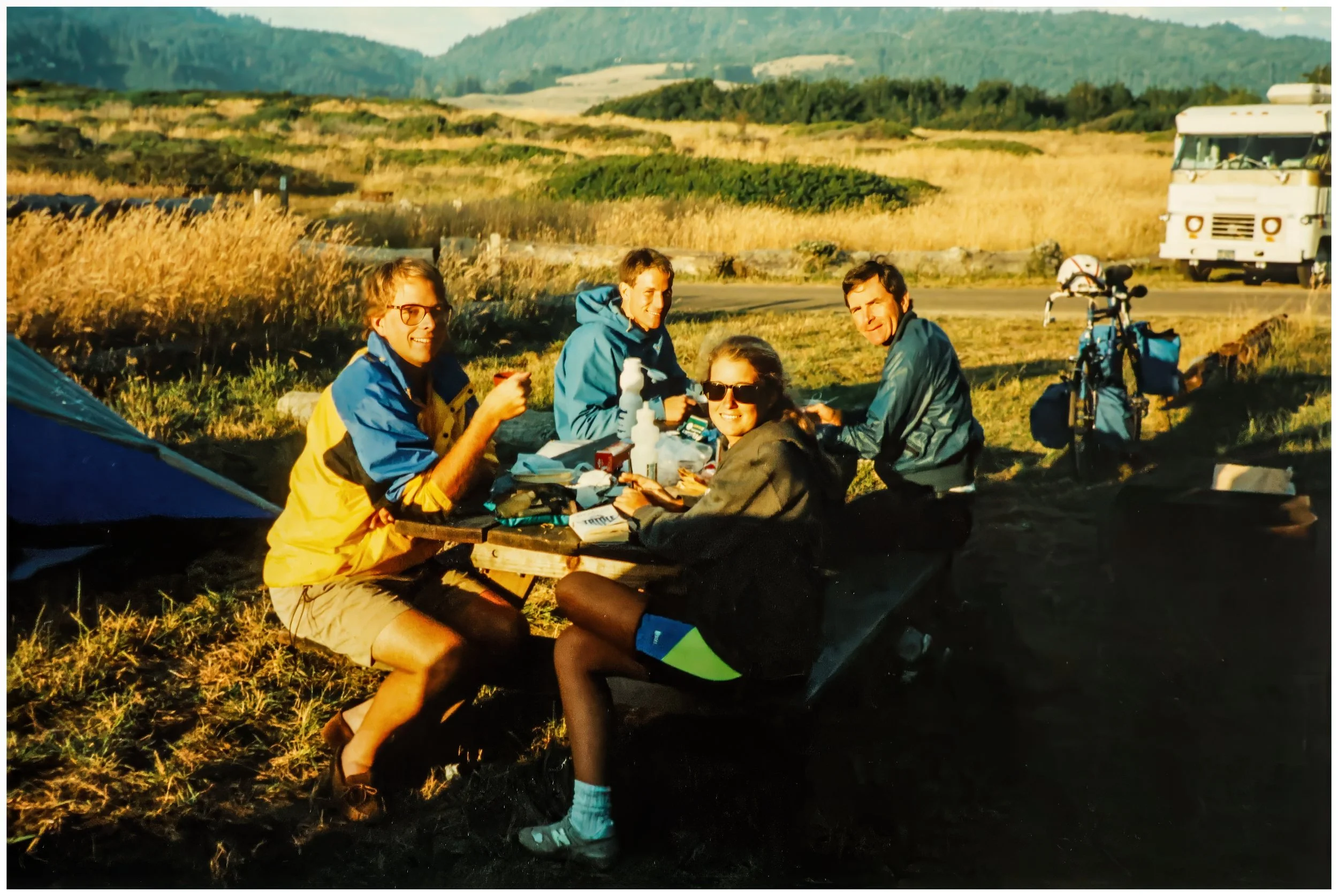
+ Christy's Journal
Day 10: Manchester
The Russian River flowed through a beautiful valley before entering the ocean. We wanted to eat breakfast there in Jenner, but we had no such luck. We weren’t able to get food until Salt Point, 27 miles after we had started that morning. We stopped in Gualala for some yogurt, where we rejoined Fred, Don, and Steve. Food shopping in Point Arena, where we shared a campsite with the guys. No showers and pit toilets. Yuk. We walked to the beach, where there was a lot of driftwood.
Enjoying some afternoon sunshine while hanging with Don and Steve at the Manchester Campground. (Click image for geotag)
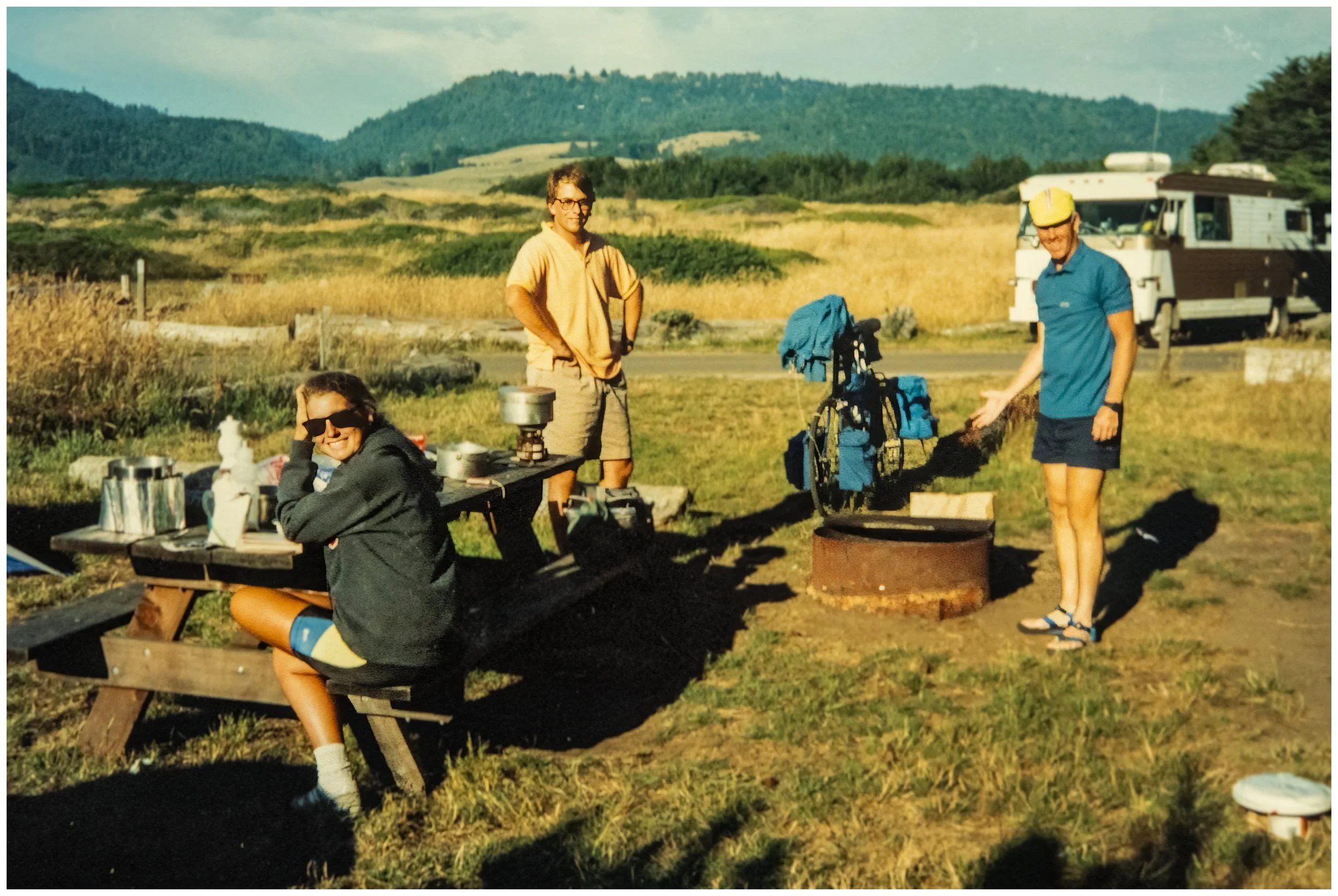
Don explains firepit basics to Fred (who is behind the camera). Manchester State Park. (click image for geotag)
Dinner with Steve and Fred. Manchester State Beach. (Click image for geotag)
After dinner beach exploring with the gang. Manchester State Beach. Note the indispensable and thoroughly awesome fanny pack that I rocked for the entire tour. (Click image for geotag)
Day 11: Redwood Summer.
-
Date: Wednesday, July 18, 1990
Destination: MacKerricher S.P., Cleone (C2)
Miles: 44
Total Climb/Descent: Up 3,221 / Down -3,227
High Point / Low Point: 436 feet / 1 feet
Feet Per Mile: 73
Route Score: 95 (Hard)
+ Hayduke Lives!
My brother turned me on to “The Monkey Wrench Gang” during our family trip to Alaska in the Summer of 1989.
Edward Abbey’s best-known work of fiction is a novel about the use of sabotage to protest environmentally damaging activities in the Desert Southwest. It was so influential that the term "monkeywrenching" has come to mean, besides sabotage and damage to machines, any sabotage, activism, law-making, or law-breaking to preserve wilderness, wild spaces, and ecosystems.
This was heady stuff for 23-year-old Sean, and I loved the book and all of Edward Abbey’s other works—especially Desert Solitaire.
That admiration continues to this day. Heck, the title of this website, “Take The Other,” comes from Abbey’s Road, one of his later books.
I’m not alone in my fondness for Abbey, and I’m not the only one who took his message to heart. The Monkey Wrench Gang inspired Dave Foreman to found Earth First! in 1980.
This environmental organization often advocated the sort of minor vandalism depicted in the book and had the motto "No compromise in defense of Mother Earth!”
In the summer of 1990, Earth First! organized a three-month environmental activism movement to protect old-growth redwood trees from logging by Northern California timber companies.
On this eleventh day of our tour, we entered the epicenter of that movement, which had been dubbed “Redwood Summer.”
While our arrival on the scene was happenstance, and we never saw large protests or environmental actions, it did cause me to consider: What would I do if I knew, without a shadow of a doubt, that my actions would save a grove of old-growth redwoods?
Would I cross a busy highway? Of course. Would I walk five miles? Yep. Would I peacefully confront employees of the timber company? Err .. yes, but it’s no longer comfortable.
Would I lie down on a busy highway to stop traffic? To 100% save an old-growth grove? Probably.
Would I trespass and chain myself to a tree? Maybe. I didn’t know. I was glad I didn’t have to decide.
I did know that I didn’t feel comfortable destroying anything and would never intentionally do anything that could hurt somebody.
So, over the next week, I kept an eye peeled, wore my “Think globally, Act locally” T-shirt, and pondered how I could do the most good—but really didn’t do much at all.
Fortunately, the success of Redwood Summer did not depend on my decisions, and it’s now considered a turning point in environmental activism.
+ A 70,000-Pound Menace
So, my direct-action environmental activism fizzled, but that doesn’t mean I wasn’t directly affected by the North Coast timber industry during our tour.
Through Big Sur (and later along the coast just north of San Francisco), we had learned to ride on busy roads with little or no shoulders using a strange mixture of boldness and caution.
The trick was to read the traffic—and sometimes individual drivers—to determine when to pull over and when to take the lane safely.
In Big Sur, the traffic was mostly tourists. While they were often distracted and clueless, they were usually considerate.
Many times, a driver would politely wait until it was safe to pass, giving us a thumbs-up or a friendly wave once they had moved past.
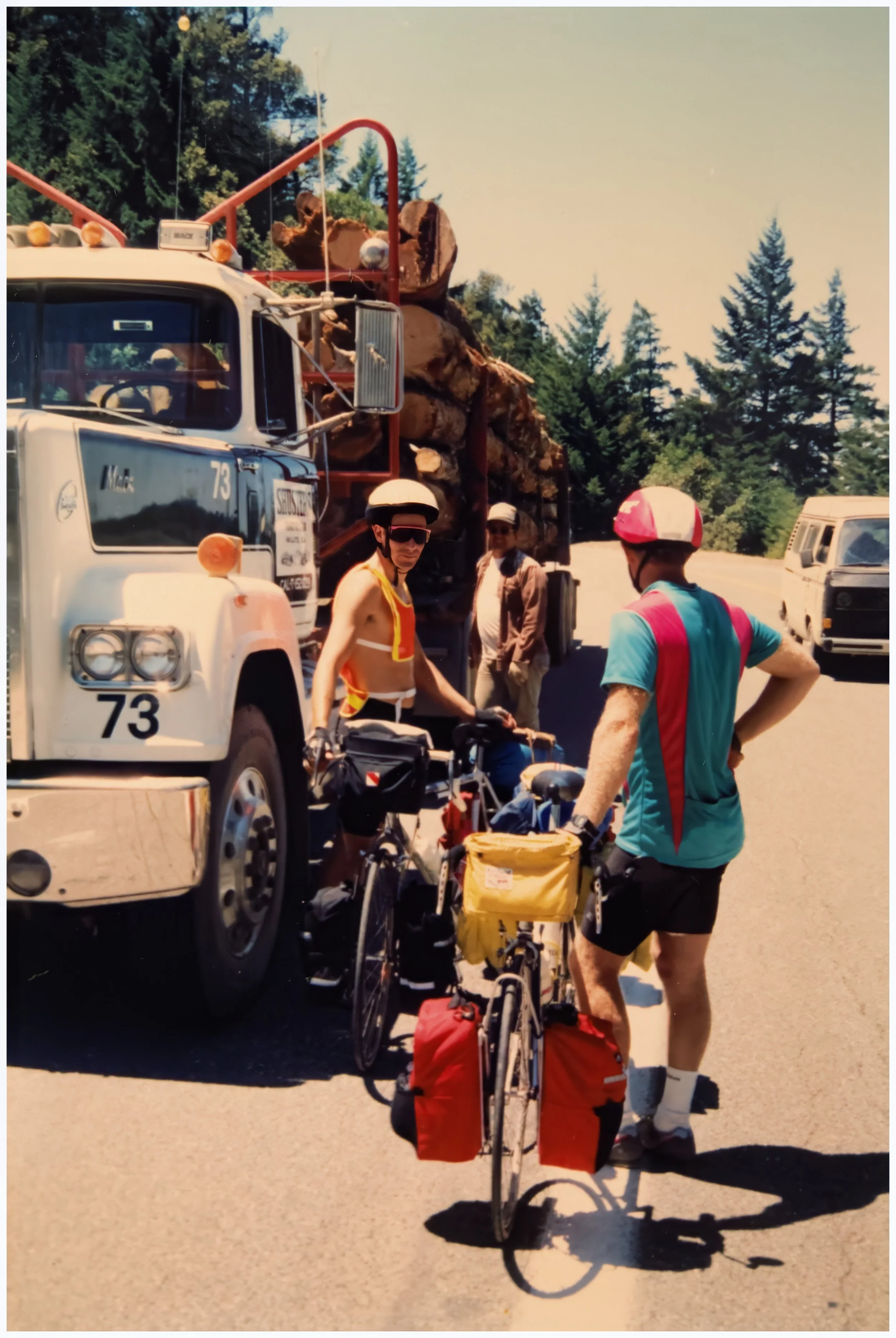
But on day 11, we had entered timber country, and the traffic now included the dreaded timber truck.
With the backdrop and tensions of Redwood Summer in mind, we took no chances, hugging the right margin of the road and pulling over and stopping when we heard one of the large semi-trucks approaching.
But this wasn’t always possible, and the first time a loaded logging truck blasted by us at 40 or 50 mph, it left a lasting psychic impression.
The drivers were professional and alert. They were also the apex predator on the road and had places to be.
We took the threat seriously and survived, but it was never routine when they passed.
+ Christy's Journal
Day 11: MacKerricher
Our first whole day of logging trucks.
We ate breakfast at a Cafe in Elk (a cute place with great music).
I went a little crazy on groceries that night. We just missed a beautiful sunset on the beach.
Steve and Don and a logging truck.
Day 12: Leggett Hill.
-
Date: Thursday, July 19, 1990
Destination: Standish Hickey S.R.A., Leggett (C3)
Miles: 44
Total Climb/Descent: Up 4,503 / Down -3,661
High Point / Low Point: 1,906 feet / 31 feet
Feet Per Mile: 104
Route Score: 131 (Difficult)
+ "Abandoned touring bags lining the road."
After almost two weeks along the damp, foggy coastline, we were heading inland today and into the heat.
The way was guarded, however, by the famous Leggett Hill.
Kirkendall and Spring had this to say in Bicycling The Pacific Coast: “A hill just south of Leggett is the principal point of interest for the section; with an elevation of nearly 2,000 feet, it is the highest point on the bike route. Cyclists talk about Leggett Hill up and down the coast, increasingly exaggerating its proportions as they go. Contrary to rumor, abandoned touring bags do not line the road, nor are there graves of cyclists who did not make it. Although a long climb, Leggett Hill is by no means the steepest climb on the coast.”
It was, however, a stout 9.3-mile climb that gained just over 2,000 feet. A “Cat 1” in Tour de France speak, but a lowly 1.97 using the more esoteric FIETS scale.
But it was to be a welcome change. We powered up with a big breakfast in Westport, in a room of an inn that looked like somebody’s dining room.
At mile 18, we turned inland and headed up through dense, shadowy forests. Again, the climb's consistency and honesty made it fun to tackle. We watched the miles tick off and chatted as a group.
Breaks in the canopy of trees revealed how much we had climbed—long vistas across deep forested canyon—and the rising temperature as we pulled away from the coast.
Finally, the climb eased, and after a strange three-quarters of a mile on almost perfectly flat road, we began our long plunge to the South Fork of the Eel River and Highway 101.
+ Another Roadside Attraction
We descended into Leggett with temperatures well into the 90s and bright sunshine.
The tall groves of redwoods, however, made the heat bearable; more of a novelty with so much deep shade at hand.
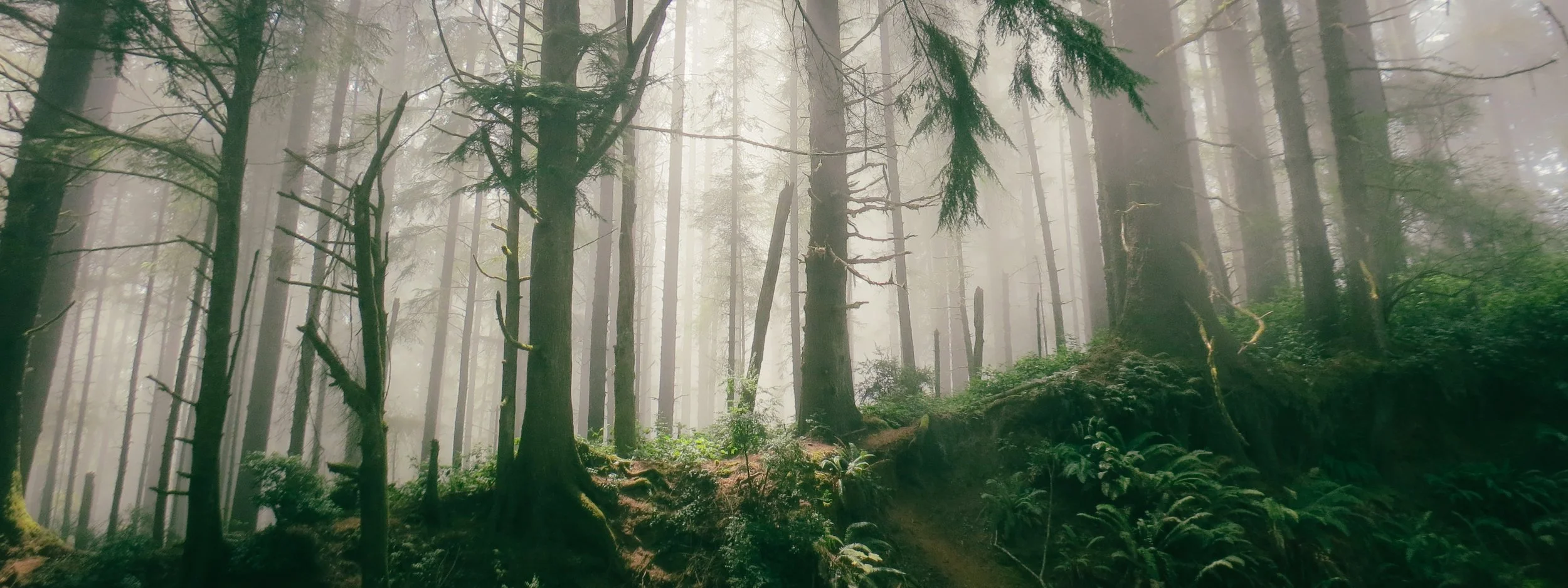
We were in true redwood country now, nearly at the gateway to the famous Avenue of the Giants, and redwoods were the backbone of the tourist industry here.
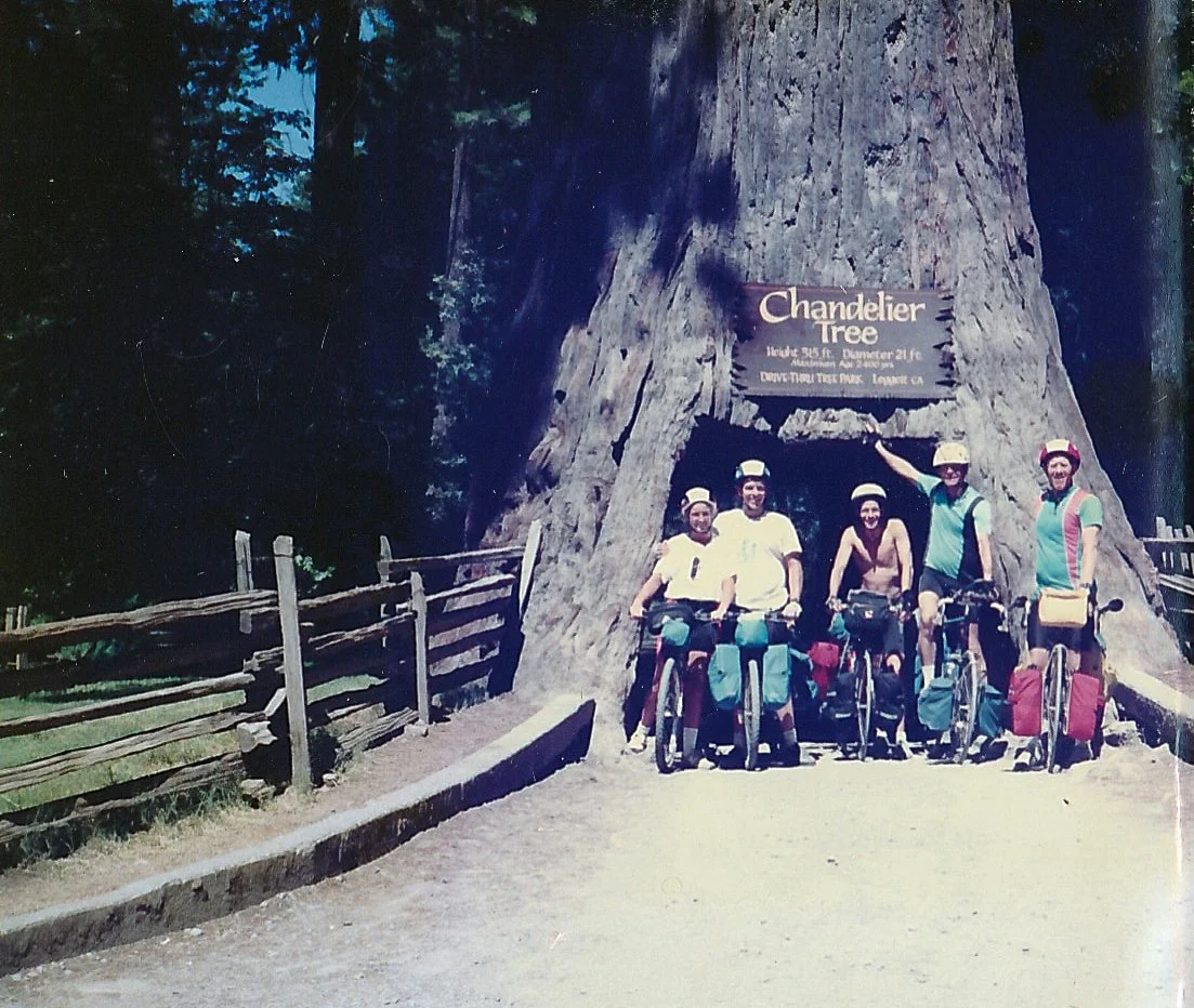
Over the next few days, we’d be confronted with enticing tourist traps like the World Famous Tree House, Confusion Hill, and the Trees of Mystery (which featured an enormous 50-foot-tall concrete statue of Paul Bunyan and his ox Babe).
“Drive-through trees” were also popular. We had barely finished our long descent from Leggett before we were posing for a group photo at the “Drive Thru Tree of Park Leggett.”
(Alas, those photos were also lost in the rear pannier debacle of Day 37.
But spirits and temperatures were high, and Standish Hickey campsite offered the first of many opportunities we’d relish over the next month: A swim in a river.
With a six-pack of beer and wonderfully tired legs, hanging onto a fallen log in the cold waters of the Eel River was precisely what we needed.
+ Christy's Journal
Day 12: Standish Hicke
The day we had been soooo worried about was here.
We had breakfast at a little inn in Westport. The lady was lovely enough to serve us some pancakes. The first hill wasn’t too bad, in fact, it was beautiful and peaceful with the trees, birds, river, and flowers—until you could hear the chainsaws in the distance
Leggett was hard, but nothing impossible, and the downhill for the next two and a half days was great!
After making it down the hill, we decided to ride our bikes through the drive-thru tree.
On our way there, we ran into the guys who were having lunch. We ate and then went to the tree.
We got into camp, got a six-pack, and headed for the river! Ahh! It was great. We had dinner at the deli across from the campground, and I got eaten by mosquitoes.
Breakfast in Westport with Fred, Don and Steve.
The Leggett Chandelier tree with Steve, Fred and Don (click image for geotag).
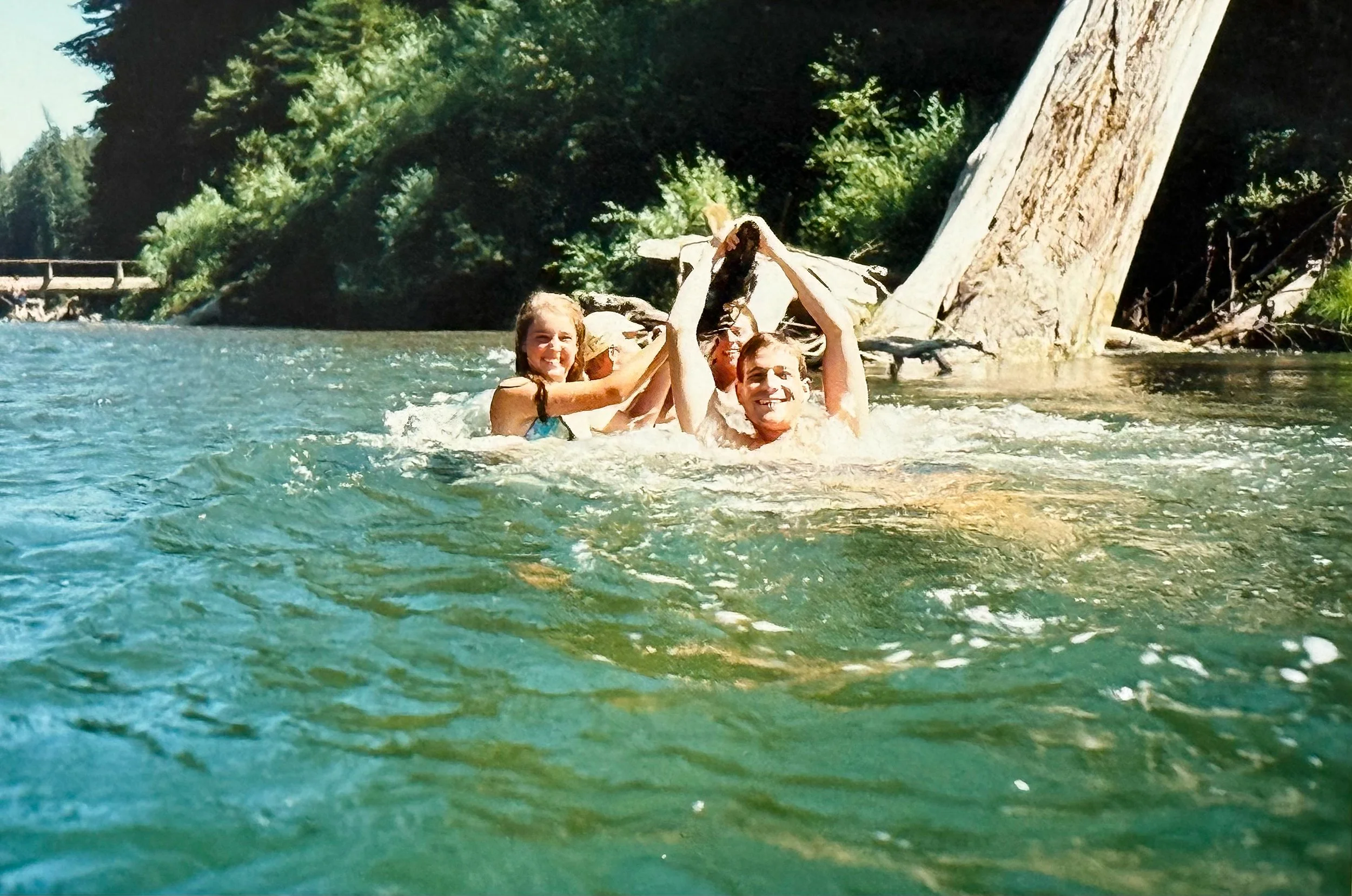
Cooling off in the Eel River with Don and Steve after our climb over Leggett Hill. Cooling off in rivers when we had a chance would be a favorite pastime for the next month.
Day 13: Avenue of the Giants.
-
Date: Friday, July 20, 1990
Destination: Burlington Campground, Weott (C1)
Miles: 46
Total Climb/Descent: Up 2,821 / Down -3,541
High Point / Low Point: 925 feet / 171 feet
Feet Per Mile: 61
Route Score: 87 (Hard)
+ Due East of the Lost Coast
From Standish Hickey, we’d travel along Hwy 101, a major throughfare that picked up a lot of traffic.
Looking at a state map, you could see that this corridor was a bit of a choke point.
To the west was the near mythic Lost Coast, the most undeveloped and remote portion of the California coast, whose shoreline was deemed too rugged for state or even county roads.
To the east, there was the Klamath Range and a long, convoluted four-hour drive before you hit the I-5.
So, no surprise: in some places, Highway 101 was a divided road with two lanes in each direction and felt like a freeway. It was a far cry from the roads we had grown accustomed to.
Fortunately, there were some well-timed side roads, like Hwy 271, that were far less busy and much prettier, with great views of the Eel River and many stands of tall redwood trees.
We had settled into touring life by now, and most riding and camping tasks were reflexive.
We had grown strong and resilient. Our many flat tires were no longer catastrophes. The true mark of competence was being able to patch a rear wheel puncture without removing the wheel from the frame.
But in some ways, we were still too goal-oriented and fixated on the route. We rarely made side trips and were hesitant to stop anywhere for too long. Once we got riding, we tended to keep riding, and most days, freewheeling spontaneity was frowned upon.
+ "The Finest Forest Drive In The World"
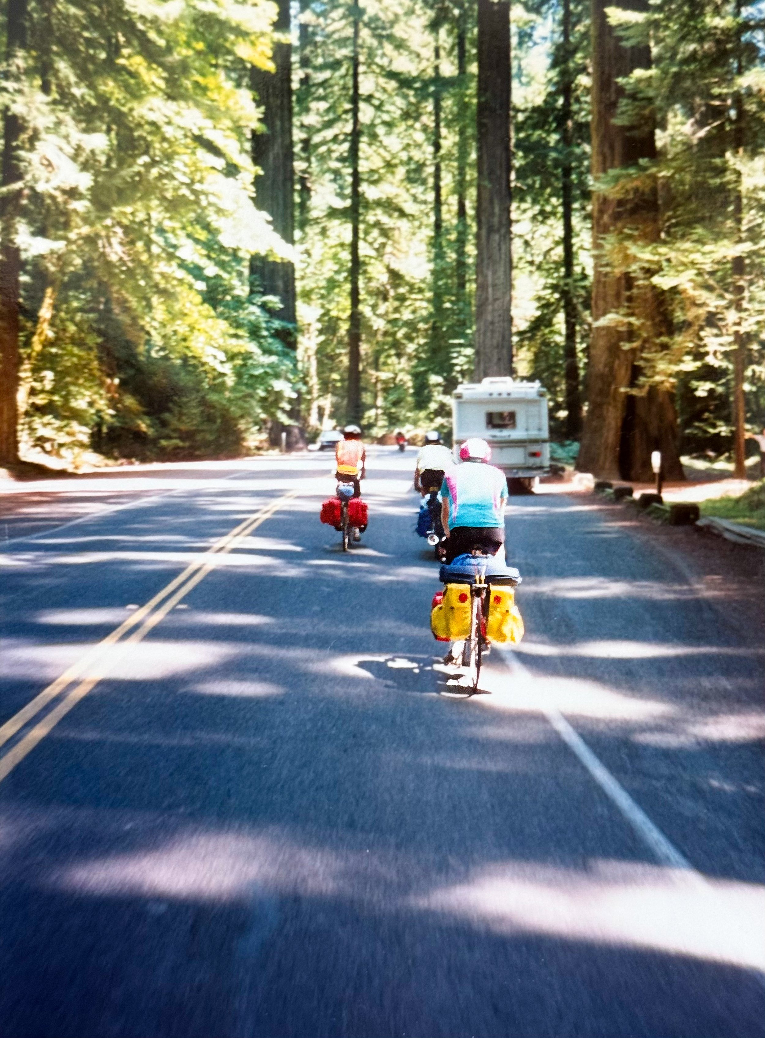
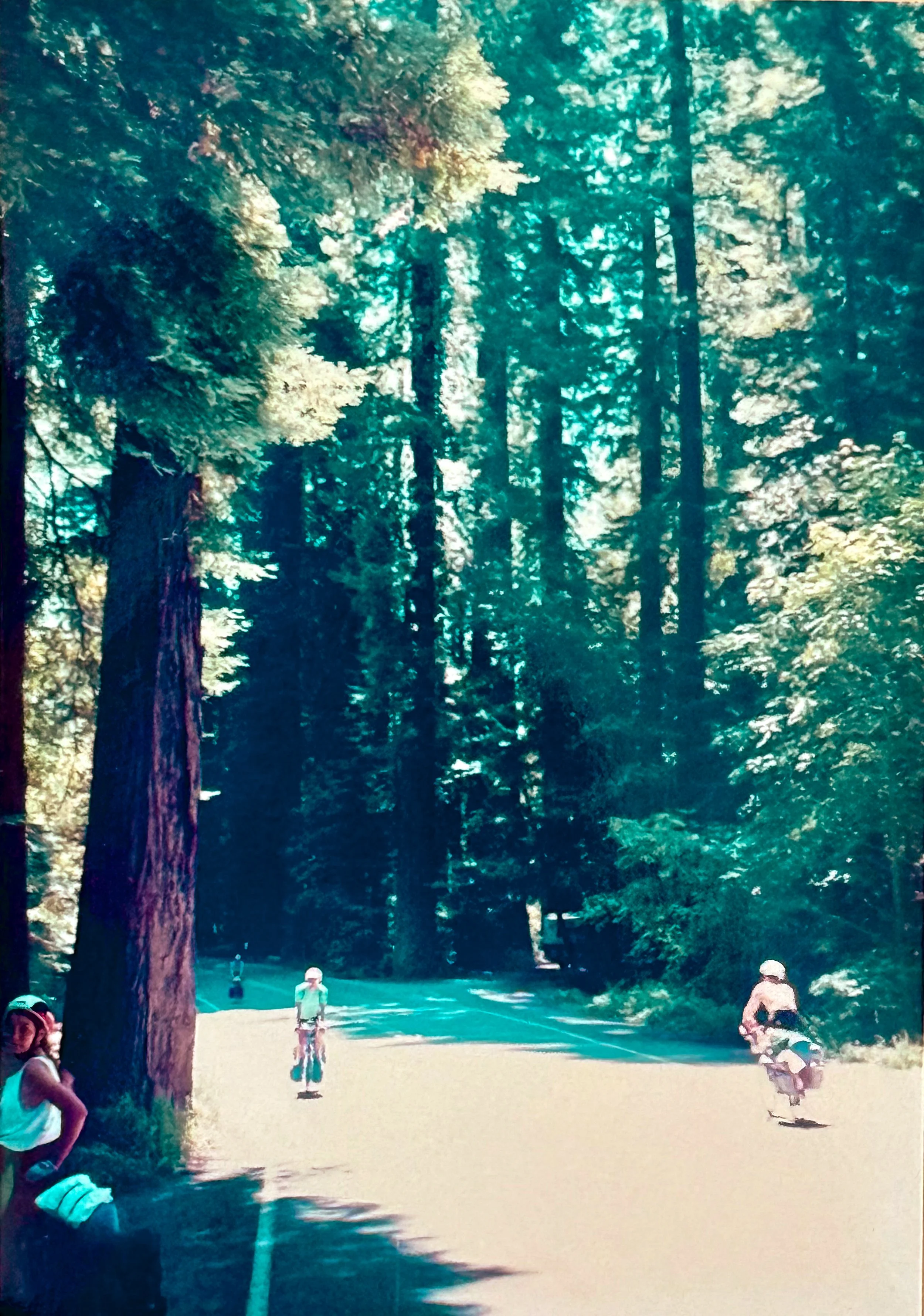
California 254, otherwise known as the Avenue of the Giants, parallels Highway 101 for 31 miles through some of the most scenic stands of coastal redwoods anywhere.
For us, it was an excellent opportunity to ride together as a group, often spreading out across the quiet road as it gently meandered down the Eel River Valley.
This was easy, scenic riding. The high temperatures were the only challenge.
Fortunately, we had reached Burlington Campground by early afternoon—when temperatures were peaking—and quickly were on the short trail down to the river for more, you guessed it, river swimming. A delight!
+ Christy's Journal
Day 13: Burlington
A relatively easy 47 miles, mostly downhill, but very hot! Upper 90s at least.
We met up with the guys in Garberville and had breakfast at the Eel River Cafe.
It was hot when we got back on the road, but the shade along the Avenue of the Giants helped.
We stayed at the regular campsite that night and went swimming in the river again.
It was Don and Fred’s last night with us, so we had a group dinner (in courses): corn, potatoes, steak, and chicken.
Easy riding along the Avenue of the Giants
Ready for a swim as we near Burlington Campground in triple-digit temperatures. Avenue of the Giants
El Scorcho along the Avenue of the Giants.
The Eel river swimming hole near Burlington Campground.
Day 14: Don & Fred’s Last Day
-
Date: Saturday, July 21, 1990
Destination: Patrick’s Point State Beach (C2)
Miles: 77
Total Climb/Descent: Up 3,076 / Down -3,091
High Point / Low Point: 391 feet / 5 feet
Feet Per Mile: 40
Route Score: 159 (Difficult)
+ The Merry Band Breaks Apart
The long ride to Patrick’s Point was memorable in several ways. It had the most mileage, a stout 77 miles, primarily through more developed areas near Eureka, the largest town since San Francisco.
It also marked our return to the foggy coast. The transition from the low 90s found along the Avenue of the Giants to the breezy 56 degrees that greeted us in Eureka was shocking.
Finally, it was Don & Fred’s last day, and we were sorry to see them go. Friendships on the road are easy to make and become surprisingly strong in a short time.
Don and Fred had been great to ride with—gentlemen and interesting. The road would be much lonelier without them.
Steve would be with us for a few more days, but then we’d part ways with him as well. He’d be heading up the Oregon coast before cutting east at Newport, riding to Northern Montana via Oregon State Route 26.
+ The Pie
We’d be making dinner with Steve tonight. He’d be in charge of the pasta, and we’d make a salad.
So we stopped at “Saunders Trinidad Market” for lettuce, carrots, tomatoes, grapes, alfalfa sprouts, and bananas.
For dessert, I chose pie—but not just a slice, a whole pie.
We strapped the frozen French Silk Pie on my back rack, on top of our tent, and made our way to the campground.
I don’t think we ate half of it, but it made us laugh at the end of a long and chilly day.
+ Christy's Journal
Day 14: Patrick’s Point
Our longest day of the trip (mile-wise) at 76 miles. We got off to a good start and didn’t stop for breakfast until Fortuna (the 30-mile mark), where we met up with the guys.
We hit some winds before breakfast and after Eureka.
Don & Fred waited for us at their freeway exit in Arcata to say “goodbye!”
We stopped in Trinidad to get food (only salad stuff—Steve got stuff for Spaghetti).
Patrick’s Point was beautiful but cold and foggy! Neat trail to the showers.
Dessert: Sean’s French Silk Pie.
Day 15: End of Stage One
-
Date: Sunday, July 22, 1990
Destination: Crescent City (American Best Motel) (H2)
Miles: 54
Total Climb/Descent: Up 3,891 / Down -4,082
High Point / Low Point: 1,236 feet / 10 feet
Feet Per Mile: 72
Route Score: 140 (Difficult)
+ The Beatings Will Continue Until Morale Improves
We were slow on the draw at the beginning of this, our last day on the Pacific Coast.
For the past 693 miles, we had reveled in this spectacular part of the world: the cliffs of Big Sur, crossing the Golden Gate Bridge, the quaint towns like Mendocino, the grand sea stacks and rugged North Coast, riding through (sometimes literally!) redwoods.
It had been spectacular. But we had drunk our fill, and I think we were ready for something new—or at least something a bit warmer.
Dawn arrived at Patrick’s Point Campground with foggy, drippy conditions and a morale-sapping temperature of 54 degrees.
For the past two weeks, we had camped out every night except one. Our tent was soggy, and we were worn out. Physically, we were doing okay, but mentally, we were ready for a break, a bed, pillows, and a toilet you didn’t need a flashlight to find.
Fortunately, our first Zero Day was approaching—all we had to do was get there.
We had said our goodbyes to Steve, who left slightly before us. We might see him along the road, but there was a good chance we wouldn’t.
We freewheeled down the small hill to Big Lagoon, where we met a slight but noticeable headwind and fog so dense we thought it was raining.
Pedaling around this lagoon and Stone Lagoon after it, we felt cold and tired and lonely—also a bit trepidatious about the days to come, when we’d leave the well-worn bicycle touring groove of the Pacific Coast for the lesser-known challenges of the Cascades.
We warmed up in Orick at a mediocre breakfast spot, and the fog lifted a bit, but our mood was poor as we started up the first of two significant climbs standing between us and day’s end.
As our muscles warmed, we appreciated the gentle grade up into Redwood National Park, but the climb through Del Norte Coast Redwoods State Park nearly broke us. I could see that Christy was struggling. So was I.
+ Looking Forward To A Fresh Beginning
The steep, 1,000-foot descent into Crescent City was so welcome, and we decided then and there that we had reached the end of the road for the day.
We pulled into one of the first motels we encountered (American Best Motel) and paid the $62 for a room without a second thought.
The harbor was across the road, and downtown was nearby, but we were content to cocoon, take long hot showers, and watch TV. When dinner time arrived, we didn’t even venture out of our room, opting instead for pizza delivery.
The pizza was lousy, but we were content. The next day, we’d leave the coast for good and start a new stage of our adventure.
+ Christy's Journal
Day 15: Crescent City
Our last full day on the coast. I was in poor spirits, to say the least, and tired from the day before.
The day began with such heavy fog that we thought it was raining.
We got a late start and stopped for breakfast in Orick (a Podunk town).
I was having a terrible day, so Sean convinced me to get a motel in Crescent City. We found a nice place and ordered a pretty bad Pizza! But it was great to sleep in a bed.
Part Two: The Cascades
Day 16: Six Small Steps
-
Date: Monday, July 23, 1990
Destination: O’Brien and Scotty’s House (Home Stay)
Miles: 46
Total Climb/Descent: Up 3,700 / Down -2,295
High Point / Low Point: 2,153 feet / 15 feet
Feet Per Mile: 81
Route Score: 113 (Hard)
+ Bridge Out! The Sequel.
Spirits were much improved this morning. Some creature comforts, some TV watching, and a long sleep in a bed had us ready to tackle a new chapter in our journey.
Of course, when we wheeled our bikes out of our room, we saw more gray skies.
This time, however, we were sure they would not last.
Less than a quarter mile north, we made a turn on Elk Valley Road and left the Kirkendall book behind for good. From now on, the route would be mine.
The road was lined with residential homes and small farms, and it was quiet and peaceful. The first few miles were going great.
That did not last. Turning onto Hwy 199, the route we’d follow all day, we saw the first signs: “Bridge Out. Road Closed Ahead” and then some instructions on the appropriate detour.
We looked at our state map, and our hearts sank. The detour looked like it would add somewhere between ten and twenty miles to our day—it was hard to tell—and would take us back to the soggy coast.
We were just three miles from the bridge. Was it worth our while to see if it was actually closed? Maybe two bicycles could get through.
We hemmed and hawed for a few minutes and then rolled the dice. No detour for us before we at least knew it was impossible to make it through.
Christy wasn’t completely sold and seemed exasperated by the whole situation, but was willing to try.
We climbed up a short hill through another redwood grove (“more damn redwoods!”) and then coasted downhill to the Smith River.
More signs and a large fence greeted us, but we also saw something else. While the main overpass was indeed a long way—months and months—from completion, there was a smaller, slightly dicey-looking temporary construction bridge just to the north.
You would not want an RV crossing it, but it looked just fine for a couple of bicycles.
We saw a construction worker and told him our story, trying to look pitiful and pleading—which was not hard to do.
He said it was no problem for us to take the construction bridge, but there were “six steps on the other side” we’d have to figure out how to get over.
Six steps to save twenty miles? Heck, yeah! We were saved. We rode over the temporary bridge, feeling oh-so-smart, and then got our first look at the steps.
Except they were not steps. The hillside on the far side of the river had been graded, and there were a series of terraces, each six feet tall, that led up to the nearby road, where we could occasionally hear a car pass.
I counted the terraces. There were six of them.
Well, a job started is a job half finished. I clambered up my frame so I could belly crawl onto the first flat. Then, with Christy pushing and me pulling, we heaved our 70-pound bikes onto the platform.
A hand down helped Christy climb up.
Now repeat five more times.
Fortunately, our technique improved, and the steps lost a bit of height near the top.
We pulled out onto the highway dirty and sweaty, but with huge grins on our faces. Less than an hour had passed since we saw the first road-closure sign.
+ Climbing To The Sun
For the next 30 miles, we slowly gained altitude as we followed the Smith River to the Northeast.
We stopped for breakfast at the historic Hiouchi Cafe (“Best breakfast in the county!”) and continued to follow Greg Lemond’s progress in the Tour De France, where he had a good chance of repeating his victory.
Soon, the sun burned off the morning fog, and the temperature rose to the low 70s. Wonderful!
The Middle Fork Gorge of the Smith River was spectacular, the water an emerald green as it cascaded from one deep, rocky pool to another. Traffic was minimal, and the climb was gradual.
We continued up the river, passing small villages and campgrounds. As the sun rose, the heat slowly ratcheted up and traffic increased, but the riding was still good.
What a relief! This was the first day on routes that I had designed myself, and I was never sure what the roads would be like until we actually encountered them in person.
The riding felt remote after the wonderfully named hamlet of Darlingtonia. While towns were few, there were bathrooms in the many campgrounds we passed, which kept things civilized.
We passed the Patrick Creek Historic Lodge at mile 26, but kept on climbing. There were logging trucks, but also many turnouts where we could look down to the river.
We stopped at the palatial Collier Tunnel Rest Area before heading through its namesake tunnel (short and not scary).
Then the road pointed downhill, and we zoomed down to the Oregon border and the adventure of the Cascades beyond.
We had done it! Our first day on our own, on our own route, and it had been a good one.
Even the six steps seemed like a happy anecdote.
+ Christy's Journal
This, sadly, is Christy’s last journal entry from the road.
Day 16: O’Brien
Our first day in uncharted territory.
Only a couple of miles in, we got to the 199 and saw a sign reading "road closed to through traffic."
The detour was 25 miles out of our way, so we decided to risk it.
When we got to the end of the road, there was a ½ build bridge! Great!
One of the construction guys said we could take the construction bridge and then push our bikes up the steps on the other side.
No Problem! Until we got to the steps. They were six feet high.
Day 17: Zero Day
-
All hail the mighty zero day!
Date: Tuesday, July 24, 1990
Location: O’Brien, Oregon (Home Stay)
Miles: 0
Total Climb/Descent: Up 0 / Down -0
High Point / Low Point: N/A
Feet Per Mile: N/A
Route Score: N/A
+ A Little Hippy Dippy
After sixteen straight days, where we racked up 793 miles and 48,856 feet of climbing, we finally had a day off at Christy’s uncle’s house near O’Brien, Oregon.
She had warned me that they were a little “Hippy Dippy,” but they were also welcoming and kind.
Rick Butts and his second wife lived on what I’d consider to be a farm—it had chickens at least. At the minimum, it was country living unlike that available in San Diego and Orange County.
They had a young toddler, and Rick’s wife dropped the front of her dress so she could breastfeed while we were sitting at the table with them—something that seemed like it was from another planet back in 1990.
+ Off to the Races
Our stay in O’Brien was restful and productive. We slept in, did laundry, and hung out with Scotty, Rick’s first child, who was a few years younger than Christy.
We were also able to address some bike maintenance issues.
A distinct popping noise had developed in Christy’s front hub, and it only seemed to be getting worse. So Rick loaded the bike into his truck and drove us down to Dick’s Bicycles in Grants Pass.
Zooming down the road at 60 miles per hour was thrilling—how soon we forget just how fast you can go in a car!
The bike mechanic said the race on Christy’s front hub was blown, with the ball bearings beginning to shear apart because of it.
Christy recalled that he recommended a new race, but I opted only for new ball bearings. It sounds pig-headed and short-sighted, so it’s probably true—but I have no recollection of it.
Anyway, with new ball bearings in the hub and some spares to take with us, we were ready to be back on the road.
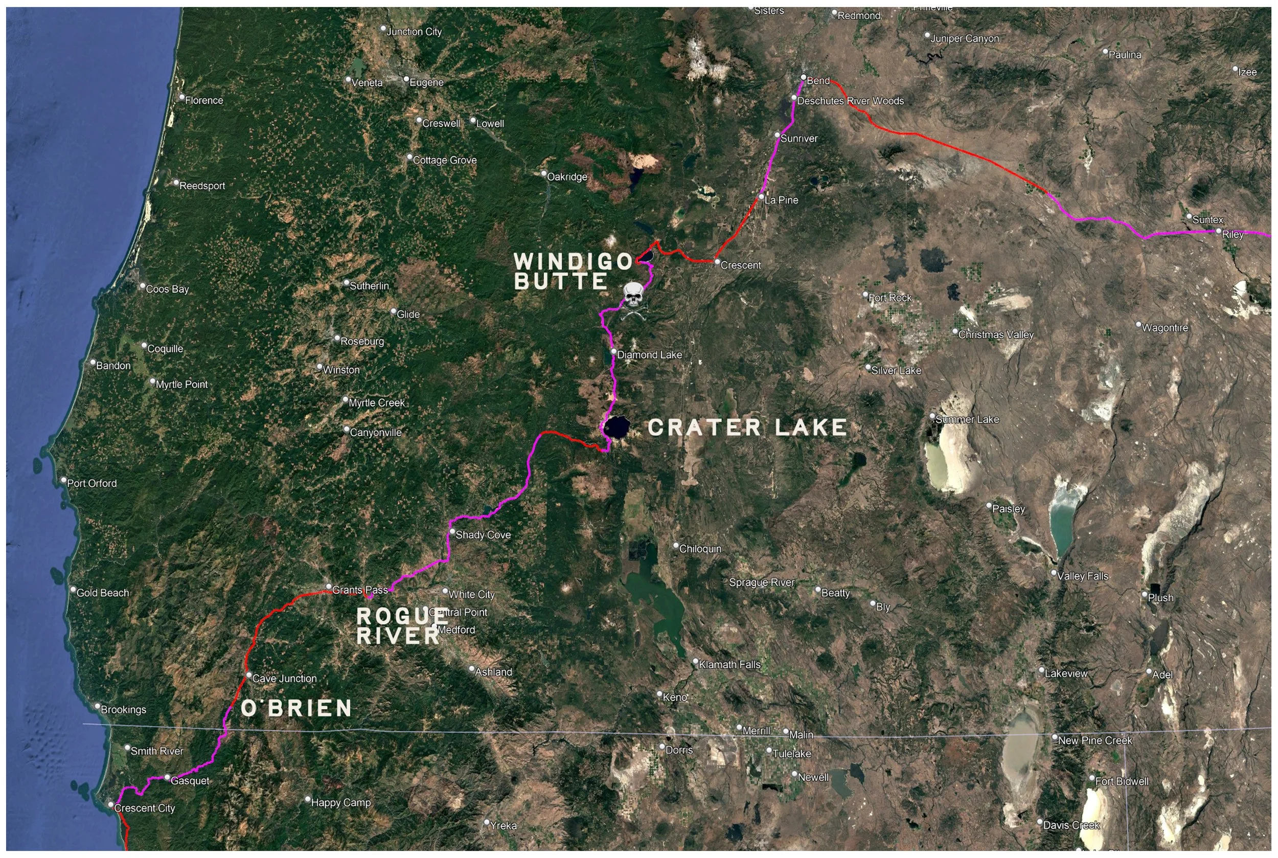
The route ahead: After climbing over the Klamath Range northeast of Crescent City, we'd hit the sunny valleys of southern Oregon. After a rest day in O'Brien, we camp on the Rogue River before tackling a long, two-day climb up to Crater Lake. From the national park we'd head offroad over Windigo Butte, and spend a few days on the Cascade Scenic byway into Bend. It all sounded good on paper. Reality, however, was a bit different.
Day 18: The Rogue River
-
Date: Wednesday, July 25, 1990
Destination: Valley of the Rogue S.P., Rogue River (C3)
Miles: 49
Total Climb/Descent: Up 1,591 / Down -1,989
High Point / Low Point: 1,674 feet / 904 feet
Feet Per Mile: 32
Route Score: 52 (Moderate)
+ The Malleable Nature of Time
It had been less than three weeks since we left home, but the experiences of those 18 days had built a wall in our brains, a clear line between “before” and “now.” Seldom do you have an opportunity to file away so many memories in such a short time, and we knew we were in the midst of something special. Something that was rewiring our brains.
A big part of that was from the mode of travel itself. Each day was undeniably real. We could stick our foot down at any time and touch the ground. We were actually there. Geography lost its abstraction: each climb, each descent, each gust of wind had a physical consequence.
We were no longer passive observers. We couldn’t be. We were experiencing the topography and geography in a way that’s never possible while riding in a car. Climbs made us sweat; descents chilled us and made our eyes water. We felt the wind, smelled the sea air, and road kill. We could feel the energy a meal gave us. We were fully awake.
And so the memories piled up fast, and the days seemed to elongate, until it seemed impossible that so much had occurred in such a short period of time.
Time had become malleable.
We laughed about it, talked about it. It was amazing.
Twenty-five years later, we stumbled upon someone experiencing the same thing.
“When you're a kid, everything's new, so you don't have to work for it—you're just astonished,” says traveler and author Jedidiah Jenkins. “Once you're an adult, that's a choice. You choose adventure for your own life. But it's not about the bike; it's about getting out of your routine, and that could look like anything.”
“That's what I'm doing here. That's why I'm doing this bike trip, because I don't want my days to control me. I don't want my life, the calendar, to be my boss. I want to control my days. I want to choose the adventures that I go on. And I want to choose a mind and a soul that's wide awake, because in a sense it turns your hundred years on this planet into a thousand.”
+ Point A to Point B
We said goodbye to the Butts family and were on the road by 9:30, heading north on Highway 199 toward Grants Pass and the Rogue River beyond.
It looked like a straightforward route, following the Illinois River, before gradually climbing up to Hayes Hill Summit. From there, it would be a steep descent down into Grants Pass, a town of 17,000.
Traffic was heavier than we had seen in a while, and the roads were much straighter, so cars were whizzing by us. The shoulder was wide, however. The only new treat Oregon had for us was the placement of rumble strips on the shoulder, deep enough to rattle the fillings out of our teeth if we strayed into them.
The road had a different vibe. We had flipped the switch from sightseeing and scenic routes to roads designed to get you from point A to point B. Transportation-first highways.
We were also now on roads that didn’t see many bicycle tourists, which made us minor novelties whenever we stopped.
“Where are you going? Where did you come from? You know there are mountains ahead, right?” It was fun being the weirdos, but we missed the camaraderie of the coast and looked in vain for other bikepackers for the next three weeks.
We reached Grants Pass (“It’s The Climate!”) in the early afternoon, with temps nudging into the middle 80s, which felt pretty good. We also knew that a swim in the Rogue River awaited us at the campground.
We pulled into a lunch spot and rifled through the old sports pages. There it was: Greg Lemond had secured his second Tour de France victory right about the same time we were lugging our bikes over the six small steps.
We enjoyed following the race and were grateful to read this final report. Coverage in newspapers was sporadic. With the internet still years away, who knows when we would have learned of his victory otherwise?
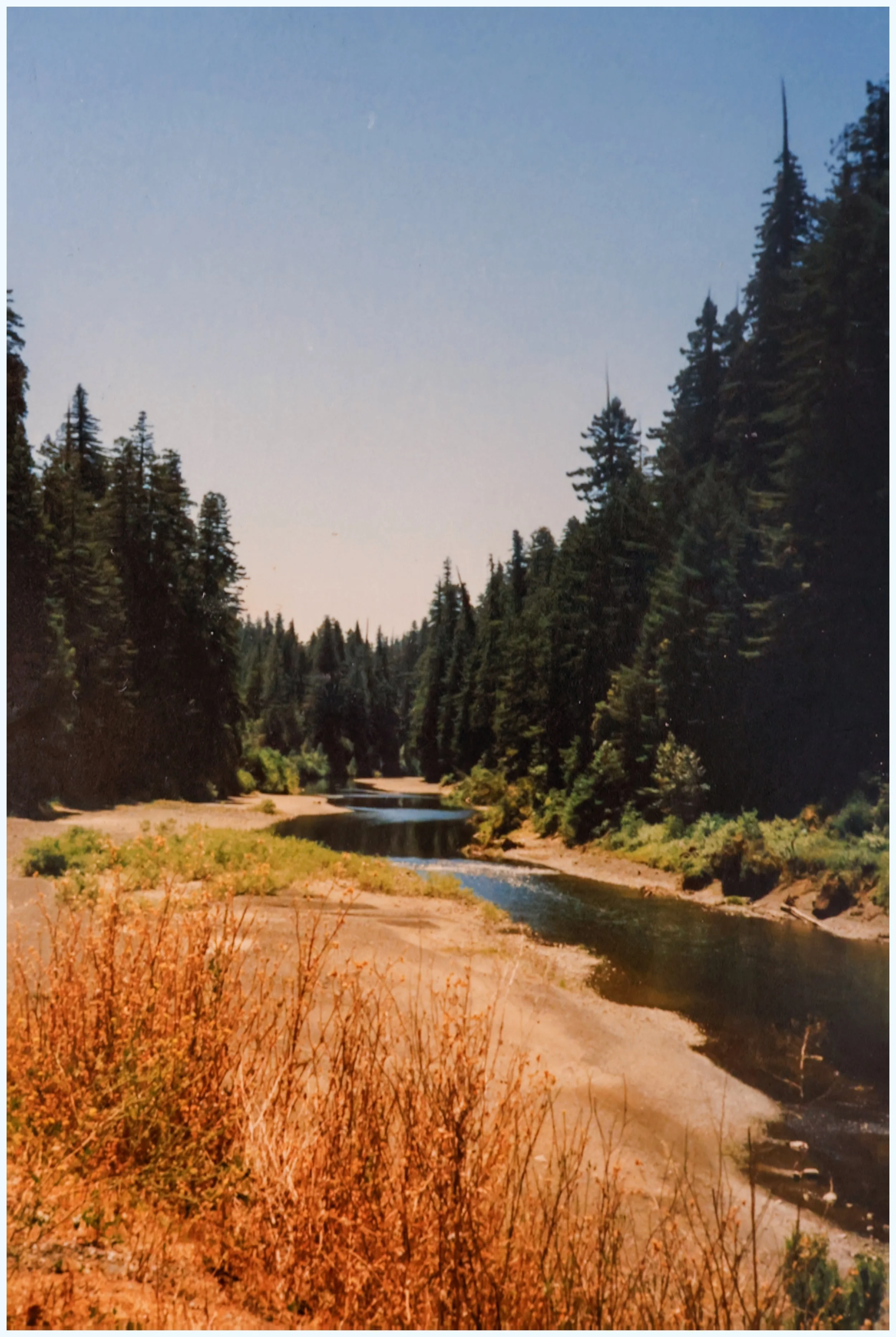
We began to follow the Rogue River upstream at mile 37. We’d be following it for the next two days as we climbed into Umpqua National Forest toward Crater Lake National Park. The river’s gradient was mild here, however, and the pedaling was easy.
The campground was large and busy, but it lacked a hiker/biker campsite. It also lacked an established swimming area. The River looked broad and powerful—much larger than the Eel River. With temps in the low 90s, however, we still cooled off as best we could.
It was strange—and a bit lonely—not to be in a hiker/biker spot, however. But the showers and firewood made up for it, and we had a peaceful night along the river.
Day 19: Farewell Bend
-
Date: Thursday, July 26, 1990
Destination: Farewell Bend Campground (C1)
Miles: 63
Total Climb/Descent: Up 3,534 / Down -1,145
High Point / Low Point: 3,413 feet / 1,017 feet
Feet Per Mile: 56
Route Score: 149 (Difficult)
+ Feeling Roguish
We woke up to another clear, dry morning, with cool temperatures we knew wouldn’t last.
It was going to be in the mid-90s today, so we were eager to make an early start and gain some altitude—and forested shade—before the afternoon hammer descended.
We stopped for breakfast in Gold Hill, poring over our Auto Club Oregon state map as we ate French toast, ham, and hash browns.
The route looked straightforward: 15 miles on Highway 234 before about 40 miles of gradual climbing into the Cascades on Highway 62, to the doorstep of Crater Lake National Park.
After breakfast, it was still a cool 70 degrees as we slowly followed the Rogue River north. The road was forested and offered only glimpses of the Rogue, but we could hear Dillon Falls as we rode past.
We left the river and entered farm and ranch lands, with many large homes on either side of the road. It looked fertile and prosperous.
Tall, wooded hills were all around us, but the wide valley carved by the river kept the gradual climb barely perceptible. The local traffic—mostly pickups—was courteous.
At mile 20, we crossed the river again (something we’d do four more times that day) and saw our junction with Highway 62 ahead. Gulp! The road had a lot more traffic, including semi-trucks, but the shoulder was wide enough.
We had climbed about 800 feet in the first 20 miles, but had 2,800 still to climb. Now, the road tilted up. Straight ahead to the north, we could see the blue-green silhouettes of forested mountains.
We had reached the High Cascades.
+ The Cascades
We passed Shady Cove, a small town with markets, river rafting guides, and small motels—a holiday sort of place. The river was close to the road, which offered good views.
We could see small rafts floating on the current and fishermen on the riverbanks. We had crossed some invisible threshold into a more forested land.
At mile 30, the road made an abrupt turn east, and the hills began to crowd around. The shoulders narrowed, and the sun on my neck felt hot.
Soon, we crossed over the river again at the base of a long, steep hill. This one wasn’t fooling around, cutting through the basalt folds of the mountain in a straight line up.
We climbed the 6% grade for two miles to Lost Creek Lake. The road, having broken free of the timid gradients of the lower valleys, now climbed steadily into the mountains before us.
We were winded, hot, and sweaty—our water bottles nearly empty—as we crossed over the lake on Peyton Bridge and rode up to the small village of Prospect.
Now the change in scenery was unmistakable. We entered a forest of tall Douglas fir and ponderosa pines. The straight road split the forest canopy like a Death Star trench. The hot temperatures moderated, campgrounds began to appear to our right and left, and the speed of the passing cars eased.
Just like that, it was scenic.
But it had been a long, tiring day with little coasting and many miles of gradual climbing—we were fried, and the road did not relent now.
The afternoon sunshine slanted through the canopy as we rode past the 59-mile mark (our expected finish line), but there was no end in sight.
A mile later, we reached Union Creek Resort with its picturesque lodge, tiny market, and small cabins.
We stocked up our supplies and heard good news: our campground was only a mile ahead.
Farewell Bend Campground felt remote and quiet. The tall trees murmured in the breeze, and the river lazed past our campsite. The Rogue had been our companion all day, but here we would part ways. Tomorrow would be a long, non-stop climb up to Crater Lake.
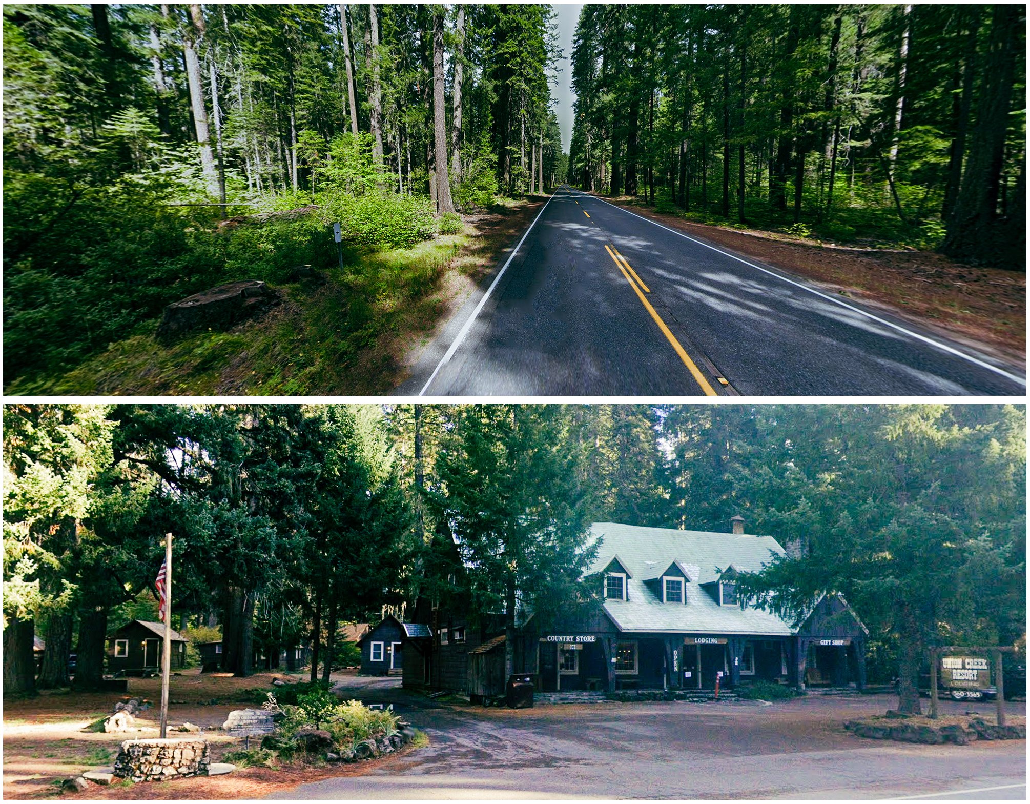
Recent Google Map images of Highway 62 and Union Creek Resort.
Day 20: Burning Sensations
-
Date: Friday, July 27, 1990
Destination: Mazama C.G., Crater Lake National Park (C3)
Miles: 32
Total Climb/Descent: Up 3,969 / Down -1,357
High Point / Low Point: 7,122 feet / 3,408 feet
Feet Per Mile: 126
Route Score: 84 (Hard)
+ Two Lovers’ Hearts a-Rising
Today’s ride would be part novelty, part drudgery. At 19 miles, it was the shortest day of the entire tour. A lark. A jaunt. But those 19 miles were all uphill, a "hors catégorie" climb to Crater Lake’s Mazama campground. This was more sobering. The topo map showed a long procession of contour lines we’d need to surmount as we climbed the dormant volcano.
From Farewell Bend, it was less than a mile until the road split, and we turned toward the mountain, still hidden by the dense forest. The grade was modest, but unrelenting, climbing about 1,000 feet every five miles. We labored in silence, sweating in the cool morning air, maintaining a pace of about 6 miles per hour.
After an hour, we passed the Thousand Springs Sno-Park, and the views opened up. My daydreaming kept my mind occupied as my body tackled the task at hand. I drifted from thought to thought until a line of verse reared like an iceberg:
“A nice breeze blows in.
Whenever the big fella cracks a grin
And when the time and the place is right
We sit down, sip some bouillabaisse.
Ah, you know I'm gonna have me a little fun
I got a candle, I can get a lot of reading done”
Then my voice booms out in the overly quiet morning:
“Somewhere the sun is shining
On this world, but not for me
Two lovers' hearts a-rising
Oh, how long before I'm free?”
I cackle and then pant from vocal exertion, and I hear Christy pick up the tune from behind me.
“I feel like Jonah in the belly of the whale
I get so lonely in the belly of the whale
(Oh, oh, oh-oh-oh-oh)
Yeah, I feel like Jonah in the belly of the whale
(Oh, oh, oh-oh-oh-oh)”
Our Burning Sensations “Belly of the Whale” karaoke continued, and the miles slipped by. We felt good, the sun was shining, our bodies were strong, and we made a good team. It was just about perfect. Even a 19-mile climb couldn’t bring us down.
+ Unencumbered to the Rim
“Well, this is unexpected,” I thought.
Mazama Campground was hot and sun-baked, nearly empty in the noon sun. Everyone seemed to be at the lake, another 1,200 feet above us. We unloaded our bikes and set up the tent, unstuffed our sleeping bags, and inflated our Therm-a-Rests.
“Now what?” I wondered. The campground was luxurious: showers, laundry, a store, and a restaurant. It would not, however, provide six hours of entertainment. We waffled for a bit, then did the only logical thing: hopped back on our bikes and headed uphill.
So it wouldn’t be a 19-mile day after all.
Stripped of our panniers and luggage, the bikes felt squirrelly but seemed to surge ahead with every pedal stroke. We were already warmed up and tackled the grades with gusto. A truck passed us, slowed down, and asked if we wanted a lift to the top. We declined and waved thanks.
I shifted to a bigger gear and got out of the saddle, slowing my cadence to a waltz as I moved up through the switchbacks near the rim.
“Oh, what a beautiful morning
Oh, what a beautiful day.
I’ve got a beautiful feeling,
Everything’s going my way.”
I sang with the requisite irony, distilling out the saccharine for a thin veneer of toughness, a world-weary indifference. Who was I kidding? It was gorgeous, and the ability to ride up 4,000 feet with such moderate effort was exhilarating. I’d remember this feeling 24 hours later and wonder how it could be the same person.
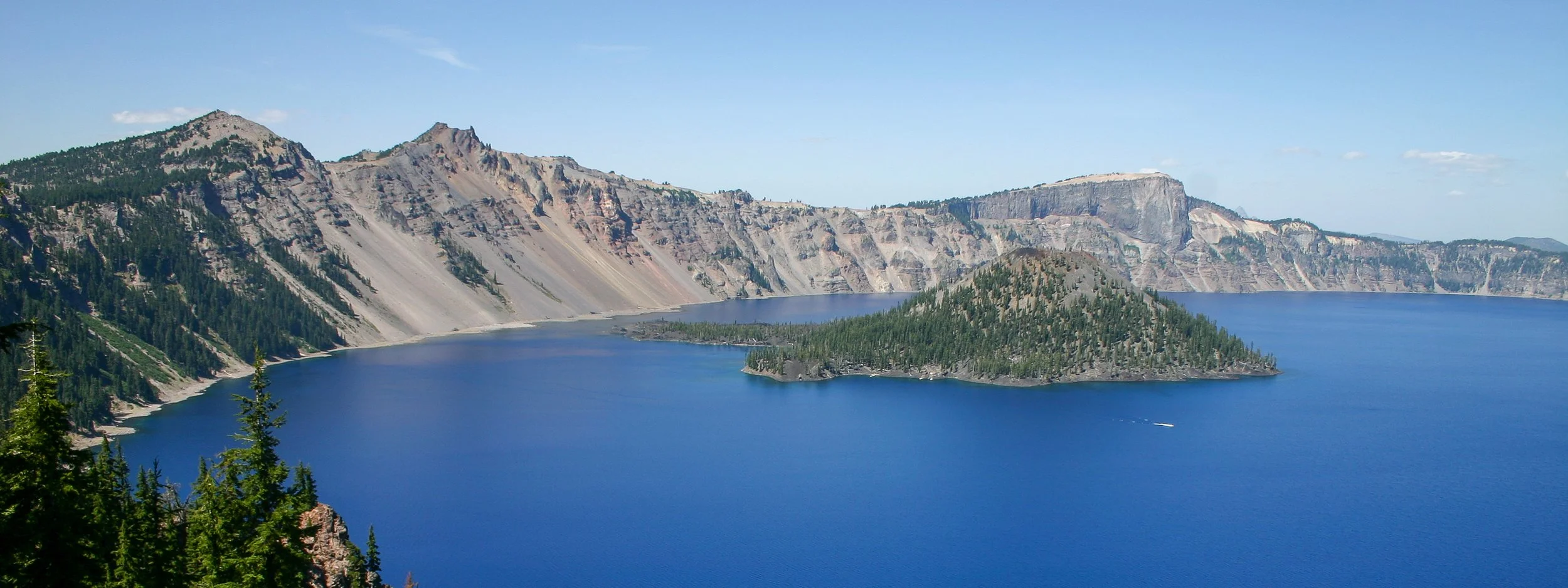
But for now, it was all good. We crested the climb and rolled along the rim, gawking at the deep blue lake 1,000 feet below, an impossibly gorgeous setup under perfect blue skies.
We locked our bikes outside the Crater Lake Lodge, a historic hotel built in 1915 that embodies the National Park Service’s architectural style—heavy log work, broad porches, and big stone chimneys. Inside, expansive windows faced the caldera, offering views that have wowed generations of visitors.
I had seen photos, nodded in appreciation at the aptly named Wizard Island, but seeing it in person was staggering.
We lingered on the rim, taking photos we’d never see, listening to the stillness of this grand space, enjoying the satisfaction of being here—soaking it all in. It had been a great day, one of the best, capped by a zooming descent back to our campground in the late afternoon.
We were bulletproof, I thought. Nothing could stop us.
If only. Our humbling was near, and it wouldn’t be kind.
Day 21: Windigo Butte
-
Date: Satuday, July 28, 1990
Destination: Spring Campground, Crescent Lake
Miles: 73.8
Total Climb/Descent: Up 5,377 / Down -6,533
High Point / Low Point: 7,678 feet / 4,221 feet
Feet Per Mile: 74
Route Score: 303 (Extremely Difficult)
+ Breaking Point
The sun had turned the tent into an easy-bake oven as we contemplated getting up and moving at Crater Lake’s Mazama Campground. Our legs felt heavy after two days of climbing.
It would be a good route: we’d climb back up to the rim of Crater Lake again this morning before beginning a descent off the volcano, through forests and pumice fields to a dirt road that climbed up and over Windigo Butte.
Crescent Lake was someplace beyond that, and it was our destination for the day—a stout 56 miles away, with lots of climbing, much of it on dirt.
Over the past several days, the weather had gradually warmed, and today’s forecast called for hot, dry conditions with temperatures in the high 80s.
We had a quick breakfast at Annie Creek Restaurant and grabbed a few snacks at the Mazama Village Camp Store next door before setting off. The seven-mile climb to the rim was more demanding with loaded bikes, but we managed with only mild griping.
Once past Crater Lake Lodge, the road began to climb once more. “What the heck? Weren’t we already at the rim?” we both groused as we climbed another four miles to Watchman Overlook at 7,600 feet.
We could feel the altitude, the warming sun on our backs, and the heaviness in our legs. When we pulled up at the overlook, that fatigue was forgotten. The viewpoint seemed to look straight down onto Wizard Island, 1,500 feet below, and the immensity of the blue lake filled our view.
The road climbed for another half mile and another hundred feet, but soon we were past the hump of Hillman Peak and looking north.
A vast panorama of forest and mountains greeted us. The jagged summit of Mount Thielsen was most prominent, along with Mount Bailey. A good way farther—40 miles as the crow flies—was the shield volcano of Mount Diamond, nearly lost in the heat shimmer. Crescent Lake would be somewhere beneath that.
Gravity pulled us down, and the hum of our tires rose with our speed. In the next six miles, we’d give up all the elevation gained during the past two hours of work. We bombed down the quiet two-lane road—zipping past meadows, down dusty corridors of trees. The decline held at a consistent five percent. We thought it would never end.
But then it did. We came out of the trees into a sunny, hot, open space: the Pumice Desert. Mount Thielsen was in front of us, looking far taller but not much closer than it had from the rim.
I switched to my second water bottle as we began to climb again, sweat rolling down my face and into my eyes. The next three miles were rolling: gradual descent separated by short, steep climbs. We passed Highway 138 on our right—the bailout down to the towns along Highway 97—as the road began to head downhill again.
Something nagged at me. In the last twenty miles—ever since Crater Lake Lodge—we had passed through unbroken forest. Sure, there were some turnouts and a few pit toilets, but nothing else—no gas stations or resorts or towns—just dry forest under a warm—no, hot—sky.
We were alongside Diamond Lake, 28 miles into the day’s ride, as the clock neared noon. The highway, however, was half a mile to the east of the lake’s shoreline and several hundred feet above it. Some lunch would be nice, a cold drink, a break in the shade. It would be nice to fill our water bottles, which were now disconcertingly light.
But the wall of trees continued unbroken. We began another long descent, our speed drying the sweat of our overheated bodies.
A small sign: Diamond Lake Recreation Area. Resort Area. Quickly followed by a nondescript turn.
My hands hovered over the brake levers, but I didn’t grab them. Why interrupt such a great descent? We continued straight, down the hill, and into trouble.
Thirty years later, in the uncertain early months of the Covid-19 pandemic, Christy and I would find ourselves down there on the shores of the lake. We sat at a picnic table in the grassy shade of the Diamond Lake Resort, eating burgers and enjoying the coldest bottle of Deschutes Mirror Pond pale ale. The lake lapped on the nearby shoreline. It was an idyllic reprieve in a world gone very scary, very fast.
In 1990, we knew none of this. We only cared that we were coasting down a smooth highway. I knew that Lemolo Lake was ahead, and a KOA campsite on its shoreline, which was bound to have food and water.
Five miles later, at mile 34, we saw a sign for Windigo Pass Road and turned right. The poorly paved road quickly turned to gravel as it shot straight through the forest, seductively trending downhill.
At mile 39, we passed over the shallow and thin Umpqua River, and I realized Lemolo Lake was five miles to our left, in the entirely wrong direction. Christy looked tired and sweaty—more than a little worried. We had another 16 miles before our campground. Could we make it that far with the water we had? Was adding another 10 miles to visit the KOA on the lake worth it?
I argued that the area was full of campgrounds and we’d stop at the first one to fill up. Christy, reluctantly, agreed. We turned right, rounded a bend in the road, and the road began to climb. Over the next three miles, we climbed 1,000 feet as the dirt forest road snaked up the forested slopes.
We focused on the hard work in front of us, but kept expecting a campground. None appeared.
Christy began to ask me how far it was to the summit. I did the calculations in my head. It was about a 1,700-foot climb over 8 miles. We had done more than half the climbing but had about 4 miles left to go. “Not very far. A few more miles,” I said, finishing all my water except for a final, emergency sip.
The road did seem to be flattening. With full water bottles and lunch in the belly, it would have been fun. Now it was just hot, thirsty work. The bonk was creeping closer.
Then a miracle. The first car we had seen since turning off the highway was heading toward us down the gravel of the forest road.
We gave a wave, trying not to look desperate, and the pickup came to a stop in a cloud of dust. “Do you have any water?” I asked, holding up my empty bottles as proof of our situation. The couple looked at each other and then around the insides of their cab, before the hammer blow: “No, I’m sorry. We don’t.”
We watched them recede down the hill. The good news? They said the pass was just around the corner. The bad? There would be no campgrounds—or water—until Crescent Lake.
We continued around the corner, and the road kept climbing. No pass could be seen. I could hear Christy quietly crying behind me.
The next two miles were a mind game. That gap in the trees was surely the pass, right? “I think I see it,” I exclaimed, only to be proved wrong as the road continued up. Christy thought I was doing this on purpose and fell silent.
Finally, we reached the pass. The climbing road eased, went flat for a hundred yards, and began to descend. There could be no doubt: the Pacific Crest Trail crossed our road. We had made it!
Christy pulled ahead, rode around a sweeping corner, and went down. It was a slow-motion crash caused by deep sand grabbing her front wheel. She wasn’t hurt, thank god. But she had passed her limit, tear tracks down her dusty face, and a fuck-it-all disposition that I knew included me.
We continued in silence. The lemon juice in the fresh cut: we now had to pedal hard—downhill!—to float over the sandy stretches.
This would be no victory coast to the lake.
+ What’s For Dinner? More Beatings!
Crescent Lake, four miles long and about two miles wide, was a scenic but modest destination. Its blue waters, surrounded by conifers and lodgepole pines, gave it the character of a high-elevation alpine lake—even though it sat at 4,800 feet.
But it felt nearly deserted—less than five of its 70-odd campsites were occupied. We chose a spot near the lake, found the water spigot, and began to rehydrate.
The final thirteen miles had been a thirst-addled blur, characterized by a forest road that steadily improved, but never lost its patches of loose dirt and sand. We were heads down, thankful for the decline but ready to be done.
At mile 56—supposedly the end of the day—we reached a junction with a sign: Crescent Lake 4 Miles. The arrow pointed to our left, a steady climb that bowed out of sight. I felt Christy's exasperation radiating like a nuclear reactor after meltdown.
I apologized. We rallied through our exhaustion, and we finally made it to camp. And yet, the feeling persisted that we were in the deserted middle of nowhere. The afternoon wore on, and our stomachs gnawed at us. What we wouldn’t have given for cold drinks and a burger! We were out of food, except for our emergency rations: two dehydrated backpacking meals.
Then a daft idea: let’s cycle around the lake to the resort on the north shore, resupply, load ourselves down with all sorts of drinks and treats, and then come back to the campground reinvigorated. Maybe there would even be a restaurant.
We had already gone 60 miles and climbed 5,000 feet—much of it with little to no water. If we stopped then and there, it would already be the second hardest day of the whole tour. We tried, but couldn’t get the idea of a burger and cold drinks out of our mind.
We set off again, our cooling legs complaining with every pedal stroke. The miles passed. The afternoon light increased its slant and then abruptly disappeared behind the mountains to our west. Like everything else on this day, the trip around the lake was farther and harder than we thought. Seven miles one way.
The resort felt like a gilded reprieve, although it was half deserted. The restaurant was closed, but we were able to pick up supplies and drinks, load them on our bikes, and wobble back around the lake in the blue hour past sunset. We ate in exhausted silence in the quiet campground. The day was done, and we had made it, but could we stand anything resembling an encore?
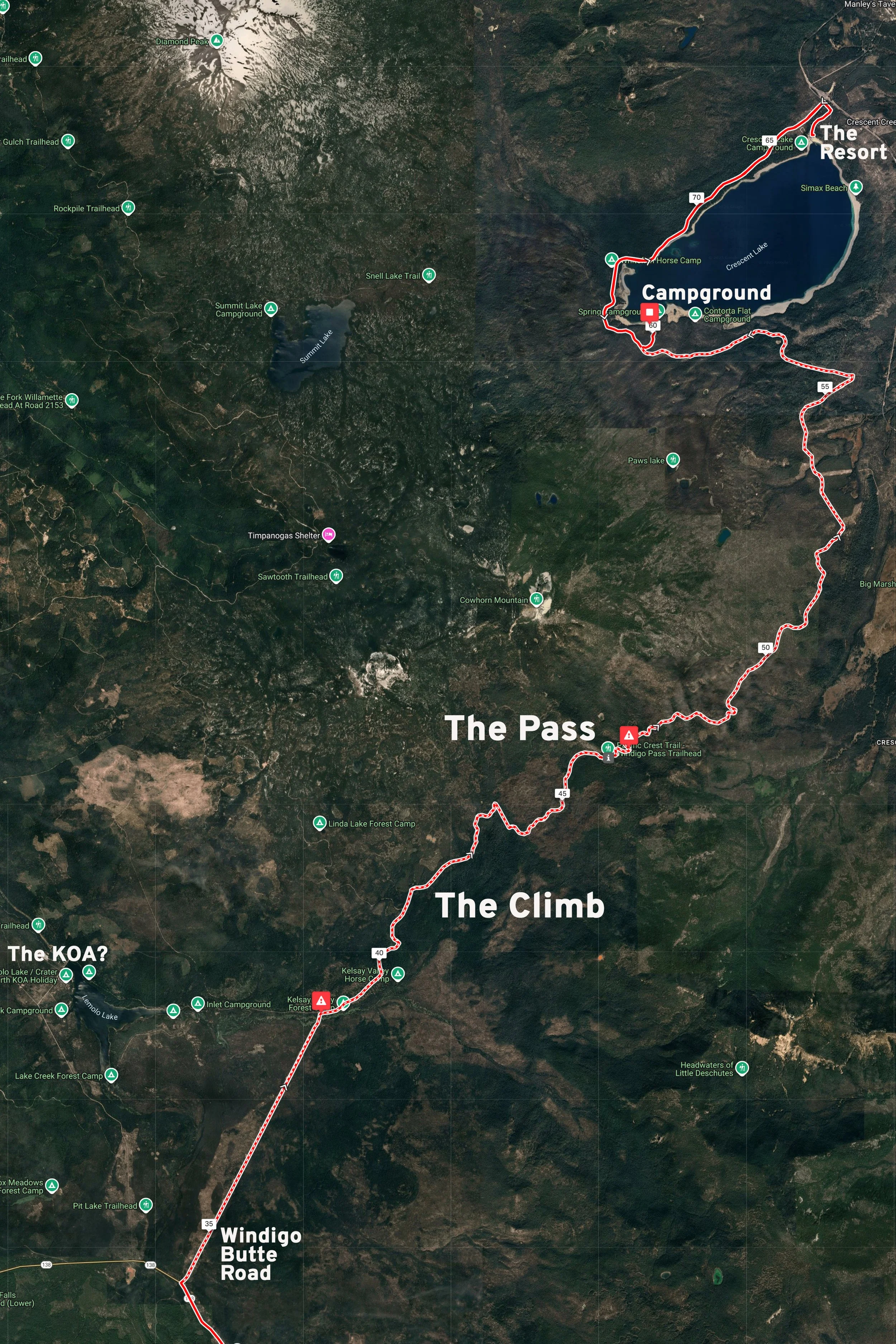
Day 22: Waving The White Flag
-
Date: Sunday, July 29, 1990
Destination: La Pine (La Pine Motel)
Miles: 41
Total Climb/Descent: Up 990 / Down -1,608
High Point / Low Point: 4,996 feet / 4,223 feet
Feet Per Mile: 24
Route Score: 27 (Easier)
+ A Retreat Down The Hill
The Cascades had given us a beating. Now we had to figure out what to do about it.
We awoke exhausted and sore from the day before, still dehydrated and a bit leery of the road ahead. The plan was to ride about 50 miles to Elk Lake, close to Mount Bachelor, where there was supposedly a resort. We’d travel all day on the Cascades National Scenic Byway, past lakes and through large swaths of national forest. Again.
Our state map didn’t show any towns between Crescent Lake and Elk Lake, just a thin gray line heading due north through the Deschutes National Forest.
The last town, Shady Cove, was three days and 140 miles behind us, back on the western slopes of the Cascades. We needed to resupply, take a shower, sleep in a bed, and regroup. And honestly, another full day of nothing but forested miles did not have the same appeal it had three weeks earlier.
We were still in camp when we decided: we’d bail on the Cascades, coast down out of the mountains, and find a place to stay in one of the towns along Highway 97. We’d stay along the highway and ride into Bend the next day for a much-needed zero day.
The decision buoyed our sagging morale. We loaded our bikes and were soon traveling the road along the north side of the lake, which felt like a well-worn path by then.
We dropped down from the lake and by mile 8 had returned to smooth pavement on Highway 58. A gas station mini-mart provided breakfast, and the waterless heebie-jeebies from the previous day began to fade.
We turned onto the Cascade Lakes Scenic Byway and climbed around Odell Butte before starting a long, gradual descent to the Highway below.
We were past the Cascades. Past the suffocating, monotonous wall of tall trees. We coasted into the town of Crescent, pleased with our decision and comforted by the traffic, the small businesses, and the presence of other people.
The next twenty miles were easy riding: flat or slightly downhill along the wide shoulder of the highway. Every five miles or so, we’d encounter a small group of houses, a gas station, or an RV park, and that was fine by us. La Pine, reached at mile 41, seemed to offer exactly what we needed.
+ The Worst Motel
A penance was unavoidable.
La Pine was a wide stretch of highway, gas stations, and low-slung businesses set back behind gravel lots and pines. Semi-trucks and RVs rolled steadily through town, pulling in and out of diners, mini-marts, and feed stores clustered near the road.
The air smelled faintly of pine sap, and everything felt spread out—functional rather than quaint.
Beyond the buildings, flat land and dark forests stretched away in every direction, giving the place the feel of a crossroads town built to serve travelers who needed fuel, food, and a place to stop, and not much else.
We were content to be in town, booked in a motel, ambling down the glass-strewn highway to the market.
But the La Pine Motel ($32.10 for the night) was dark and smelly and shabby and too sketchy for anything other than a day of reckoning, a day of white flags and reboots.
We showered and napped and shopped and ate, and felt good about all those things—even though under any normal circumstances this would be considered a kind of purgatory.
To us, it was a sanctuary tinged with the faint whiff of defeat.
Day 23: Riverside Regroup
-
Date: Monday, July 30, 1990
Destination: Bend (Bend Riverside Hotel - H3).
Miles: 33
Total Climb/Descent: Up 629 / Down -1,260
High Point / Low Point: 4,526 feet / 3,607 feet
Feet Per Mile: 19
Route Score: 14 (Easy)
+ Along Highway 97
We woke feeling refreshed, anticipating an easy day and some sightseeing in Bend—a town we had heard a lot about but had never visited.
Even back in 1990, it carried the aura of someplace special. We couldn’t have known the deluge of growth Bend would experience over the next 30 years. The quadrupling of its population would prove the region’s attractiveness, but also endanger its charm. All we knew then was that it marked a welcome destination: the halfway point of our tour, the eve of our second zero day.
Highway 97 into Bend wasn’t a treat—there was a constant stream of loud cars and lumbering semi-trucks—but it did offer easy, mindless pedaling on flat roads for the first 13 miles, nearly the halfway point for the day.
We caught glimpses of Mount Bachelor and The Sisters as we rode past Sunriver, climbing a slight grade with a passing lane and not much shoulder. Impatient drivers smashed the accelerator to get around slower traffic and zoomed past us at a frenetic pace.
Near the high point of the day’s ride, the jagged, blackened land of the Newberry National Volcanic Monument came into view to the north. Once past Lava Butte Lookout, however, the day finished quickly: an 11-mile downhill run into Bend, made spicy by disappearing and reappearing shoulders and heavy traffic.
No doubt we could have chosen a more scenic route into town. At least the highway offered fast pedaling.
Soon we were in Bend, which felt like a metropolis after the deserted roads of the past week. Never mind that the town had a population of only 20,000 back then. We saw restaurants, supermarkets, bike shops, outdoor retailers, and a lively downtown.
In the space of a quarter mile, we went from worn-down travelers to vacationers with a full day of relaxation on the dance card.
What could be better—or more deserved?
+ Reset
The Bend Riverside Motel wasn’t fancy, but its location on the river and near downtown made it the perfect base. Like all the other rooms, ours had a balcony that looked down onto the Bend Spillway on the Deschutes River—a small, manmade cascade at the edge of Pioneer Park.
We unpacked the bikes and aired out our sleeping bags and tent, then turned to the more odiferous task of hucking most of our clothes into the washing machine. It had been a week since our last laundry opportunity in O’Brien, so it was a top priority.
While the wash ran, we walked through Pioneer Park and did a quick recon of downtown, scouting options for dinner.
With clean laundry, a nap, some vegging out in front of the TV, the constant rumble of falling water from the spillway, and super-long hot showers, we were feeling human again—and able to look ahead to the coming days, when we’d traverse Oregon’s loneliest quarter.
A recent Tripadvisor aerial photo of the Riverside Motel and the Bend Spillway.
Day 24: Zero Day In Bend
-
Date: Tuesdsy, July 31, 1990
Destination: Bend (Bend Riverside Hotel)
Miles: 0
Total Climb/Descent: 0 / 0
High Point / Low Point: 3,607 feet / 3,607 feet
Feet Per Mile: 0 (Rest Day)
Route Score: 0 (Rest Day)
+ Blue Light Special
Our second full zero day of the tour started slowly, as it should. We ambled toward downtown for breakfast, checked the weather forecast in the paper, and then mounted up on our bikes, still unloaded, for the big mission of the day: a three-mile ride up Highway 97 to the Mountain View Mall and Kmart.
It was time to restock our film supply ($2.39), buy a cheap pair of shower sandals ($1.00), a new bicycle inner tube ($2.82)—along with a few other sundry items. Our legs felt rested, and it was good to give them an easy spin. We were starting a new chapter in our ride tomorrow, and we weren’t sure what to expect. The past few days, however, had given us time to rest, resupply, and regroup, and we felt ready for a new experience.
+ The Road Ahead
Close your eyes, take a moment, and think about Oregon.
What do you see? Miles of dense forest? A rugged coastline dotted with rocky sea stacks? The snow-clad height of the Cascade volcanoes?
All good answers, and reasonable—but those images are not the whole story.
East of the Cascades, in the rain shadow of the high peaks farther west, is a lonely and desolate land. Look at a map of the United States. Southeastern Oregon is among a handful of places farthest from any interstate highway.
Back from Kmart, we had the Oregon state map spread out on the bed of the Bend Riverside Motel, examining the lonely red line of U.S. Highway 20 that would shape—and consume—the next four days.
This would be Great Basin country, where rivers never reached the sea, creeks disappeared into sage flats, and services were sparse because they were never needed. A landscape that resisted settlement. More people were shopping in the Bend Kmart that day than lived in the two outposts we’d rely on the next day.
Highway 20—one of the longest roads in the United States—runs from coast to coast. But the 131-mile stretch we’d begin to tackle tomorrow was gravel until the 1940s, hopscotching from one small outpost to another, with a whole lotta nothing in between—a broad, empty land of huge skies and straight roads running toward the horizon.
We looked at the map. What else would we find when wind, heat, and distance played such a prominent role? What else could there be?
So we packed our supplies for the next day with care, considered (once again) the map’s long, lonely line, and hoped.
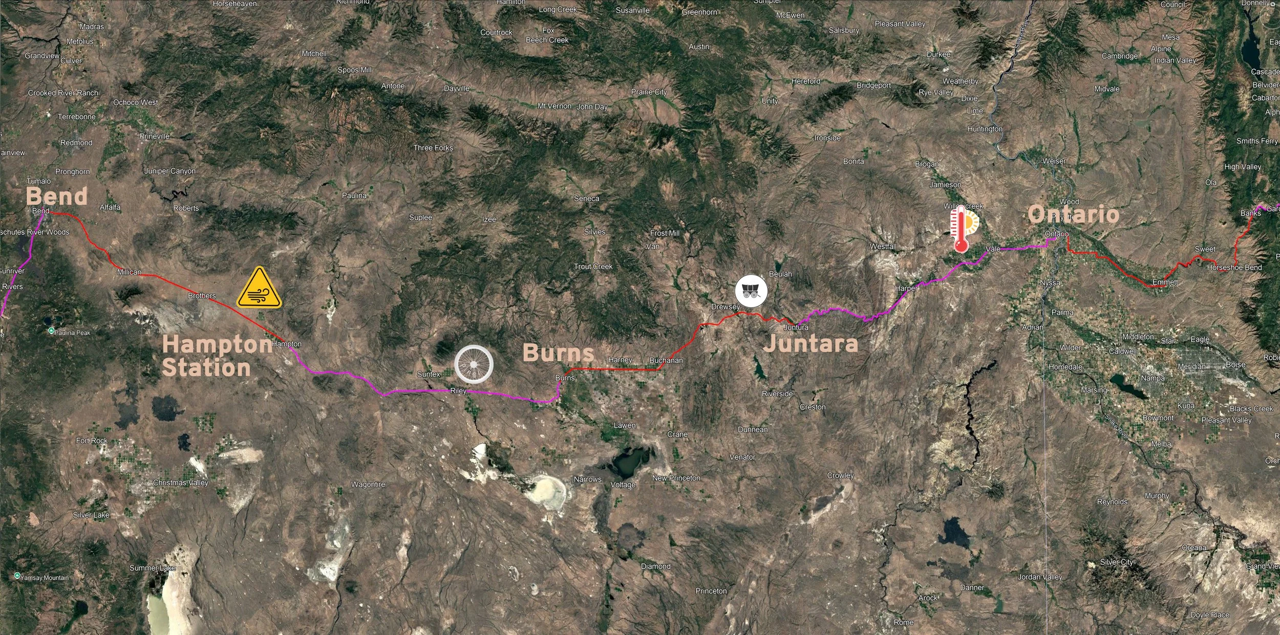
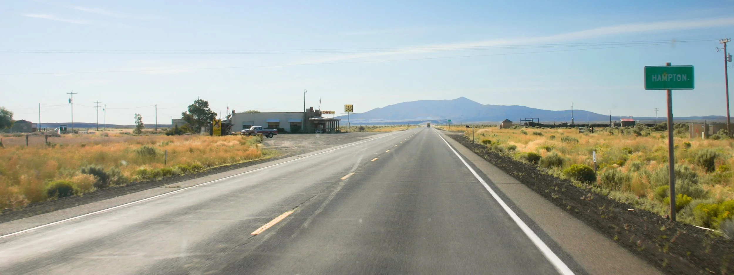
Part Three: Southern Oregon
Day 25: Rattlesnakes and Jackalopes
-
Date: Wednesday, August 1, 1990
Destination: Hampton Station (C1)
Miles: 63
Total Climb/Descent: Up 2,266 / Down -1,454
High Point / Low Point: 4,734 feet / 3.543 feet
Feet Per Mile: 36
Route Score: 95 (Hard)
+ Into The Great Wide Open
We carried extra water. We had learned that much.
Before 9 a.m., we made the left turn onto U.S. Highway 20, a quiet highway we’d follow for the next 255 miles and four days—all the way to the Idaho border.
The initial portents were favorable: little traffic, mostly flat, and a slight tailwind. We were soon past Pilot Butte and had left downtown behind for a green, well-watered land of widely scattered ranches. After ten miles, even those gave way.
We entered a land of low, twisted junipers and yellowish-gray, cracked basalt. A six-foot-wide shoulder seemed ample; we could hear a car approaching from hundreds of yards behind us. We nervously laughed. “Well, there goes civilization.”
At mile 15, we crested a shallow hill and could see a tall escarpment several miles ahead. There didn’t seem to be any way around it. Sure enough, we were soon chugging up a five-percent grade that lasted just shy of three miles.
It was still and quiet, the temperature pleasant, the riding not too difficult. Then, a sound. From far behind us, barely audible, we could hear the staccato brap of motorcycles. Definitely more than two. They got louder and louder as they approached. Heck, there was a swarm of them! The din increased until a flying rank of Harleys blasted by us at 70 mph, ten bikes strong.
These were fully loaded motorcycles, the riders in leathers. The sound faded quickly with the Doppler effect; the last rider looked over his shoulder and pumped a fist up and down—clear encouragement for our slow efforts. The landscape faded back to silence.
We reached the summit of Horse Ridge (4,292 feet) and passed a natural dividing line. The juniper forest disappeared, replaced by low, rolling hills of golden scrub. The wind at our backs picked up, as if urging us into the new, broad landscape. We could see for miles. Approaching cars? Silent dots that seemed to increase in size only gradually.
To either side of us, forested mountains rose in a blue haze. The highway, however, cleaved straight past them with a barely perceptible rise.
At mile 25, we approached Millican, a potential supply point that didn’t appear on the state map but was noted on some of the regional maps I found in SDSU’s Map Room. The gas station was boarded up, but the attached store appeared to be limping along. We grabbed drinks and surveyed the two or three other buildings that gave this remote outpost all the justification it needed to have a name and a place on the map.
Taking a break in front of the store, we heard another swarm of Harleys approaching—four this time. They, too, were here and gone before you knew it.
A few miles past Millican, the road went perfectly straight for miles. The sky seemed to expand its clear blueness as the surrounding mountains receded. The tailwind made pedaling easy. It was a landscape where a cow was worth mentioning, and a tree was worth a five-minute conversation. It was vast, but surprisingly pleasant.
The straightaway lasted ten miles and showed no sign of deviation when we reached our next outpost of civilization: Brothers at mile 42. There was a café and post office, a Greyhound bus stop—even a school! We took advantage of all that it offered, including the cinderblock bathrooms of the “Brothers Oasis”—a barren rest stop with a few cement picnic tables and scrawny trees.
A few miles outside of Brothers, we reached an unmarked summit. It seemed like you could see at least twenty miles in every direction—something we hadn’t experienced the whole tour. Even better, the highway ahead seemed to be trending downhill.
The wind continued to rise—the perfect tailwind. The speed readout on my Avocet 30 nudged up past 17 mph. A few miles later, I looked down to see a consistent 22 mph. We were flying—and barely pedaling!
We were traveling the same speed as the wind, and it grew strangely quiet. This was something else, something we didn’t want to see end. Now, with only 11 miles left until Hampton Station, we started considering our options. Should we go further that day? Could we make it to Riley, a whopping 104 miles from Bend?
Then, a strange sound. A distinct ping from my rear wheel. I motioned to Christy that I needed to pull over. The noise of the wind rose as I came to a stop. It didn’t take long to see what had happened. I had broken a spoke, and my wheel was already out of true.
Visions of extended tailwind riding were replaced by worry. Would I be able to fix this? Could I even keep riding with my wheel like this?
+ Bound For Sturgis
We were blown into Hampton Station in the early afternoon. The northern hills drew closer, and center-pivot alfalfa fields—some more than a half mile wide—gave hints of civilization long before the small dot of the café appeared on the horizon.
Power poles, each about 100 yards apart, stretched into the distance, like some “learn to paint” perspective drawing. I tried to count the number of poles until our destination, but could never count past 30 before they merged into a uniform smudge in the heat haze.
The lone building looked small in the vast landscape and was painted with “Hampton Station” in six-foot letters along the side. A few picnic tables under a deep veranda fronted the building, which featured a sign reading "café". A large corral was across the highway—no doubt responsible for the “station” portion of this lonely outpost’s name.
It was good to get out of the wind. The café didn’t offer many surprises at first glance—wagon wheel light fixtures, a menu of hamburgers and fries. There was a small store with snacks and cold drinks.
But there was more. A glass case held several large, preserved rattlesnakes. The owner, Gary, said the town hosted a popular “rattlesnake hunt” each spring, with prizes awarded to the person who killed the largest snake. Another taxidermy wonder, a stuffed rabbit with deer antlers—a jackalope—stood guard near the register.
We ordered lunch, and Gary had lots of friendly questions about our ride. We said we were the cyclists who phoned a month ago, inquiring about the camping spots near the café. He seemed pleased to have overnight guests.
“You heading to Sturgis?” he asked. We must have looked confused. “No, Yellowstone in about two weeks,” I answered.
After lunch, he walked us out to a bare lot with a few trees, the “campground.” It was simultaneously bare-bones and the most luxurious accommodation for 30 miles in any direction. We unloaded the bikes, set up the tent, and then took residence on the picnic tables outside the cafe.
I fiddled with my rear wheel but knew I was outmatched. I had a Park Tool freewheel remover, but no spoke wrench. A rookie mistake.
Hopefully, there would be a bike mechanic in Burns, but with a population of around 3,000, it certainly wasn’t a sure thing. Tomorrow’s ride of 68 miles to reach town wasn’t guaranteed either.
We ordered a beer as the wind began to die and pondered our options.
For probably the tenth time that day we heard the distant rumble of Harleys heading toward us down the highway. They pulled into the gravel lot in front of the café—sweaty men and women in leather jackets and pants with dusty smiles.
“Whoa ho! You rode all the way across the desert on bicycles!?” they exclaimed. We smiled and shrugged as they sat at the table next to us. “That’s a ride! Where are you headed?”
That started a lively and friendly conversation. They were headed to the motorcycle rally in Sturgis, South Dakota, and had started the previous day in Portland. The festival began in five days, and about 400,000 riders were expected. “But you just don’t go to Sturgis, you ride to Sturgis, which is half the fun.”
We nodded, understanding completely.
In fact, we had a ton in common. We soon were in deep conversation, telling stories and enjoying a camaraderie we hadn’t experienced since the hiker-biker sites of the California coast. They took great interest in my broken spoke and tried to lend a hand fixing it, but none of their tools were right for mountain bikes.
We waved goodbye as they mounted up and rode off down the highway, bound for Idaho. Soon the silence descended again, and we headed inside for our second meal at the café. We were in our tent reading not too long after sunset, trying to put the image of six-foot rattlesnakes out of our minds.
Tomorrow was bound to be another eventful day, one we prayed didn’t include us hitching a ride into town with an exploded back wheel.
Day 26: That Popping Sound
-
Date: Thursday, August 2, 1990
Destination: Burns, Oregon (Silver Spur Motel - H2)
Miles: 68
Total Climb/Descent: Up 1,400 / Down -1,642
High Point / Low Point: 4,653 feet / 4,144 feet
Feet Per Mile: 20
Route Score: 64 (Moderate)
+ Counting The Miles
The crunch of gravel was loud, even as I tiptoed away from the tent, headed toward the campground's cinderblock toilet (cleanliness rating: 6 out of 10). I had walked onto the largest soundstage imaginable, hours before first call. The stillness was supreme.
It’s 6 a.m.—too early for there to be much traffic on the highway. The wind had died completely, leaving a profound void. Absence made notable. I look for snakes as my leather moccasins take the edge off some, but not all, of the sharp gravel around the restroom (comfort rating: 5 out of 10).
Nearing the café, I can hear a fan—ventilation for the breakfast griddle, no doubt. There is an angular, golden light as the sun creeps above the horizon. Ten miles away, the juniper-covered Glass Butte—rendered stark in backlight—dominates the eastern horizon. To the south, a prairie of golden scrub grass rolls past the horizon.
We pack as the sun rises, the few cars on the highway signaling their approach from a half mile away.
It was a decent night's sleep. Traffic faded and then disappeared long before midnight. We were accustomed to our down sleeping bags and three-quarter-length Therm-a-Rests, and it’s a fact that the harder the day was, the harder the sleep that followed.
We had our third consecutive meal at the café—a boon for business—and were soon gingerly heading down the road in silence and with a little trepidation.
We expected a nearly level ride, with increasing tailwinds, but a lot could happen with my back wheel in the 68 miles to Burns. Actually, it was more cut-and-dried. Either I’d wobble in with one broken spoke or, one by one, the spokes of my back wheel would fail, leaving me stranded by the side of the road.
Soon, Hampton Station and its rattlesnake displays were far behind. We worked our way around Glass Butte and entered a more hilly terrain—although our highway remained mostly level. Cattle country. Dried out watering holes. Seemingly derelict corrals separated by massive swaths of peace and quiet. A gentle tailwind.
We hummed along, feeling good, moving quickly. I began to relax. At mile 25, we could see a greener country ahead. In the most gradual descent possible (less than 500 feet over 18 miles), we approached the gentle valley of the Silver Creek drainage.
We were a mile from Riley (at mile 41 and our only resupply point for the day) when we heard another sharp ping. “Is that what I think it was?” asked Christy. We coasted to a stop. Two spokes down now and my rim faced rapid onset scoliosis. I loosened my brakes and kept riding. I didn’t know what else to do.
We were close now. At least near enough to Burns that arrival seemed imminent—even though we still had 27 miles to go. An hour later, another ping and another spoke. Three now. I was screwed.
I decided to ride a little farther and then assess. Mission accomplished. No change. A mile closer. For the next two hours, this was my world. Counting down the miles. Expecting trouble every second. Pushing my luck.
We crested a small rise and saw a gentle descent ahead. Easy pedaling. Another four miles down. I wobbled on. Ranches appeared. Alfalfa fields. The road veered north and we could see Hines, the small town just south of Burns.
We were gonna make it. Or not. Success or failure was a coin toss, happening every hundred yards.
We rode into Burns, tired and amazed. Our plans of camping out at the Village RV Park were quickly abandoned. We took a room at the Silver Spur Motel (Room 23 for $31) and, after a shower, got busy finding a mechanic. “Please, lord,” I murmured to myself. “Let there be one.”
+ The Mechanic At The Top Of The Stairs
I had a slip of paper and miraculous news. There was a bike mechanic in town. Available today. Confident he could get me back on the road.
It had taken a bit of to-and-fro to track him down, a game of telephone played expertly by the hotel's front desk clerk. Local knowledge in full display, she asked around, made a few follow-up calls, and then hung up. Ten minutes later, the phone rang, and she scribbled a note: “Timmy. 406 N. Broadway. Top of stairs.”
Now I was standing in a dim, ground-floor foyer with a steep staircase in front of me, leading to the second floor. It was an old building, brick-faced with a wooden interior, patinaed with age. This was the bike shop?
I heaved my bike onto my shoulder and began to climb, legs wobbly from the miles. Heart pounding, I reached the top of the stairs.
There, in a small room, were a few bike supplies, a pegboard with tools, and—most importantly—a small workbench with an honest-to-God truing stand. Eureka!
Then I noticed the mechanic.
What the heck?
I mean, I was only twenty-three, but even I could see this was a child. Was he twelve? Maybe fourteen? With hindsight, the diminutive “Timmy” rang with foreshadowing.
“Uh, Timmy?” I stammered, caught off guard and still out of breath.
He nodded. His black hair, cut in a bowl cut, covered his forehead. “Can you fix my wheel?” I asked, my voice a mash-up of desperation and incredulity.
He hopped off the work stool and crouched at my rear wheel, noting the broken spokes and testing the tension of those that remained by giving them a quick squeeze.
“Sure,” he said, his voice a thin trill. “Can you give me three hours?”
I thanked him again and again. I held my hand up in the universal “gimme-five” gesture, and the high five was quick and confident.
Had I stumbled upon a bike-mechanic prodigy? I descended the steps in disbelief, wonder, relief.
Three hours later, I climbed the steps again. My bike was done, and Timmy was working, adjusting the derailleur on a yellow Schwinn ten-speed.
“It’s not perfect,” he said, holding up my rear wheel and spinning it. There was the barest hint of a wobble. Otherwise, it was perfect. “It should get you back on the road.”
I don’t recall what I paid him, but it wasn’t enough. Not by a long shot.
Day 27: VisionQuest Pay Phone
-
Date: Monday, August 3, 1990
Destination: Juntara (Oasis RV Park)
Miles: 58
Total Climb/Descent: Up 2,099 / Down -3,321
High Point / Low Point: 4,843 feet / 2,961 feet
Feet Per Mile: 37
Route Score: 80 (Hard)
+ Back to the Outback
Gone was the dread about my rear wheel. A night with air conditioning, a bed, and pillows left us feeling spoiled, as had the hot showers.
Burns wasn’t a tourist town, but to us it felt abundant. There was a market, more than one restaurant, and even a bit of traffic down the main street. The flat alluvial plain of the nearby Silvies River had long supported cattle ranching and alfalfa farming. Burns also sat at a junction for both east-west and north-south routes.
So, our mood was buoyant after breakfast when we pulled back onto U.S. Highway 20 headed east. Today’s ride would start with a novelty: a completely flat, completely straight, 18-mile stretch of highway through miles of alfalfa fields.
From there, we’d climb up to the scenic-sounding Stinkingwater Pass before heading back into the American Outback. We’d cross into the Mountain time zone before reaching the small way station of Juntara, 58 miles down the road.
For an unknown reason, I had neglected to bring sunglasses. Like the spoke wrench, the importance of these tiny oversights became magnified on the road. My squinting face and the brilliant eastern sun were locked in a stare-off for two hours. I lost early and suffered greatly.
White Ford pickup trucks with step plates and rifle racks were the vehicle of choice as the green fields slowly drifted past us. Clumps of trees and a few small hills provided early scenic variety, but by mile seven, it was all flat fields and sunshine—and a disappearing line of telephone poles stretching off with the highway toward the horizon.
At mile nineteen, the highway broke free of its straight-line paralysis and, with a gentle bend to the left, began to head for the hills. Our state map showed Buchanan ahead, but at first all we could see was a clump of trees. Soon we could see a long building painted with a Native American motif. A tall yellow sign read “Indian Crafts, Tavern, Grocery.” In other words, the perfect place for a break.
Others thought so, too. Inside, we read that Oard’s Gallery had been a family-run business for 100 years, ever since it was a dusty stagecoach stop. We wandered the store before loading up on drinks, reapplying sunscreen, and enjoying the shade outside.
There would be no stores, no water, no services at all for the next 35 miles. We were heading back out into the lonely lands.
+ The Kids in the Wagon Train
We climbed in fits and starts for the next five miles, gaining 800 feet as we neared Stinkingwater Pass.
We had entered a new biome. North-facing slopes held thick stands of juniper trees. Long snow fences ran parallel to the road, looking sun-bleached under the blue August skies.
The temperature remained in the high 80s, and as our speed dropped with the gradient, we began to feel the heat. The effort felt good, though.
We geared down, our cadence rising, as we climbed up one sinuous wash after another. We crested the pass but found no clue about its name, nor any sign of water—stinking or otherwise.
It was a hot, rugged country, different from the last two days: hillier with taller, timber-covered peaks on the horizon.
We began a terrific five-mile descent, steep enough for fast, freewheel coasting. Our sweaty shirts dried, and we could see the deep blue of two reservoirs at the bottom of the valley ahead.
Groups of Harley riders continued to pass, and we usually received a thumbs up or a toot of the horn as they flew by. Bound for Sturgis.
We rode over the bridge at Stinkingwater Creek (an aha moment) and climbed over a short rise.
A long, gradual descent led to a mountain straight ahead. Cutting across its face, the highway rose like a scar. Another climb. We pulled over for a drink and consulted the map. Drinkwater Pass.
Well, at least it sounded more welcoming. Truth be told, we didn’t have much information about this remote area, just what we could glean from the SDSU Map Room and the AAA travel guides Christy's stepmother Susie had brought home.
The climb, three miles long at 5%, bathed us in sweat again. Our parched mouths, open, and gasping. The reward was worth it, though: an almost ten-mile descent, down a wooded ravine. Cottonwoods, pines, and junipers lined the road.
We zoomed out of the ravine into a larger canyon, lush with a river running down its center—the North Fork Malheur River.
But it wasn’t the greenery or the river that caught our attention. On the far bank, about a half mile away, was a long line of covered wagons. An honest-to-God wagon train. We pulled over.
At that distance, it was hard to see clearly, but it seemed the wagon train was being driven by teenagers. Some were riding in the wagons; others were walking alongside them. Their pace was slow, almost languid. Either they were exhausted or in no rush.
Confused but intrigued, we rode on, arriving in Juntara 20 minutes later.
It was a well-watered valley, there at the confluence of the Malheur and its North Fork, but Juntara itself was modest: a one-room school, a post office, about a dozen homes, and—most importantly—The Oasis Cafe and Motel.
The café had a small market where we loaded up on drinks and snacks before paying for a spot of grass in the RV park next door.
The campsite was pleasant enough: tall cottonwoods shading green grass. We set up our tent next to the white railing that separated the RV park from the parking lot.
At dinner, we asked the café owner about the wagon train, thinking it must be some sort of tourist attraction. He told us we shouldn’t worry, that they keep to themselves. We must have looked confused. “They’re VisionQuest kids—you know, juvenile delinquents.”
After lingering over dinner, we headed for the tent. There wasn't much else to do. The long twilight faded, and night approached. The highway traffic, never heavy in the first place, seemed to die down.
Not long after, we heard voices in the stillness, getting louder as they approached. Just beyond the white railing, not ten feet from our tent, were two telephone booths. We heard young voices speaking into the receiver. After a few moments and a few snippets of conversation, we realized these were the VisionQuest kids, lined up to make calls home.
Some of the teens sounded angry, but more sounded sad. They all seemed exhausted. I don’t recall any specific snippets or anecdotes, but after an hour of listening to all their calls, I was struck by how long and difficult their days sounded.
We never poked our heads outside of the tent, never saw what they looked like. Instead, we kept quiet and listened.
Only after they all left did we venture to talk, whispering to each other about the calls. Despite everything life had thrown at us, we didn’t face a tenth of the challenges these kids did.
We thought a lot about them afterwards—tired, guiding their wagons across the lonely Oregon desert, hopefully finding a better way forward.
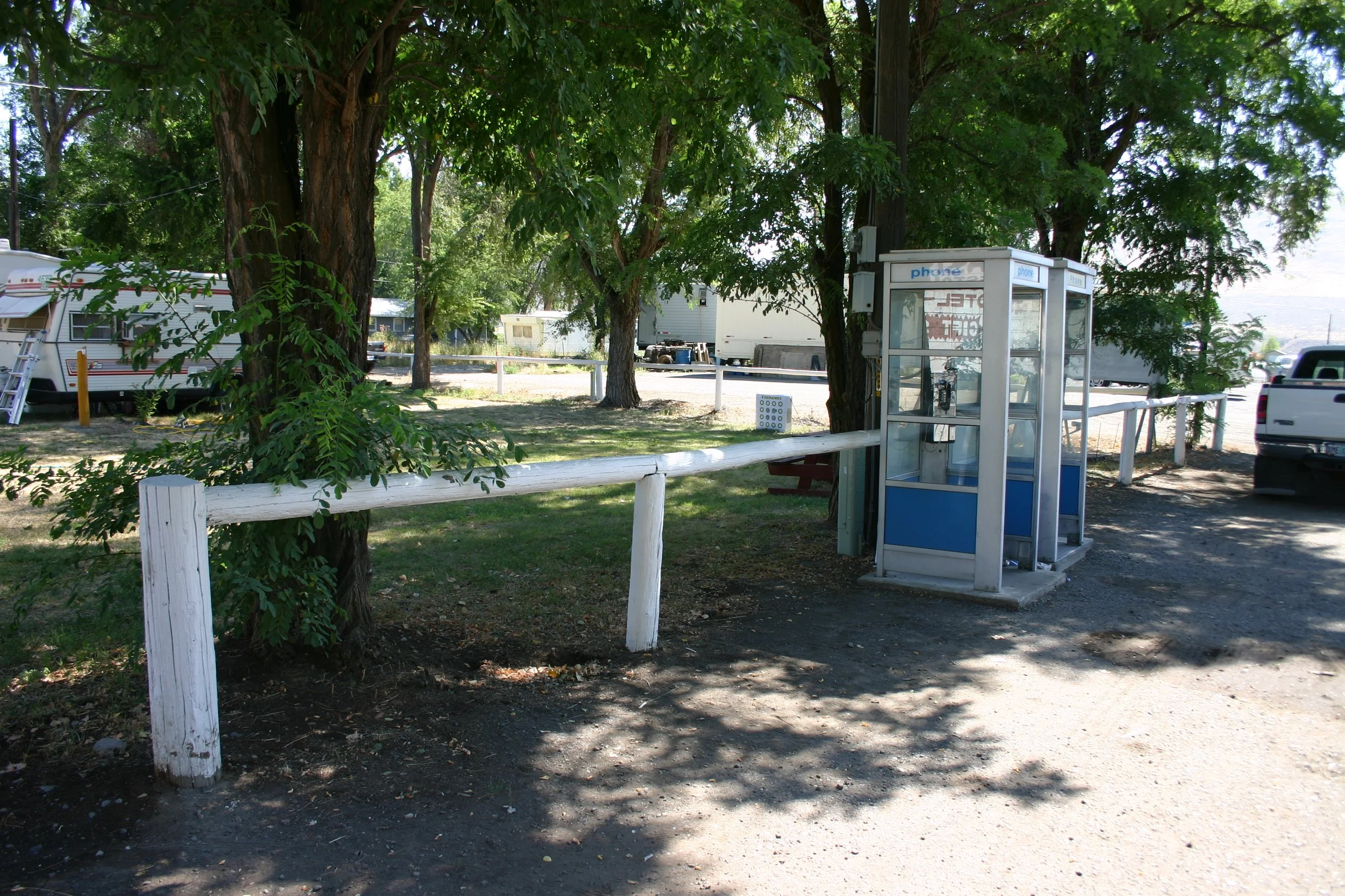
When we passed through in 2005, not much had changed. The pay phones were still there, along with the white railing and the patch of grass beyond where we pitched our tent. (Click image for geotag)
Day 28: Down The Malheur
-
Date: Saturday, August 4, 1990
Destination: Ontario, Oregon (Holiday Motel)
Miles: 73
Total Climb/Descent: Up 1,549 / Down -2,359
High Point / Low Point: 2,995 feet / 2,152 feet
Feet Per Mile: 21
Route Score: 75 (Moderate)
+ Rattlesnake Collision
“I love everything that flows.”
Goethe had it right. We are still in the cool of morning, outside of Juntara, following U.S. Highway 20. But this mother road through Oregon had a surprise for us.
Cutting through the basalt escarpments and volcanic uplands, the Malheur River offers one of the few practical east-west corridors through the region. Not just in 1990, but for practically forever.
The Northern Paiute bands used it as a transportation corridor. Peter Ogden of the Hudson Bay Company camped here while exploring the area in 1828. He called it, appropriately, “snake country.”
Stephen Meek used the Malheur River in 1845 as a shortcut for Oregon Trail emigrants—with disastrous results. It was a stage route, then a dirt road, a rail line, and finally a U.S. highway.
For us, it was a scenic descent downriver. We’d follow it for 40 miles before making any sort of significant detour. Gentle, meandering, full of oxbows, the river promised a scenic day.
The morning paper said it would be a hot one—maybe 100 degrees in Ontario. So, we rushed through our French toast and ham and were on the road a little after 8 a.m. Downhill or not, the 73 miles to Ontario would take more than five hours. We would ride through the hottest part of the day.
The first 15 miles passed quickly. The canyon narrowed, and the river made continuous turns. We could see remnants of the old railroad—trestles ending mid-river, abandoned train tunnels—and old highway bridges from the 1940s.
The road sloped downhill. The only climbs were when the modern highway cut straight through an oxbow.
At mile 22, we faced the largest hill yet, a quarter-mile climb that ended with a sinuous, shaded descent back to the river. I picked up speed quickly, zooming around a gentle left bend, followed by a sharper right meander.
I came out of the turn and spotted something in the middle of the road, right on my line.
Fifty feet flew by as my brain tried to figure out what I was seeing: A rattlesnake, a big one, probably five feet long and as thick as my wrist.
Three seconds to impact:
Voices in my head … “Steer around or hold my line? Can I miss it? Will it move out of the way? Is Christy close behind? Will she see it?
Two seconds to impact:
“Ah shit, it’s not moving, gonna crash if I swerve better straighten up lean back yank up on the bars don’t squeal like a girl oh shit oh shit.”
One second to impact:
“It’s a big one and sorta pretty I wonder if I will crash?”
+ Ninety-Six Degrees in the Shade
I’d like to think that as my wheel closed the last twelve inches at 25 miles per hour, the snake never realized my approach.
It was surprisingly solid, like running over a firehose. I leaned back and kept it upright. In the microsecond after impact, its head and tail flopped into my rear wheel.
There was a sound like an out-of-tune xylophone as its body ricocheted off my spinning spokes. In my mind, the snake was cut to shreds, probably taking out a few spokes for good measure.
Christy saw what happened and steered into the center of the road. The snake, now free from my bike, writhed in its final few seconds of life.
We pulled over 50 yards down the road. The snake, now motionless, lay in the middle of the road. There were no guts in my spokes, no damage had been done—at least not to my bike.
We continued on, shaky and laughing. I felt like I’d dodged a meteor that streaked out of the sky, aimed right for me.
By now, we were versed in the odors of roadkill. We could tell the stench of a deer from that of a raccoon or possum. We continued downriver, and I wondered what rattlesnake roadkill smelled like.
At mile 33, the canyon opened into a broad valley, filled with alfalfa fields. For some reason, the green fields made it feel hotter—humidity, maybe. I wasn’t sure. We still had a bit of water, but were already looking forward to Vale, a large town 17 miles down the road, where we’ll grab some lunch.
We passed a constriction in the canyon and entered another broad valley. Uh oh. The road left the river and aimed straight up a series of low hills. It doesn’t look severe, but it does look hot.
We began our climb, and as our speed dropped, the heat increased. Since yesterday's climb over Stinkingwater Pass, we had dropped 2,500 feet. It’s just hotter down here. We climbed past a sweeping left bend and entered an interminable false flat that stretched for miles. My mind, drifting, lands on a song, and I sing out:
“96 degrees in the shade.
Real hot in the shade.”
My voice is a croak. Christy is too far back to hear what I said and yells, “What!?”
Our karaoke session flames out before it begins.
The climb relents. A huge valley opens up below us. A wonderful four-mile descent air dries our sweaty faces and salt-encrusted T-shirts, but it’s only getting hotter.
The final five miles into Vale were torture. We pulled up at M&W Market sunburned, windburned, dehydrated, and nearly delirious. I grabbed a 32-ounce Gatorade from the cooler and started chugging. It was gone before I got halfway down the grocery aisle, so I circled back for another.
We looked for shade outside, drinking the cool concoction of sugar and electrolytes, wondering if anything had ever tasted so good.
Cooled and rehydrated, we tackled the last 17 miles into Ontario. The road was busy, and the shoulder was lousy, but at mile 67, we reached an important milestone: we turned off U.S. Highway 20 and headed north into Ontario. It had been days since we had to worry about navigation, so winding our way through town felt novel.
Ontario was a big place—larger than Bend, but not half as scenic. We traversed an honest-to-god downtown with stoplights and everything before deciding on the Holiday Motel by Interstate 84 (Room 140 for $28.57, including tax).
We had made it across the lonely deserts of Oregon and would enter a new stage of our journey tomorrow, the climb up and around the mountains of Idaho to the top of the Continental Divide. But before all that: a shower, laundry, and some air conditioning.
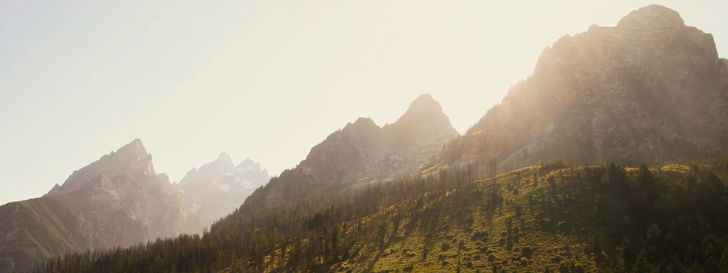
Part Four: Central Idaho
Day 29: Banks Wild Camp
-
Date: Sunday, August 5, 1990
Destination: Intended to stay at “Bank Campground” which didn’t exist. Wild Camp instead.
Miles: 67
Total Climb/Descent: Up 1,974 / Down -1,167
High Point / Low Point: 2,964 feet / 2,148 feet
Feet Per Mile: 29
Route Score: 89 (Hard)
+ Intermezzo
Past the cracked concrete—the interchange and stoplights replaced by river reeds and an expectant sky—you stand and stoke the fire.
Three quick pedal strokes, then a coast. Worry has been left behind. Uncertainty is already a mile to the rear, startled by its loneliness.
The next ten minutes will be like the last, and the ten after that. The river began preparing for this morning millennia ago. It has smoothed the hills and points the way. The river bottom rolls out ahead of you, green and lush, warm and hazy.
Hawks and ravens, starlings and sparrows wheel about you—guardians of this forgotten highway, stretching quiet in the humid morning air.
The long days have granted you strength and insight, a gauzy separation from the spinning legs below.
“The here and now is enough—this road, the next five miles, the next expected turn.”
In that simplicity, a vast freedom where past mistakes and future challenges are silenced; the nattering voices of your mind muted.
And in their stead, a place where the wild god may visit.
Perched on your handlebars, he points a crooked finger to the river bends, the building clouds, the wind in the trees, the warm air and the sweat and the fecund marshes. You laugh and nod, for you, too, have noticed them—their grandeur, their importance.
You and he are partners and friends this day, and you have many miles left to ride together
… and you are glad.
+ Payette River Flow State Pedaling
Civilization follows topography. I instinctively knew this, but it rarely played a role in day-to-day life.
This morning, though, I could sense the river long before I even came near it. We had crossed the wilds of Oregon and would soon head into a new state for both of us: Idaho.
Before we did that, we’d cross over one of the most substantial rivers in the West: the Snake.
(“Snakes. Why did it have to be snakes?”)
The Snake flows for almost 1,100 miles from its source high in Western Wyoming to the Columbia River, passing through deep, inaccessible canyons and remote wilderness.
We, however, would experience its softer side today.
Gone were the sparse high desert vistas of the last four days. We had entered the Snake River’s green network of canals and agriculture—a flat, broad, and intensively cultivated land—and with it, traffic and population.
Our hotel in Ontario was the first wake-up call: its large parking lot filled with big rigs, the road out front loud and busy.
We were up early and hardly awake when confronted by the hectic Interstate 84 interchange—cracked pavement, merging semi-trucks loaded with produce. A half mile later, we crossed over the river, quiet and somnolent on this early morning.
Our next seven days would be shaped by rivers, as we climbed up the Payette, down the Salmon, and then up the Lemhi to the continental divide.
Idaho’s first fifteen miles were novel, with small but numerous towns—Gayway Corner, Fruitland, Palisades Corner, New Plymouth. It was warm and humid, a smudge of cloud and haze that could signal thunderstorms later.
We rode either dead east or dead south, the right-angle junctions of Highway 30 determined more by property lines than geography.
We settled in, amused by the simple things: the smell of the fields, the passing houses on either side of the road. There were chiropractors and car washes and shed stores; working farms with tractor implements strewn everywhere.
Signs read “Snake River Scenic Byway,” which I thought was a bit of an oversell, but the passing sights kept our attention.
The roads calmed at mile 15 as we neared the Payette River, turning southeast on Highway 52. The stores were gone, and the homes were farther apart. It now felt like the quiet Sunday morning that it was.
There were birds everywhere, startled by our passing. Green flat fields were hemmed by winding stands of tall trees—hinting at where the Payette flowed. Pleasant terrain with new sights every minute. So far, Idaho was off to a good start.
We hadn’t found a breakfast stop yet. It didn’t look like we would—not until Emmett, another 15 miles down the road. We fell into a flow state, barely aware of the effort of pedaling, feeling the warm air on our arms and legs, drifting into daydreams with the passing miles.
+ Day Use Only
Reveries are finite—unless you’ve been lobotomized.
The grumbling in my stomach elbowed its way into my thoughts at mile 25 with a “when are we gonna eat?”
Simultaneously, the rising sun’s inevitable thermostat nudge ended the “warm-but-pleasant” morning with a “gawd-how-hot-will-it-get” lament. Emmett couldn’t arrive too soon.
We found a breakfast stop on the main drag through town and happily hung our helmets from our handlebars.
It was a busy spot, full of what seemed like ranchers just let out from church. An older crowd—freshly shaved—in starched, clean shirts and cowboy boots. We were sweaty youngins from California in Lycra shorts and bright T-shirts.
Again, we happily played the role of weird outsiders.
However, layered into the mix now was experience—and the belief that the days and miles had granted a sort of wild wisdom. We’d seen things, you know. I’m not sure this nascent cockiness was deserved, but it no longer felt audacious to say we were riding our bikes to Yellowstone.
Whatever swagger we possessed soon deflated as we crossed over the Payette River and climbed up to Black Canyon Reservoir.
It was well into the 90s now, with no shade and a slight incline. Sweat rolled into my eyes as I chugged down water and turned the crank. Count out 50 pedal strokes and then do it again, and again.
At mile 45, we left the reservoir behind and met the Payette for really the first time. It was a lively river, with gravel banks and riffles. Not too deep or intimidating. We decided that a swim was in order, somewhere soon down the line.
Gone were the flat agricultural plains, replaced by rolling gold hills dotted with pine forests.
Idaho.
These were foothills of something larger ahead, and we were excited to see what was in store.
We reached Horseshoe Bend and stopped for drinks and some supplies. Our typical camping meals consisted of Dinty Moore stew or canned chili, pasta, Gatorade, and Chips Ahoy cookies. Not exactly nutritious, but easy to cook.
We hoped the Banks Campground, where we’d stay that night, was close to a restaurant, but information was limited.
Just outside of Horseshoe Bend, at mile 55, we spotted a dirt road down to the river where a deep eddy churned. We pulled off the highway and clambered down to the water, which was icy and deep, the bottom rocky.
It felt a little dangerous and half-cocked, but we spun around in that eddy for ten minutes as our body temperature plunged and our sweaty shorts and T-shirts got an impromptu wash.
Twenty minutes later, our clothes were dry again as we cycled north into the hills.
At mile 62, like we had crossed some invisible threshold, the pines descended from the hills and gathered along our route.
Tree-lined and in a narrowing canyon, the Payette felt like a worthy destination. River rafting parties began to appear.
We began to look for Banks Campground, which was ambiguously located on the state highway map with a red tepee. We were ready for another swim.
The miles dragged on, our stamina gone, when we reached Banks Beach at mile 67.
A large “Day Use Only. No Camping” sign greeted us. The beach was nice, however, and we plunged back into the river. I could almost hear the water sizzling as it touched my hot skin.
We were at a loss, but didn’t care, floating in the cool water, afternoon sunshine making the canyon glow, pine trees swaying in the breeze.
We asked around: the nearest campground was way up the road—a whopping seven miles past our turnoff and up a huge climb.
So we weren’t going to do that.
Dejected but at least cool, we remounted our bikes and set off, hoping for a miracle.
I can’t say that’s what we got, but it was enough. An old logging road snaked up the canyon wall just a quarter mile from Banks Beach. It disappeared into the forest toward a long flat ridge above us. We took the bet and pushed our bikes up the grade as the sun dipped behind the western hills.
The first 100 yards were steep, and after a sharp hairpin turn, the next bit was even steeper. Too steep to pitch a tent.
We trudged on, wondering if this was a fool’s errand. Then the road began to flatten, and the ridgeline broadened. This could work. We found a nearly level spot in the woods, cleared the rocks and dead limbs for the tent, and made a temporary home for ourselves.
This was our first (and last) wild camp of the trip. In the world of long-distance bike touring, wild camping is commonplace. But for us, it felt adventurous and a bit like a natural progression—the latest unexpected merit badge in our journey from neophyte to more seasoned traveler.
Nevertheless, we cooked dinner with utmost care, paranoid about starting a wildfire. The temperature cooled, and we could hear the soft voice of the river below. We ate dinner with our backs against a tall tree—looking for the first stars to appear—and prayed for a quiet, undisturbed night.
Day 30: Hot Spring Soaking
-
Date: Monday, August 6, 1990
Destination: Bonneville Campground.
Miles: 54
Total Climb/Descent: Up 3,699 / Down -1,855
High Point / Low Point: 4,673 feet / 2,806 feet
Feet Per Mile: 68
Route Score: 134 (Difficult)
+ An Undiscovered Country
We woke to the sound of the wind in the trees and a feeling that we had gotten away with something. We packed in a hurry, wondering if the area was still used by logging teams—the dirt road showed fresh tire tracks.
The previous night, I caught myself listening for animals on the prowl. Ridiculous! But those jitters didn’t last long. Our first wild camping experience had been nothing but peaceful.
We replaced the rocks and downed branches, and the site looked undisturbed.
We remounted our dusty bikes and rumbled down the dirt track—a steep decline at the edge of comfort—before rejoining Highway 55, grinning like we had a secret too good not to share.
A quarter mile up the road, the Banks store and café looked closed. It was too early for any customers at the Bear Valley River Company next door. We pedaled on, aiming for a hopefully named destination called Garden Valley, 11 miles up the road.
In the years that followed, Garden Valley would grow in my mind, becoming almost a mythical Shangri-La. Anytime anyone asked where I would have a second home, I had my answer.
On that August morning in 1990, however, we only knew we had pedaled our way to someplace special.
We turned off on the Banks-Lowman road, entering the narrow valley of the South Fork of the Payette River. Just feet away, the river rumbled down riffles, swirled in powerful green eddies, and pooled under the pine shade lining the banks. Its sound filled the valley.
The road was all but deserted; a lone car passed by every ten minutes as we gradually climbed upriver, our sore legs warming to the task and the long day ahead.
Idaho was showing its character. North-facing slopes were heavily forested, but those facing south—including the tall mountain dead ahead—were nearly bare, a few lone pockets of trees providing scale.
It gave the surrounding mountains a muscular animal feel, like a huge beast silently crouching.
We continued up the road, not sure what lay ahead, but content with the here and now.
At mile four, the canyon constricted. Hillsides tumbled down in a series of small cliffs, evidence of rockfall marring the pavement.
We caught a whiff of sulfur—"Pine Flat Hot Springs,” the sign read—but saw no thermal pools. We paused at Deer Creek Launch site, a put-in spot for the rapids below.
A mile up the road, the river curved powerfully to the right, and a forested neighborhood appeared. We climbed another mile; the trees parted, and the canyon abruptly ended.
We pedaled into a wide, lush valley, rimmed with mountains. The Payette lazed away out of sight to our right. There were a few barns and small houses, but mostly a wide green field, perfectly flat, stretching a mile to the mountains.
It felt like an undiscovered place—unhighlighted by any guide book.
Now, if we could just find breakfast, it would be about perfect.
+Bikinis, Beer and Laughter—or Maybe Not
Halfway through my hash browns, the corollary appeared: just like unexpected hills felt far harder than they ought to, unexpected luxury and beauty outpaced anything you anticipated.
Garden Valley was like that. We had wrestled yesterday’s lack of a campground to the ground and found a perfectly workable solution. This morning's ride was gorgeous and varied. Even the breakfast spot appeared at just the right time. We felt buoyant.
But then a pesky question from the cook: “You going to ride through the construction zone over the pass?” Uh, construction zone? Pass? Suddenly, things didn’t feel so certain.
He said they were repaving parts of the road, and there were graders, trucks, flagmen, and delays ahead. “You’ll make it,” he said, reading our expression. But the damage was done.
At the east end of Garden Valley, the road narrowed and began to gently climb. The highway rejoined the river and worked its way out of town.
Mountains rose ahead of us. We passed the Boise National Forest ranger station and then Hot Springs Campground (this time we could see a series of picturesque steaming pools on the riverbank).
The day was warm but still pleasant as we climbed on. At mile 21, we saw the first road construction signs but didn’t lose hope. So far, the road was quiet, scenic, and not too steep.
The road followed the snaking Payette as it climbed up the canyon. Volcanic spires rose across the river to our right as we wove in and out of gullies, the road always gently rising.
Finally, at mile 24, we came around a corner and were met with a line of waiting cars—all the cars that had passed us in the last 30 minutes—lined up before a flagman. We wormed our way to the front to get a look at the road ahead: unpaved, but not terrible. Dusty. Heavy with machinery.
The flagman said there were several unpaved sections over the next three miles, and everyone had to follow the pace car to the end. We nodded, not for a second believing we’d keep up.
Sure enough, the white pickup truck—festooned with large checkered flags and “Pace Car” signage—took off.
We mashed on the pedals, but soon the road climbed upward, unlike anything we had seen that day. We were passed, one by one, in a cloud of dust by every car behind us.
Finally, the last car pulled away, leaving us panting up the climb, our dust-caked faces streaked with sweat, suddenly alone in the quiet.
But then a sound. A strange, unexpected sound. Laughter. Raucous laughter.
We wobbled over to the edge of the road. There, a hundred yards below us, a line of rafts floated in the current.
I’m not sure I could see their bikinis or their ice chests filled with cold beer. They were too far away. But not too far to imagine them looking up to see two hot, sweaty, dirt-caked faces and saying to themselves, “Look at those idiots!”
As if on cue, a fresh round of laughter echoed up the canyon. Christy looked over at me and blew a strand of hair off her face with an exasperated raspberry. “Next summer,” she said, pointing, “let’s do that.”
The descent to the Southfork Lodge allowed us to regain our composure. It had been less than 25 miles –barely three hours—since breakfast, but we couldn’t pass up the opportunity to stop at this historic riverside lodge in Lowman, grab a sandwich, and stock up on supplies for dinner.
The next 20 miles were quintessential Idaho as we meandered along Highway 21, passing campgrounds and hot springs and tiny hamlets.
We watched rafts drift past and fishermen cast their lines. It was warm without being hot. Sunny without being too bright. Even the wind was at our backs.
The road rarely strayed far from the river, and there were rest stops with pit toilets and water spigots every few miles.
In other words, we had everything we could possibly need.
And yet it was a pleasure to reach Bonneville Campground. After a day of watching others lounge in hot springs, we were ready to give it a try ourselves. So off came the sweaty lycra and on came our swimsuits.
The Bonneville Hot Springs were a short stroll up the canyon. The sky had filled with cumulus clouds, and there were distant rumbles of thunder, but the air was still and warm where we were.
We followed the trail to a large shallow pool that was fed by a steaming cascade of rotten-smelling water. Up the hill, inside an ancient shack, was a bathtub fed directly from the spring. Much too hot. We retreated to the pool and waded in.
We made dinner that night in the crowded campground. Our usual mix of chili and canned vegetables. The campers in the site next to us were friendly and curious, and when they brought a pot of macaroni and cheese with peas to us, they found instant friends.
Maybe established campgrounds aren’t such a bad idea after all.
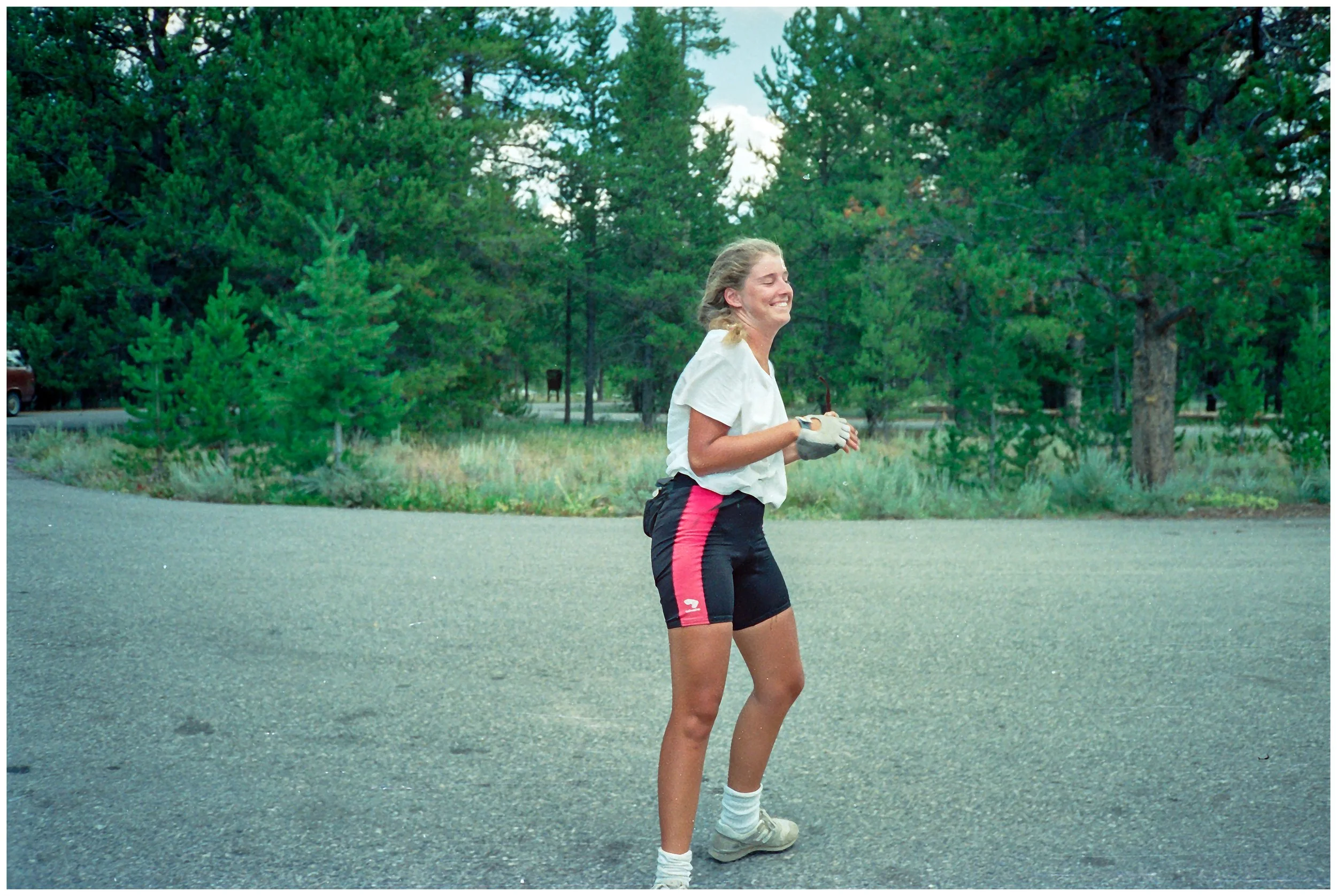
Christy, happy to arrive at Bonneville Campground and ready for a soak in the hot springs. Shot #1 from our surviving rolls of film. (click image for geotag).
Day 31: Up and Around The Sawtooths
-
Date: Tuesday, August 7, 1990
Destination: Sawtooth Hotel, Stanley Idaho
Miles: 40
Total Climb/Descent: Up 3,068 / Down -1,472
High Point / Low Point: 7,038 feet / 4,666 feet
Feet Per Mile: 77
Route Score: 82 (Hard)
+ Mile High Mind Games
It was an instant-oatmeal morning.
Not only was there no breakfast café along today’s route, but there would be no services of any kind. Up into the mountains we’d go, climbing fifteen miles and 2,600 feet to Banner Summit at 7,000 feet.
This felt different from the climb to Crater Lake. Perhaps it was the punchy afternoon skies, filled with cumulus clouds and the deep bass rumble of thunder. Maybe it was the serrated skyline of the Sawtooth Wilderness—peaks sharp and jagged. And maybe it was the hard lessons learned, the recollection of that day over Windigo Butte when everything went sideways.
Whatever it was, we were taking today seriously. So we got up early, ate heartily, stowed our rain gear in an accessible spot, and made sure our water bottles were full.
We rolled out of camp before our neighbors were stirring, still grateful for their leftovers. We pedaled out to the highway, turned left, and settled in.
At mile three, we parted ways with our old friend, the Payette River. Our road climbed the northern wall of the valley. We reached the Emile Grandjean Historic Marker and gave a final look into the river valley we had followed for the last two days.
The Payette was entering its finest stretch, a glacier-carved valley ringed by sharp peaks. It was bittersweet that we wouldn’t follow it to its headwaters at Vernon Lake (8,464 feet).
We turned north out of the valley and began to climb one drainage after another, content that the next corner would reveal only more climbing. We were pitifully slow, even a month into our tour.
Stacked down the road, each word separate and painted in six-foot letters, was the slogan: “IDAHO IS TOO GREAT TO HURRY THROUGH.”
This was great if you were going 50 mph. At 6 mph, the saying took form at a glacial pace, like a tape played back at quarter speed. “C’mon! Spit it out!”
We climbed on, the miles ticking over, the curving road serving up 200-yard views before bending out of sight.
We commented on the cracked pavement and the long, snowy winters this area no doubt endured. We talked about the huge boulders protruding from the road cuts, seemingly ready to cut loose at any moment.
Mostly, however, we climbed in silence, listening to our bodies and trying not to overcook the climb.
Nine miles in, we entered a rocky part of the canyon, where gray granite hung over the road. Canyon Creek burbled and splashed over rocks to our right.
Still, the road climbed.
We played mind games: OK, just ride to the next mileage marker—and then the next and then the next. Count your pedal strokes from 1 to 100 and then from 100 to 1. The most dangerous was this: “It looks like the road meets the horizon ahead, that must be the pass, right?”
And there it was: a series of signs, a rounded pull-out, a weather station, a boom gate across the road. A sign read “Welcome to Challis National Forest.”
Banner Pass at last. We pulled over.
It was cool up here, and a few puddles lingered from yesterday’s thunderstorm. Most importantly, the road dropped out of sight.
There was no bombing descent; it would take 25 miles to lose the 1,300 feet to Stanley, but they were glorious miles.
Somehow, spring lingered at these elevations. The Sawtooth range slowly revealed itself, becoming more magnificent with every mile until it dominated the southern horizon near Stanley.
+ Accosted at the Market
We rode into town looking for a place to spend the night. The sky had bruised again, and we could tell a storm was coming—plus, how nice would it be to sleep in a bed and grab a shower?
The Salmon River Campground was forgotten. We soon had a room at the Sawtooth Hotel (Room 20, $40.50 for the night).
We showered and changed and were soon roaming through town, thinking about the old Groucho Marx quote: “I refuse to join any club that would have me as a member.”
Everyone we met seemed cut from our cloth. There were tourists, sure, but also backpackers and river rafters, fishermen and motorcycle tourists. We felt right at home.
The market down the road near the Hwy 21/75 junction was packed with goodies—even some fresh fruit. We loaded up and got into the checkout line.
Then we saw him. Unshaven. Unkempt hair. Stained T-shirt. Then, the kicker: the half-moon tan lines of cycling gloves. Was he our people? We were so starved for camaraderie that we got out of line and accosted him.
“Hey! Are you a cycling tourist? Where are you coming from? Where are you going? What are you riding? How long have you been on the road? What’s it been like? Are you riding with other people? Are you camping? Are you staying in town? Please oh please oh please will you be our friend?”
Not surprisingly, he looked at us like we were lunatics. He told us he was only stopping for lunch and was riding south (the wrong direction). More alarmingly, he didn’t ask us a single question.
“Well … err … good luck then,” we offered, waving lamely.
He quickly walked down the aisle of the market and disappeared.
We laughed over the whole embarrassing scenario on the walk back to our room. Thunder rumbled, and a black sheet of rain approached.
Christy looked at the sky and then back to me.
“I hope he drowns.”
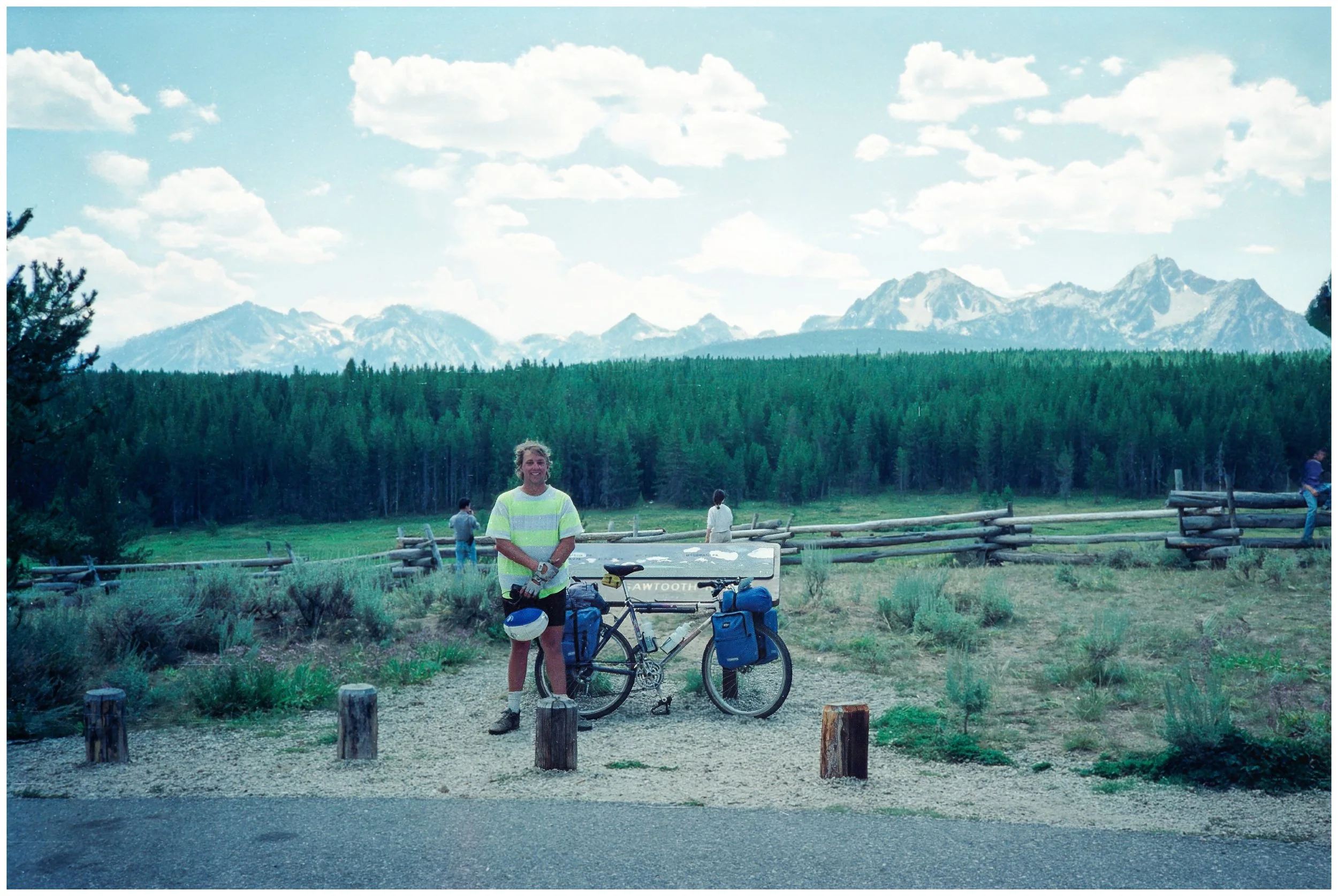
Sean at the Park Creek Overlook, with the Sawtooths in the background, about 7 miles NE of Stanley on State Route 21 (click image for geotag).
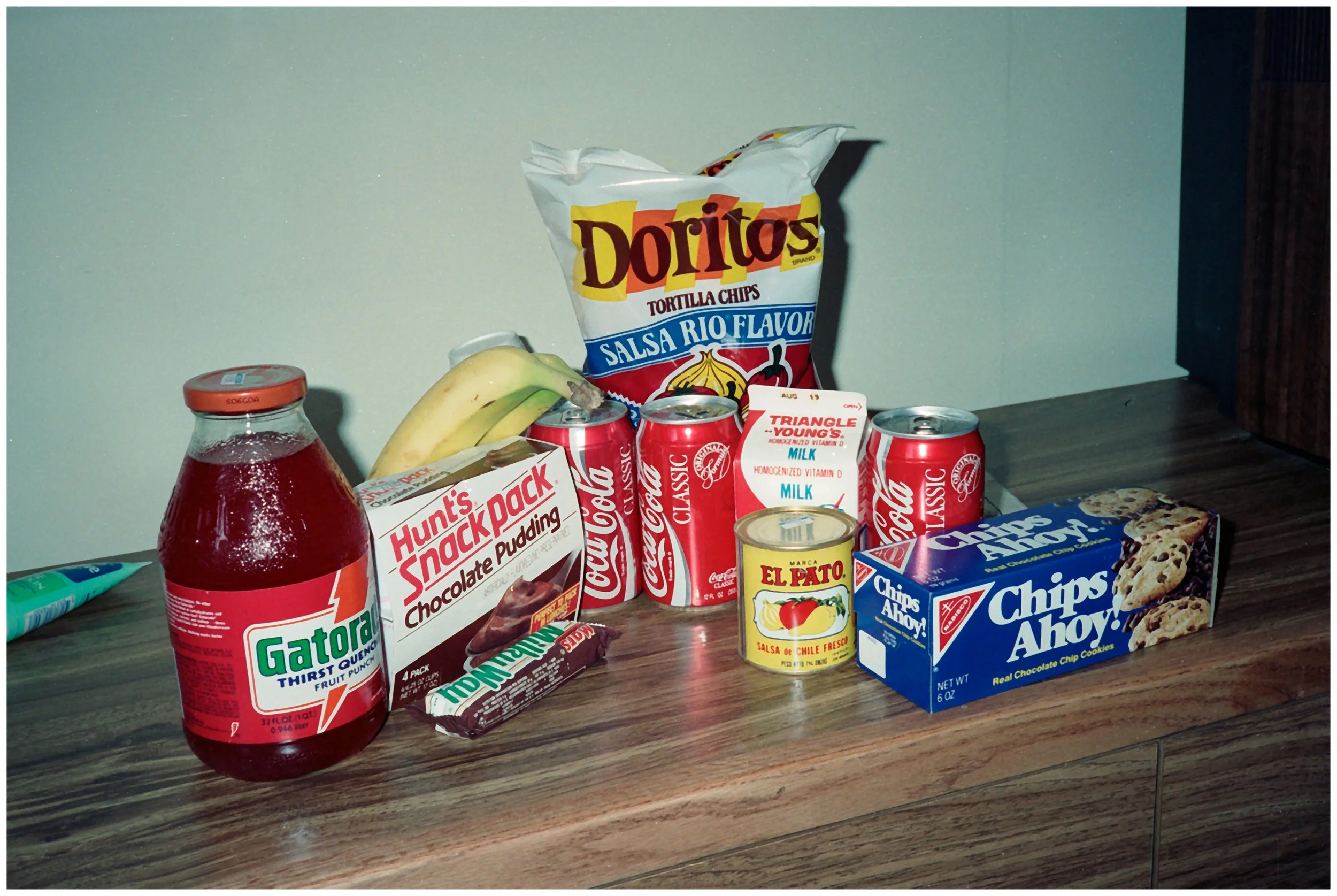
Our pre-dinner snack at the Sawtooth Hotel in Stanley, Idaho (click image for geotag).
The view up the hill from our hotel, after a brief afternoon thunderstorm (click image for geotag)
Day 32: Zero Day In Stanley
-
Date: Wednesday, August 8, 1990
Destination: Sawtooth Hotel, Stanley, Idaho
Miles: 0
Total Climb/Descent: Up 0 / Down 0
High Point / Low Point: 6.270 feet / 6,270 feet
Feet Per Mile: 0
Route Score: 0 (Rest Day)
+ Total Amnesia, With Lunch
I’ve already talked about how time had elongated on this trip—how every day was so full of experiences that it felt like it was rewiring my brain. Then there was the second rest day in Stanley.
At some point early in the day, we decided to stay there, cocooned in Room 20, and let adventure be damned. We pulled out the Visa and ponied up another $40.50.
We had feasted the night before, spending a kingly sum of $34.11 at the Kasino Club Bar & Grill on Ace of Diamonds Boulevard near the market.
Now we were staying put and filling our day with … nothing, it seemed.
Oh, we had breakfast and did laundry. Later, we grabbed lunch at the hotel. There’s a photo of me lounging in an Adirondack chair on what looks to be a newly built deck outside the hotel, the Sawtooth Range beautiful under a radiant blue sky.
But like a true rest day, we did very little.
We did discover, however, that the world had gone a bit crazy in our absence.
On August 2, when the young kid was fixing my rear wheel in Burns, Oregon, 100,000 Iraqi troops had invaded Kuwait. Now, five days later, the drumbeats of war were already beginning. President George H. W. Bush (“Nah Gah Dah!”) was on the TV talking about something called “Operation Desert Shield,” and 15,000 U.S. troops were in Saudi Arabia.
So, we watched TV, rested, fretted, had lunch, and—at least for a day—forgot that we were in the middle of the greatest adventure of our lives.

Christy at the Sawtooth Hotel in Stanley, Idaho where we spent two nights (click image for geotag).
A panoramic view of the Sawtooth Range from our room at the Sawtooth Hotel, Stanley Idaho (click image for geotag).
Enjoying the view on the new deck of the Sawtooh Hotel, which is now enclosed (click image for geotag).
Day 33: A Ways Down The Salmon
-
Date: Monday, July 23, 1990
Destination: O’Brien and Scotty’s House (Home Stay)
Miles: 46
Total Climb/Descent: Up 3,700 / Down -2,295
High Point / Low Point: 2,153 feet / 15 feet
Feet Per Mile: 81
Route Score: 113 (Hard)
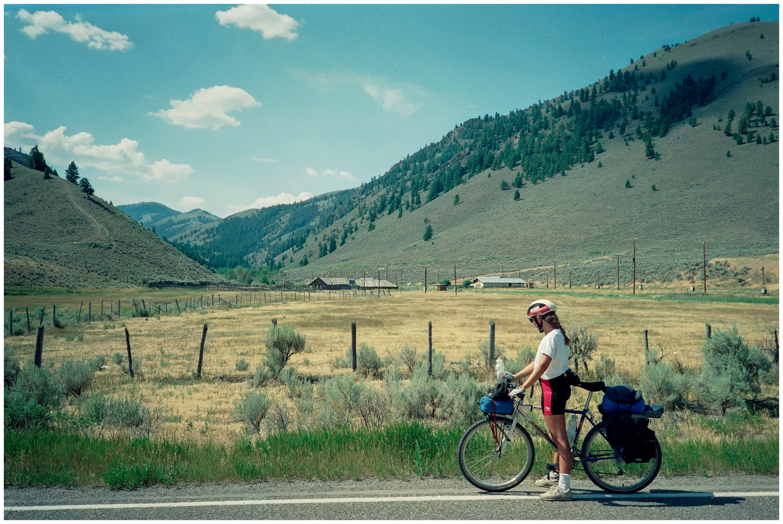
Near French Creek Road on state route 75, near Clayton, Idaho (click image for geotag).
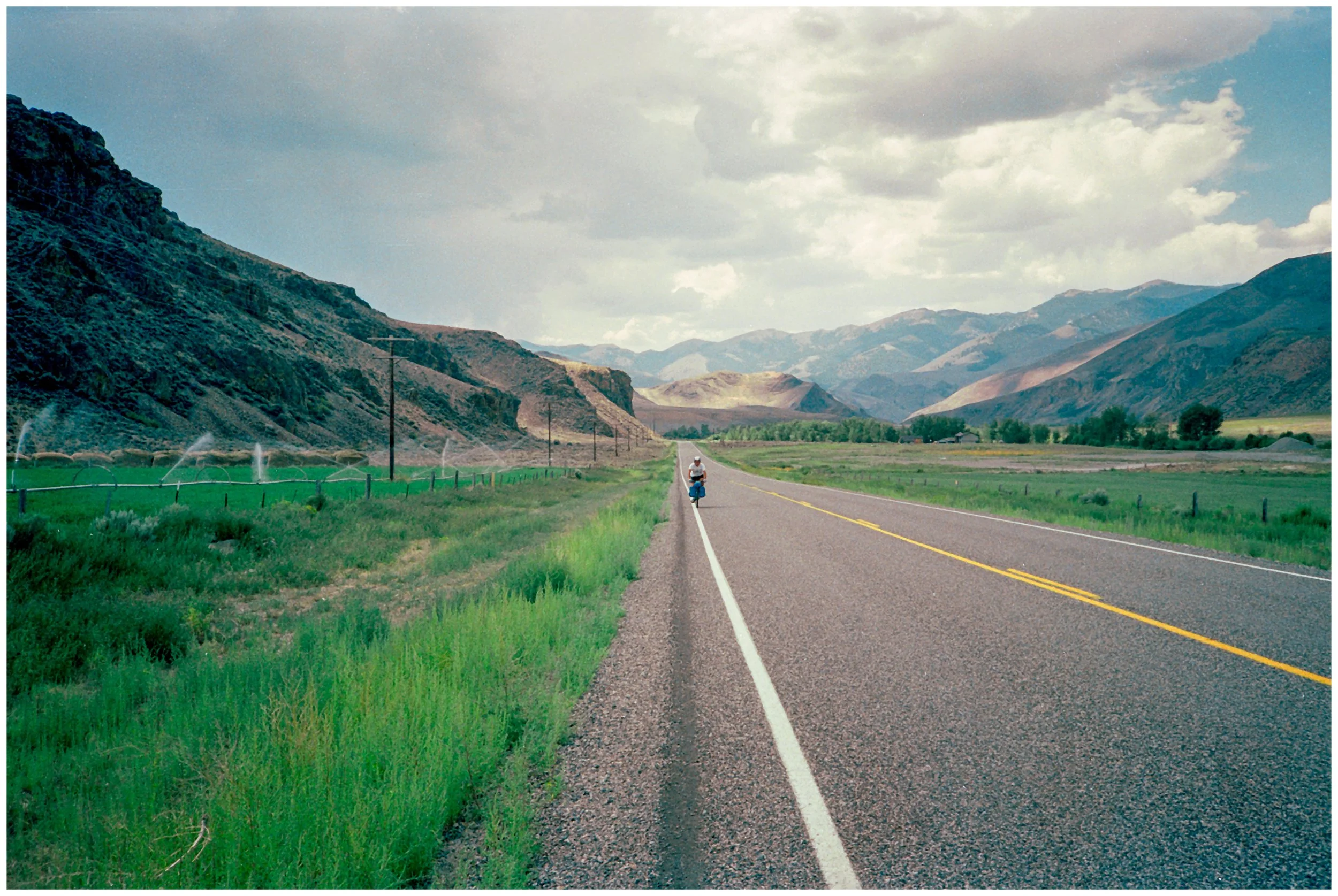
Following the Salmon River downstream near Clayton, Idaho (click image for geotag).
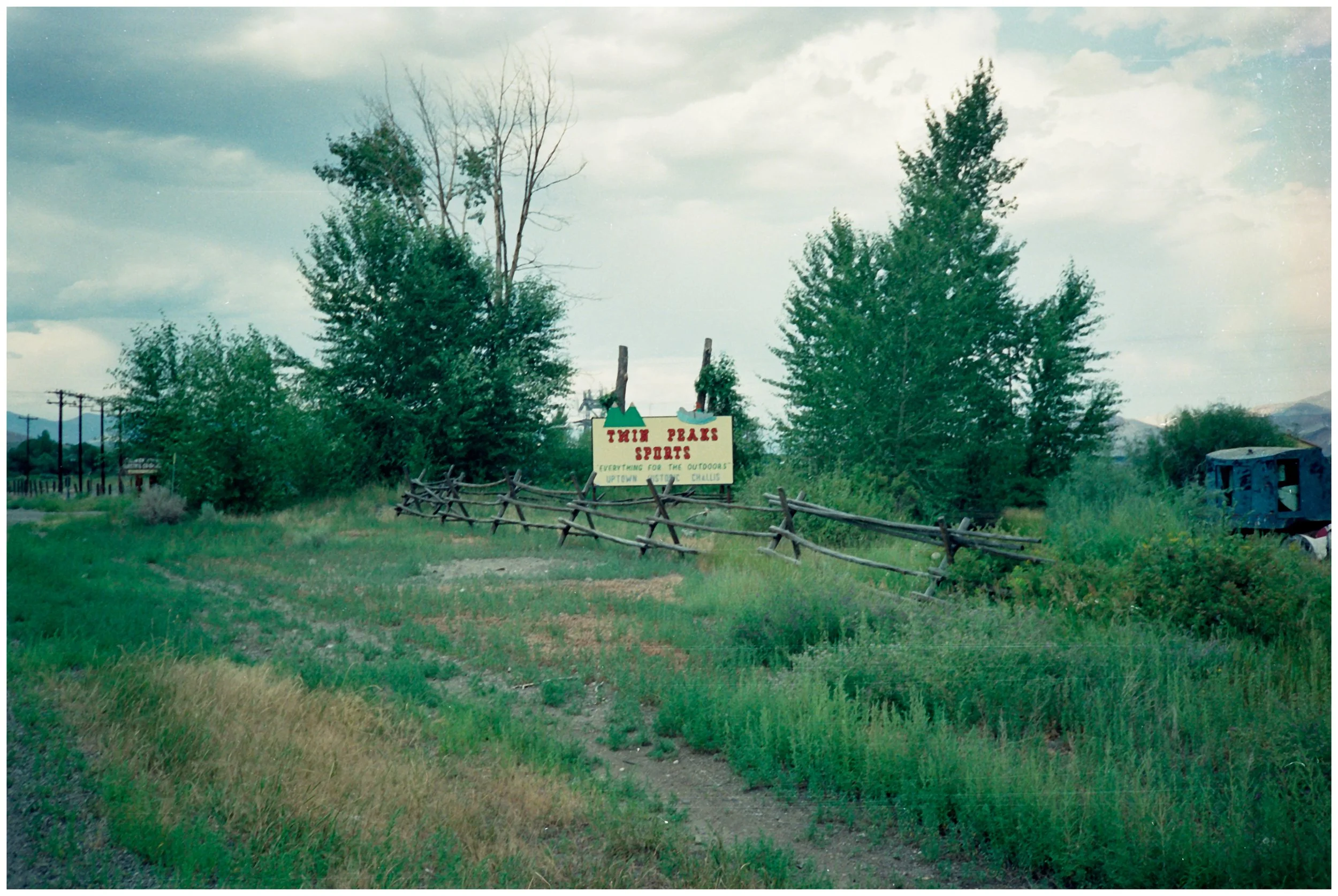
1990, when we were all cuckoo for cocoa puffs about Twin Peaks. Outside of Challis Idaho (click image for geotag)
Day 34: Back In Town
-
Date: Monday, July 23, 1990
Destination: O’Brien and Scotty’s House (Home Stay)
Miles: 46
Total Climb/Descent: Up 3,700 / Down -2,295
High Point / Low Point: 2,153 feet / 15 feet
Feet Per Mile: 81
Route Score: 113 (Hard)
-
W
-
T

Checking the map outside of Ellis, Idaho (click image for geotag).
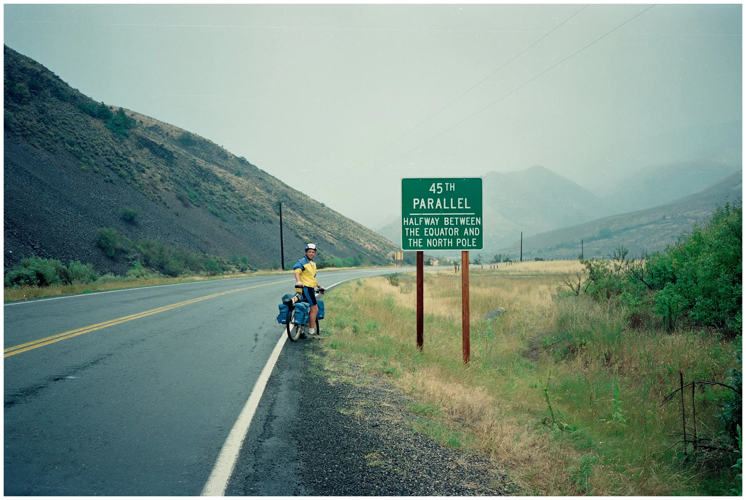
Halfway to the North Pole, outside of Salmon, Idaho (click image for geotag)
Day 35: The Continental Divide
-
Date: Monday, July 23, 1990
Destination: O’Brien and Scotty’s House (Home Stay)
Miles: 46
Total Climb/Descent: Up 3,700 / Down -2,295
High Point / Low Point: 2,153 feet / 15 feet
Feet Per Mile: 81
Route Score: 113 (Hard)
-
W
-
T


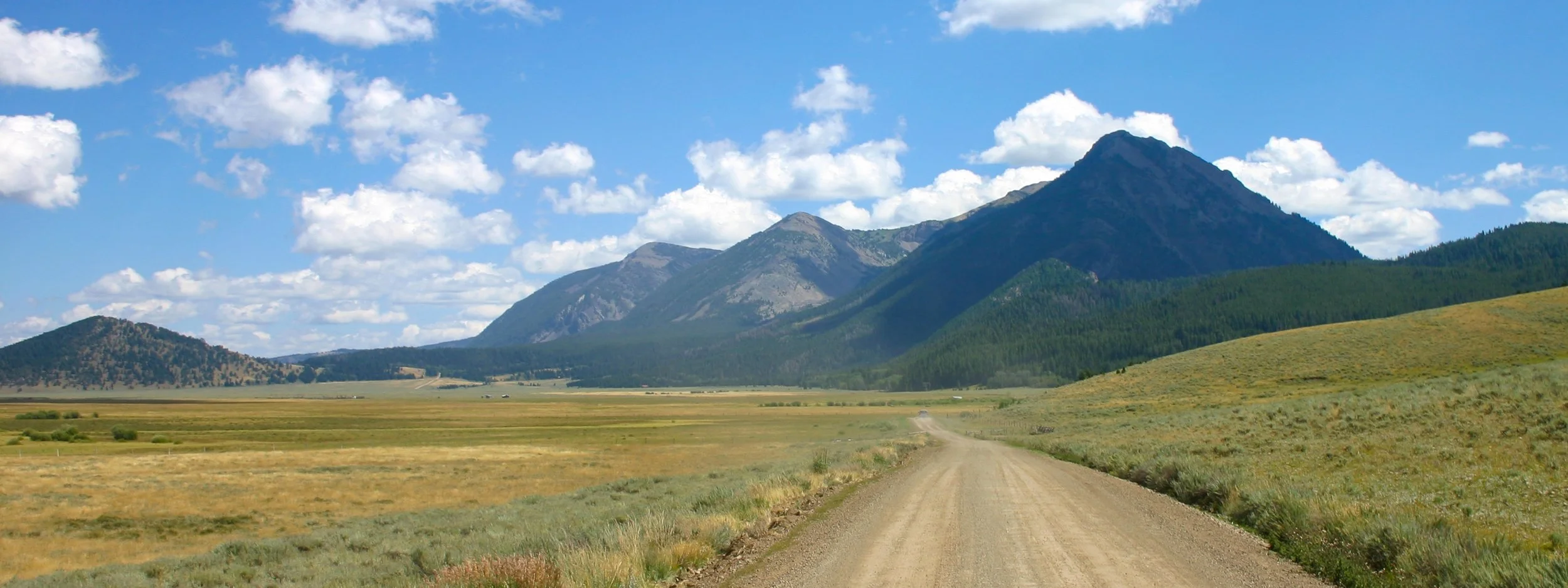
Part Five: Yellowstone Country
Day 36: The Centennial Valley
-
Date: Monday, July 23, 1990
Destination: O’Brien and Scotty’s House (Home Stay)
Miles: 46
Total Climb/Descent: Up 3,700 / Down -2,295
High Point / Low Point: 2,153 feet / 15 feet
Feet Per Mile: 81
Route Score: 113 (Hard)
-
W
-
T


Day 37: Pannier Catastrophe
-
Date: Monday, July 23, 1990
Destination: O’Brien and Scotty’s House (Home Stay)
Miles: 46
Total Climb/Descent: Up 3,700 / Down -2,295
High Point / Low Point: 2,153 feet / 15 feet
Feet Per Mile: 81
Route Score: 113 (Hard)
-
W
-
T


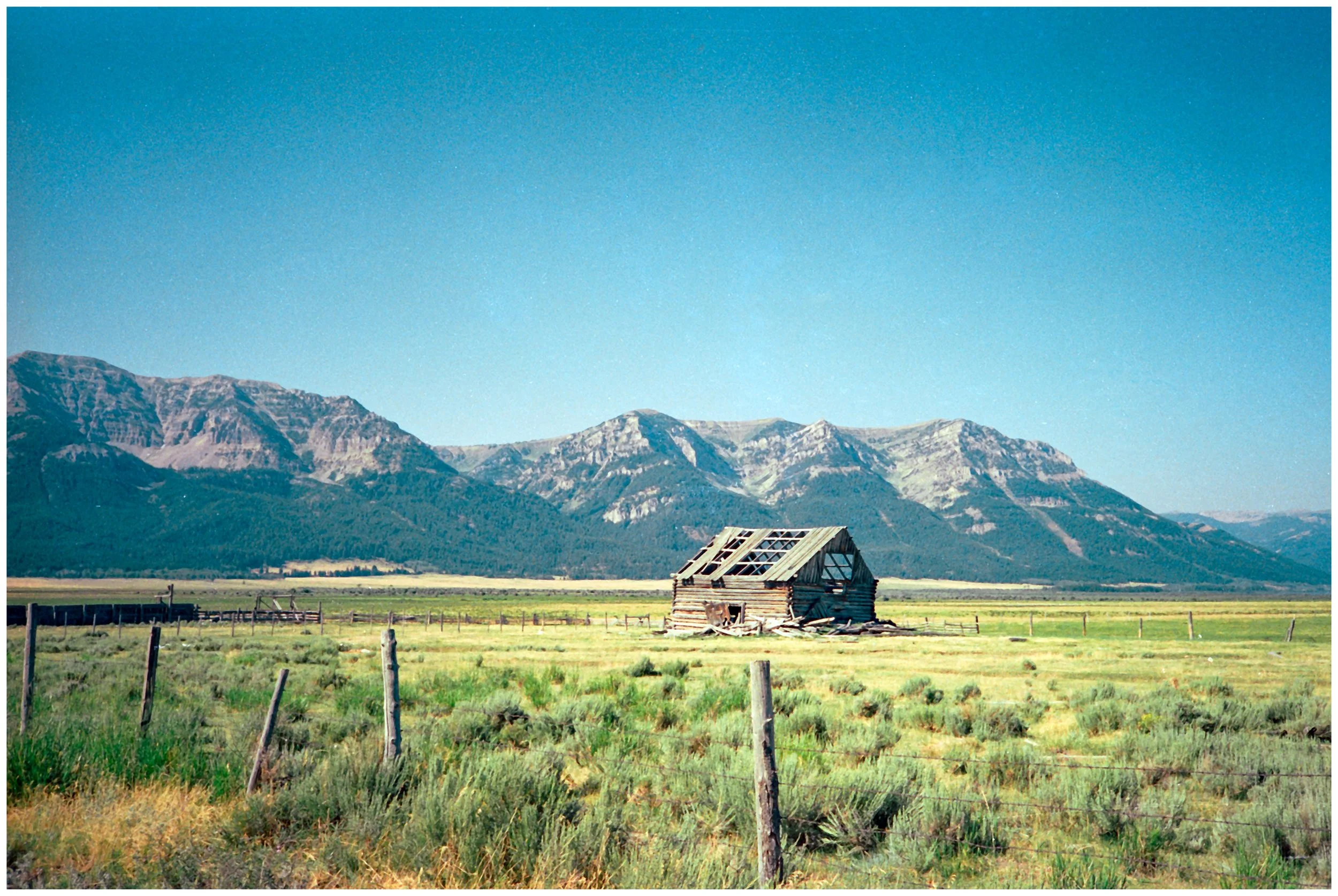
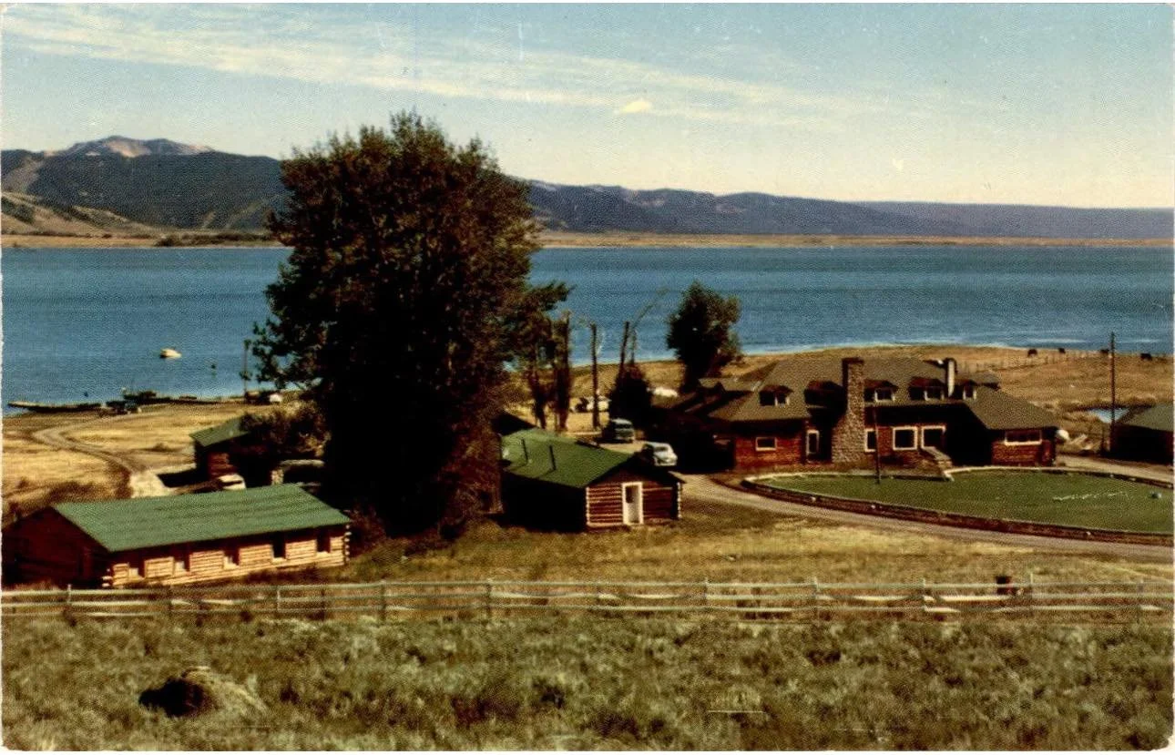
Old Postcard of the Staley Spring Lodge, which burnt down in 20XX
Day 38: The Most Unlikely Hello
-
Date: Monday, July 23, 1990
Destination: O’Brien and Scotty’s House (Home Stay)
Miles: 46
Total Climb/Descent: Up 3,700 / Down -2,295
High Point / Low Point: 2,153 feet / 15 feet
Feet Per Mile: 81
Route Score: 113 (Hard)
-
W
-
T


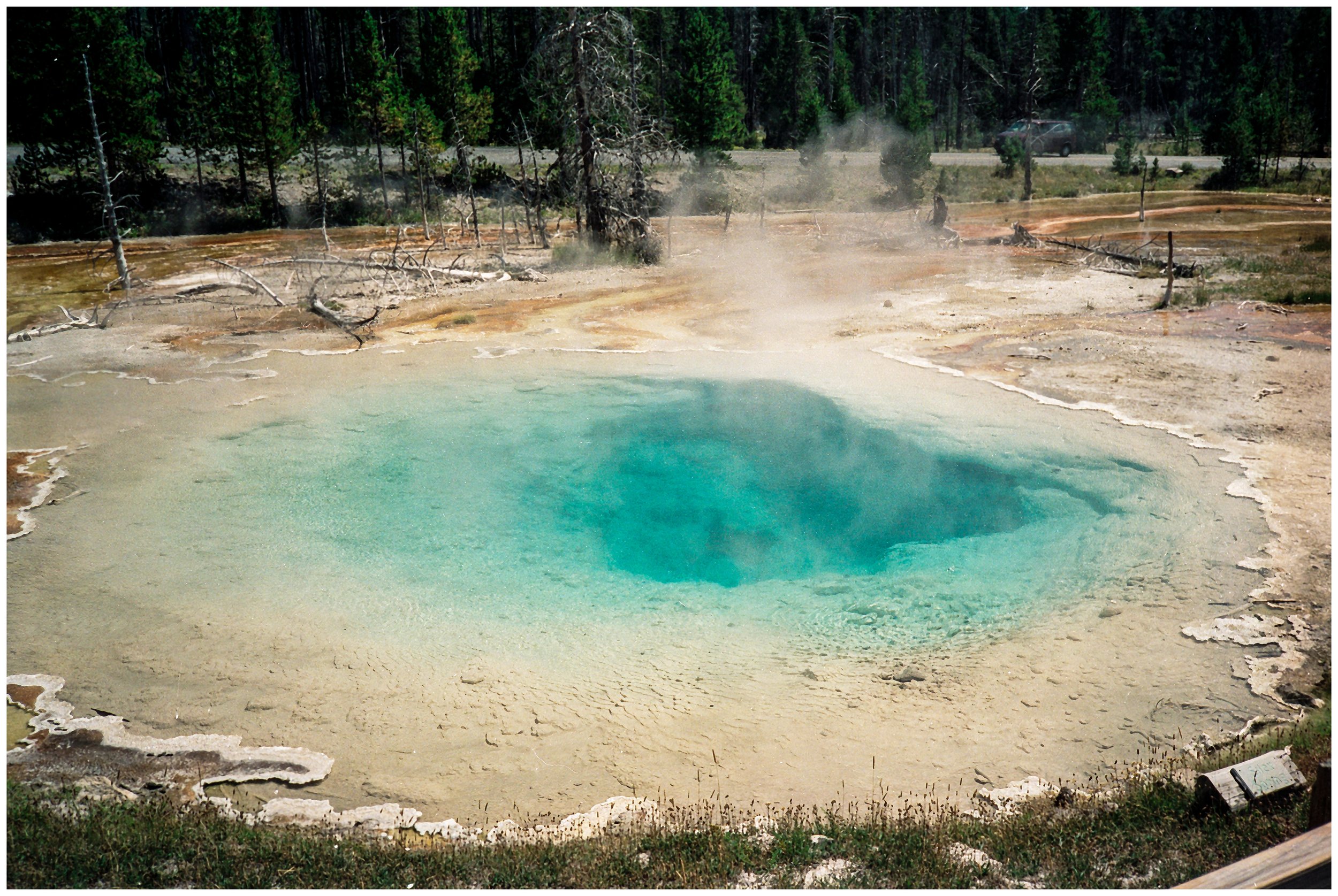


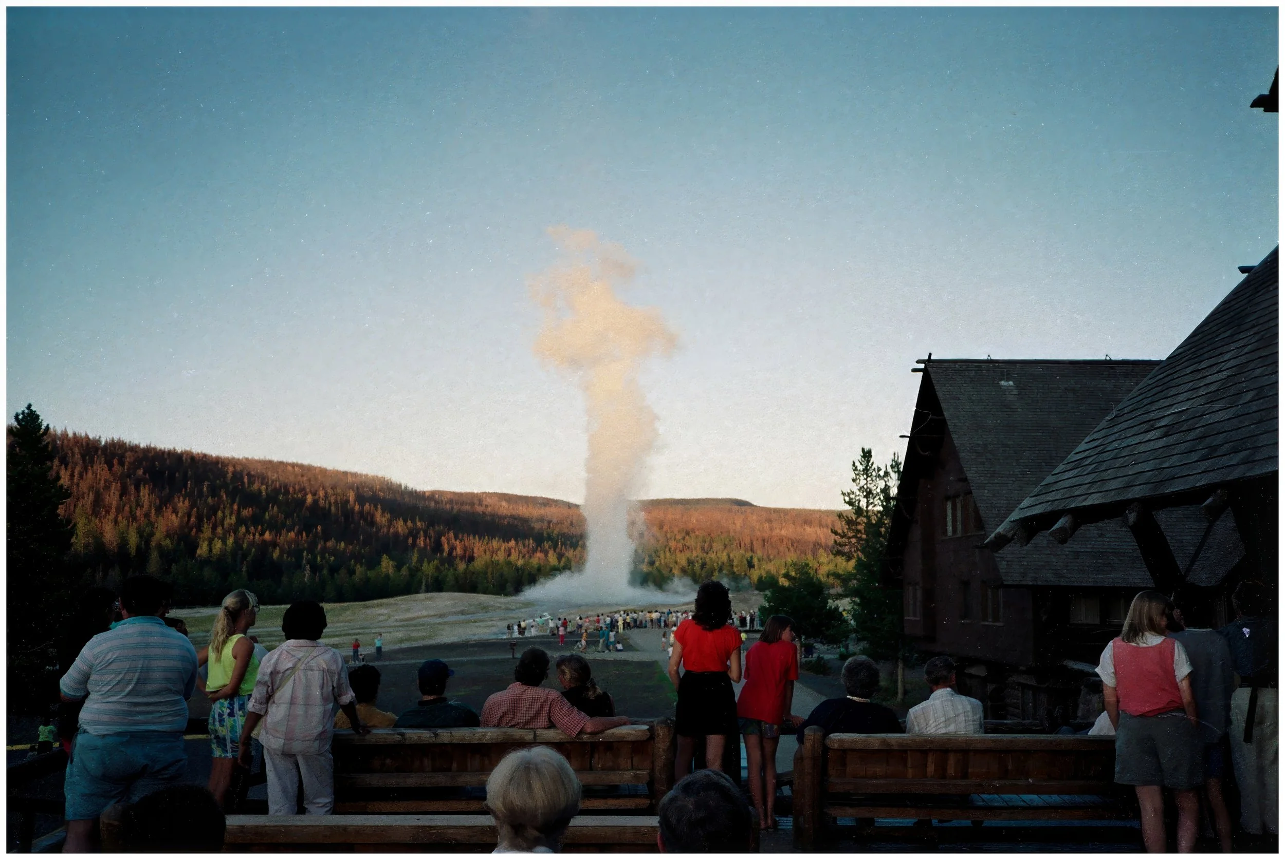
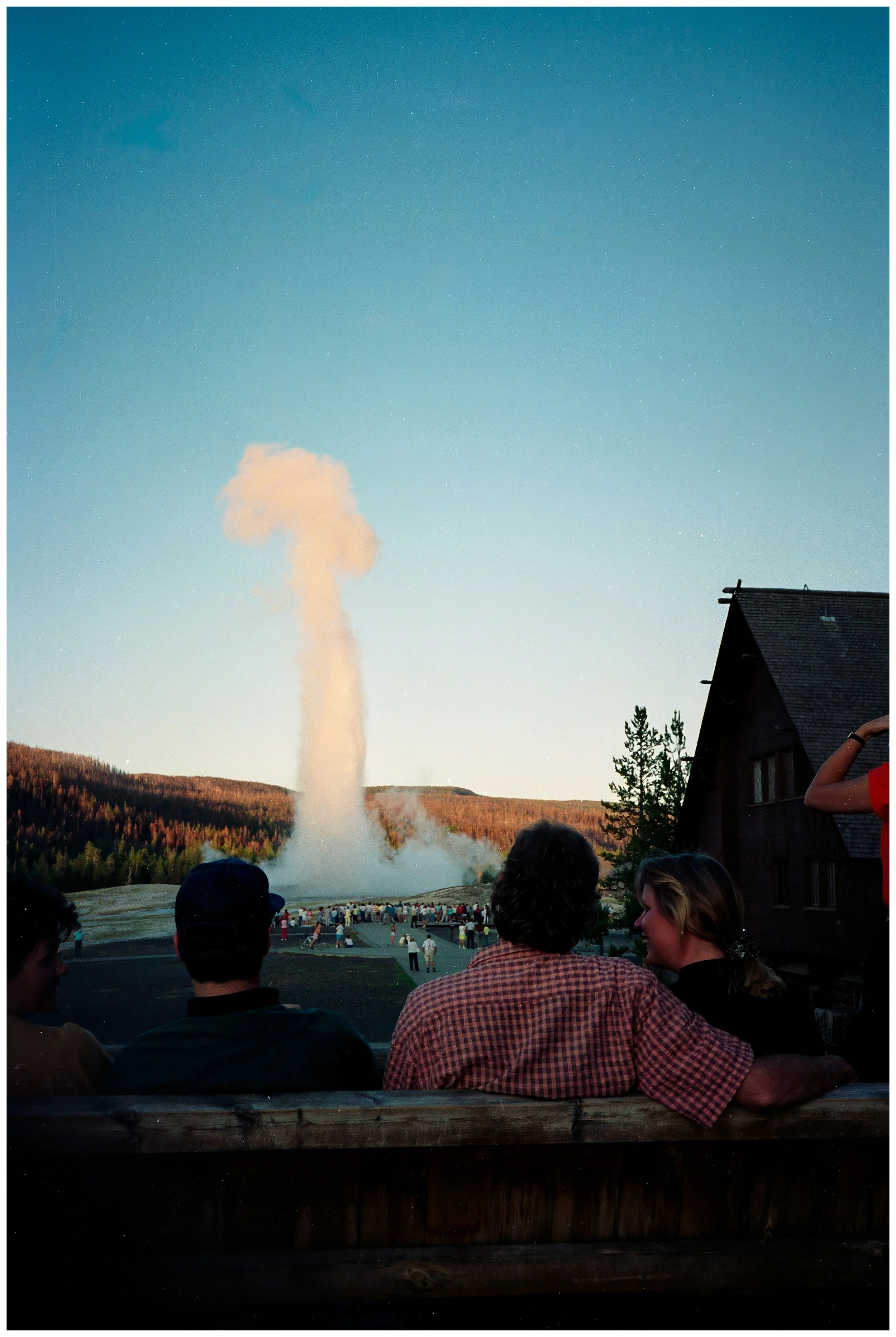
Day 39: Mammoth Ride
-
Date: Monday, July 23, 1990
Destination: O’Brien and Scotty’s House (Home Stay)
Miles: 46
Total Climb/Descent: Up 3,700 / Down -2,295
High Point / Low Point: 2,153 feet / 15 feet
Feet Per Mile: 81
Route Score: 113 (Hard)
-
W
-
T
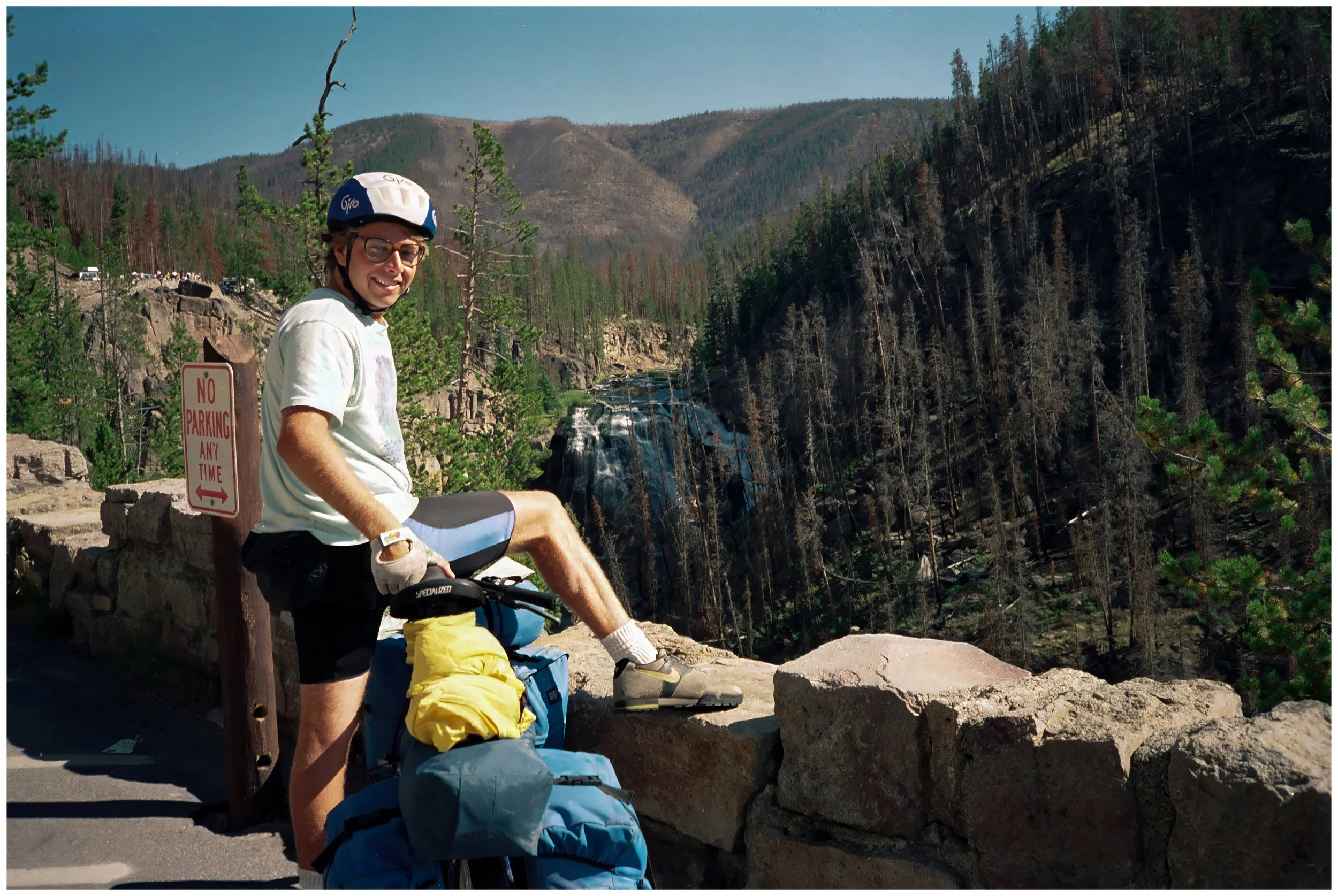

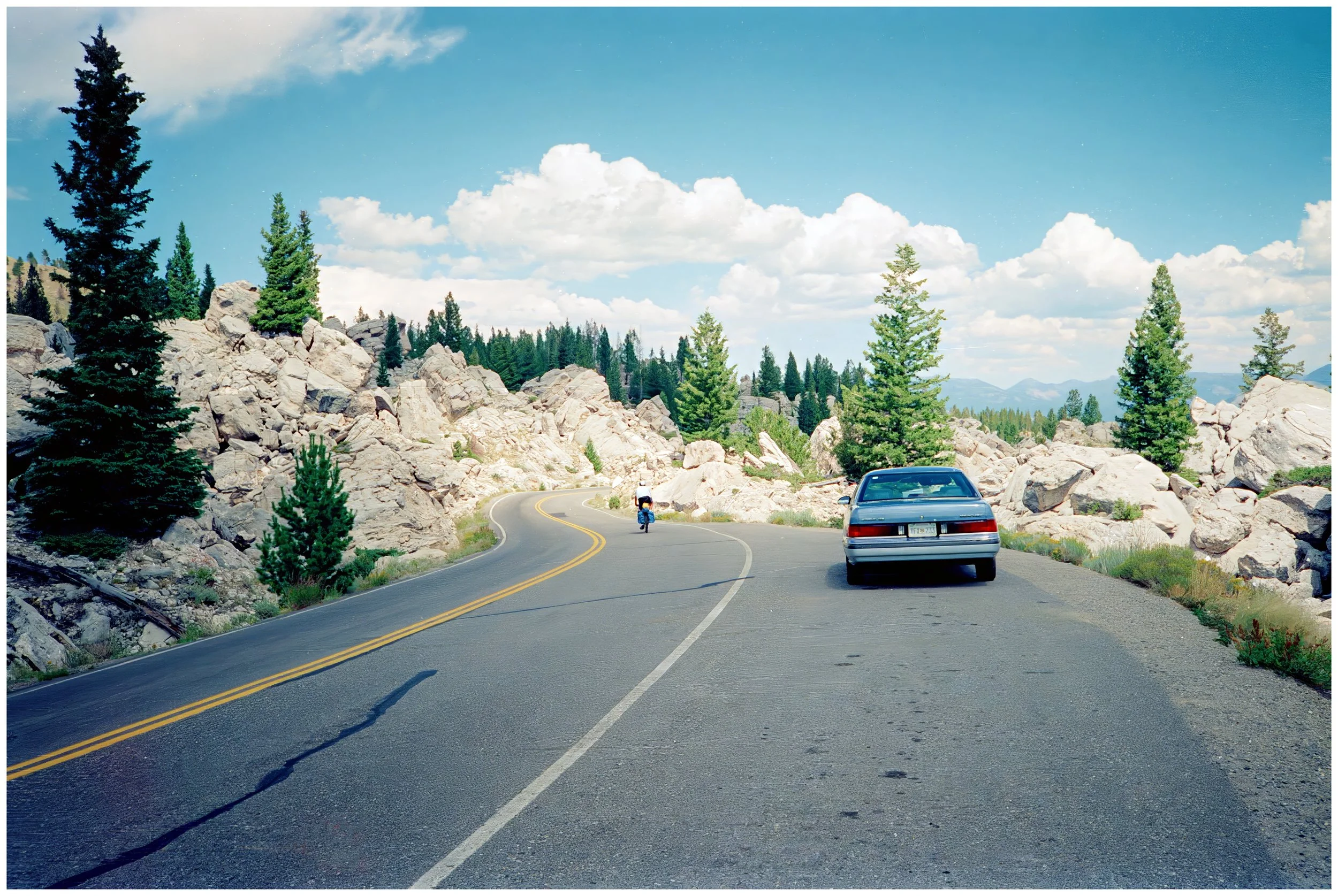

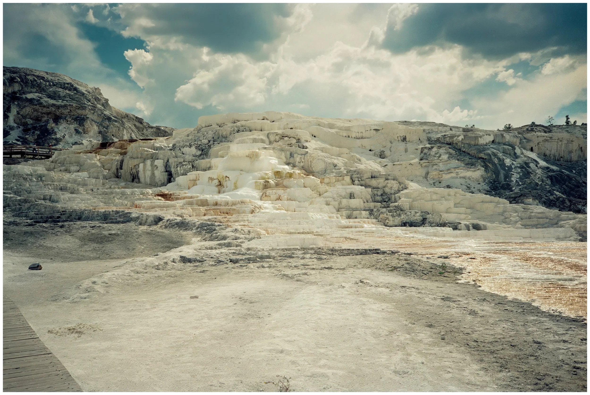


Day 40: Dunraven Pass
-
Date: Monday, July 23, 1990
Destination: O’Brien and Scotty’s House (Home Stay)
Miles: 46
Total Climb/Descent: Up 3,700 / Down -2,295
High Point / Low Point: 2,153 feet / 15 feet
Feet Per Mile: 81
Route Score: 113 (Hard)
-
W
-
T


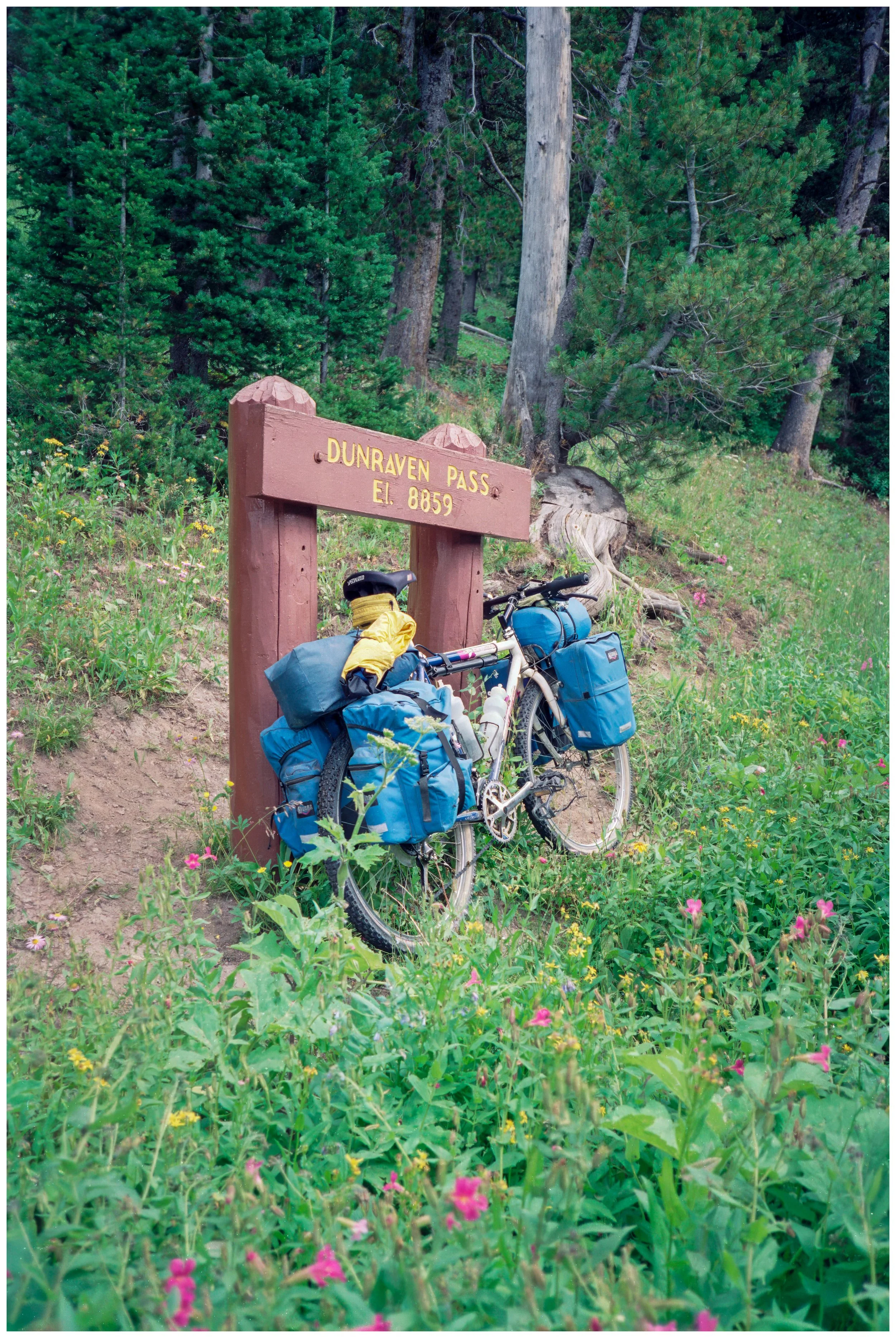
Day 41: At The Brink
-
Date: Monday, July 23, 1990
Destination: O’Brien and Scotty’s House (Home Stay)
Miles: 46
Total Climb/Descent: Up 3,700 / Down -2,295
High Point / Low Point: 2,153 feet / 15 feet
Feet Per Mile: 81
Route Score: 113 (Hard)
-
W
-
T


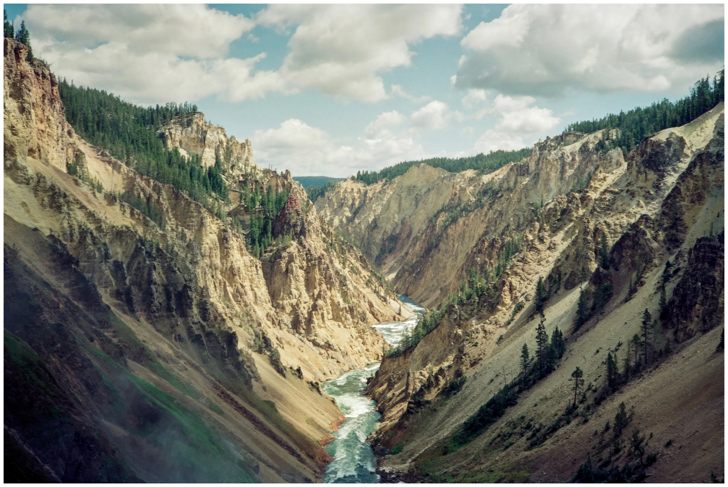
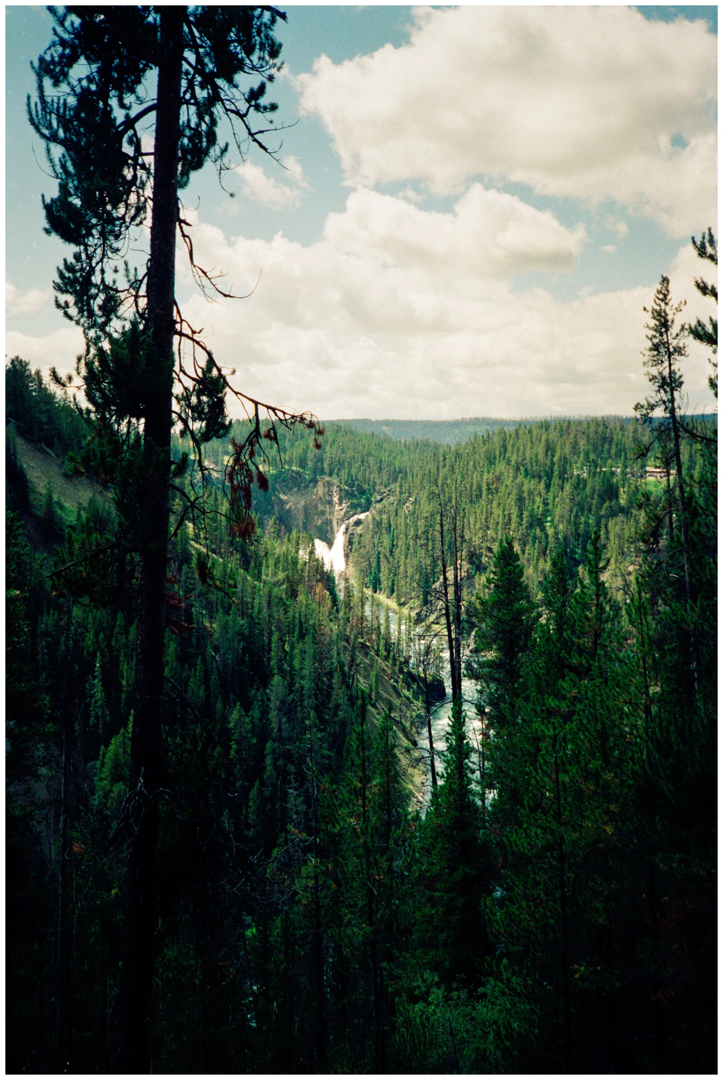


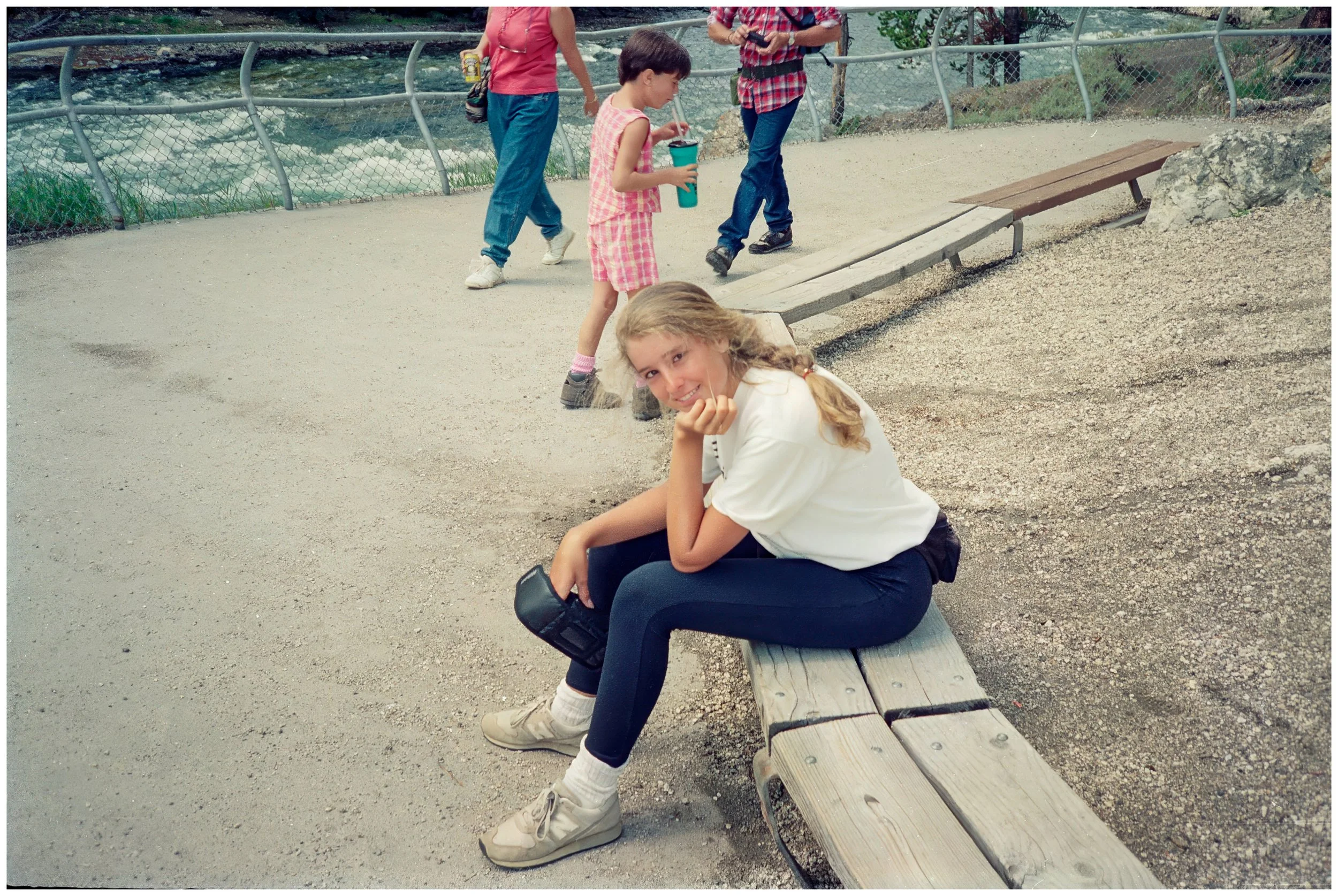


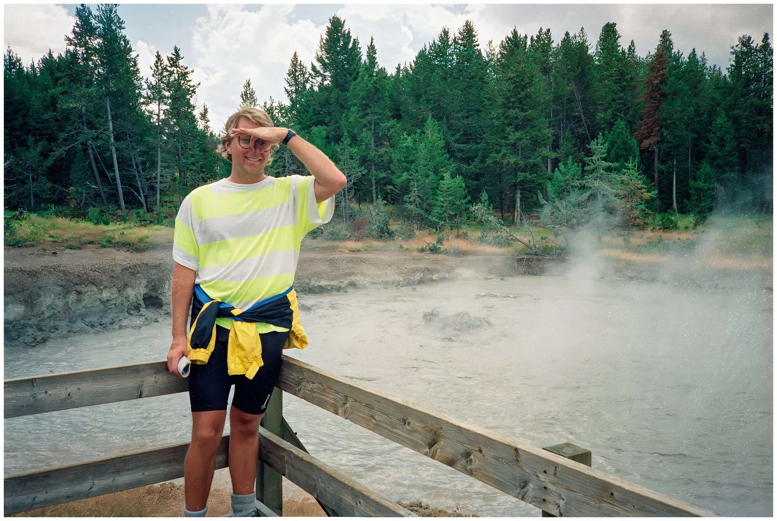
Day 42: Bullwinkle
-
Date: Monday, July 23, 1990
Destination: O’Brien and Scotty’s House (Home Stay)
Miles: 46
Total Climb/Descent: Up 3,700 / Down -2,295
High Point / Low Point: 2,153 feet / 15 feet
Feet Per Mile: 81
Route Score: 113 (Hard)
-
W
-
T


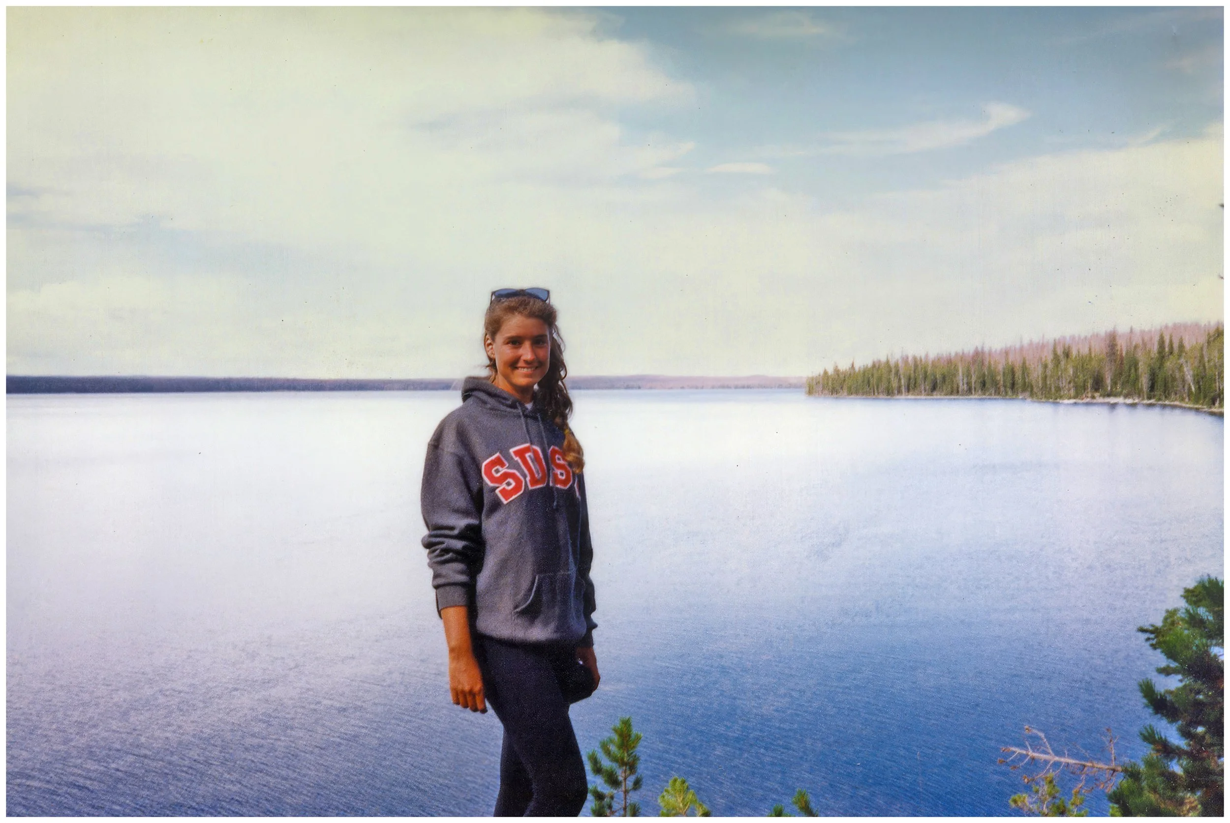

Day 43: A Dawning Realization
-
Date: Monday, July 23, 1990
Destination: O’Brien and Scotty’s House (Home Stay)
Miles: 46
Total Climb/Descent: Up 3,700 / Down -2,295
High Point / Low Point: 2,153 feet / 15 feet
Feet Per Mile: 81
Route Score: 113 (Hard)
-
W
-
T

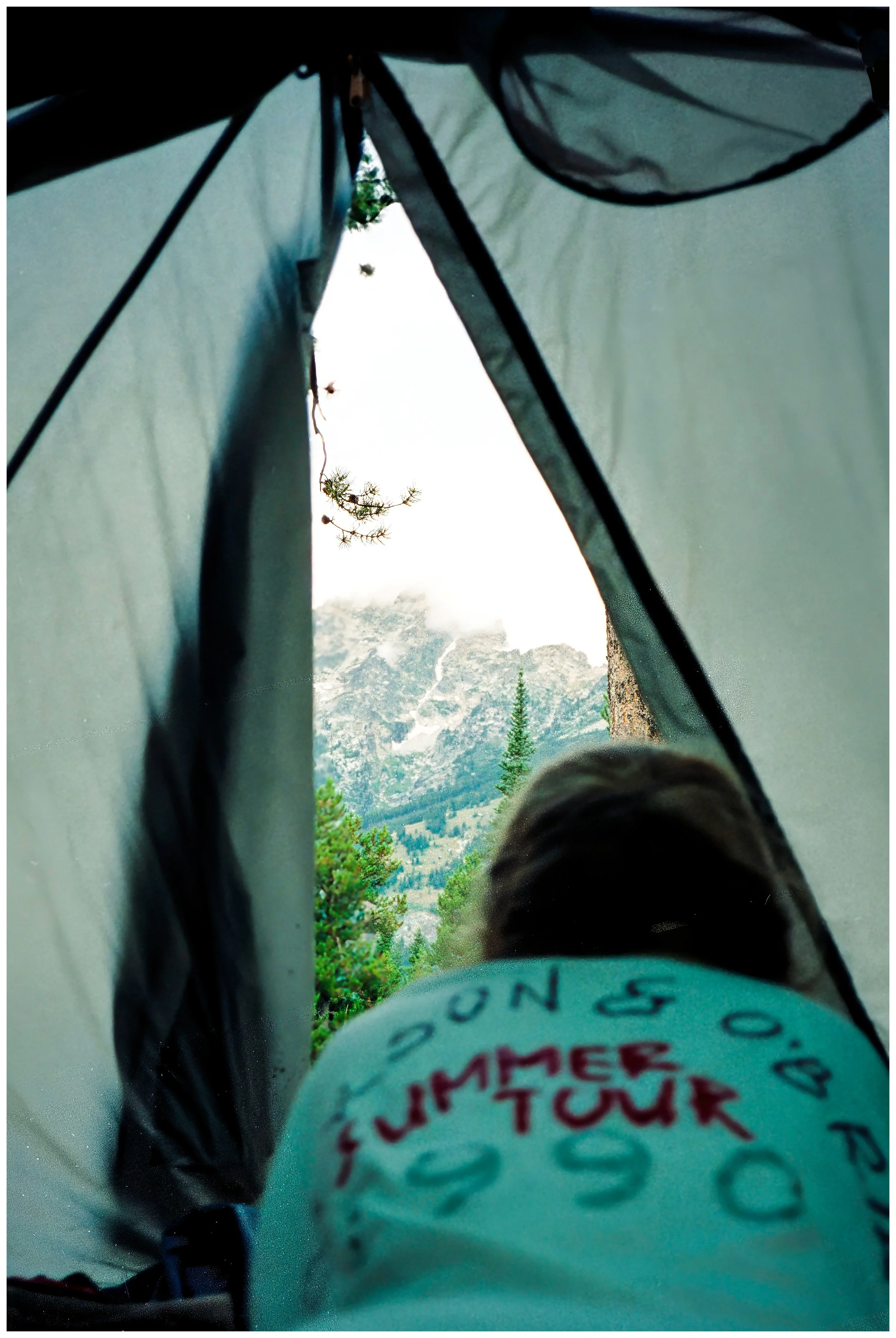


Day 44: The Last Pedalstroke
-
Date: Monday, July 23, 1990
Destination: O’Brien and Scotty’s House (Home Stay)
Miles: 46
Total Climb/Descent: Up 3,700 / Down -2,295
High Point / Low Point: 2,153 feet / 15 feet
Feet Per Mile: 81
Route Score: 113 (Hard)
-
W
-
T


Day 45-47: A Postscript
-
Date: Monday, July 23, 1990
Destination: O’Brien and Scotty’s House (Home Stay)
Miles: 46
Total Climb/Descent: Up 3,700 / Down -2,295
High Point / Low Point: 2,153 feet / 15 feet
Feet Per Mile: 81
Route Score: 113 (Hard)
-
W
-